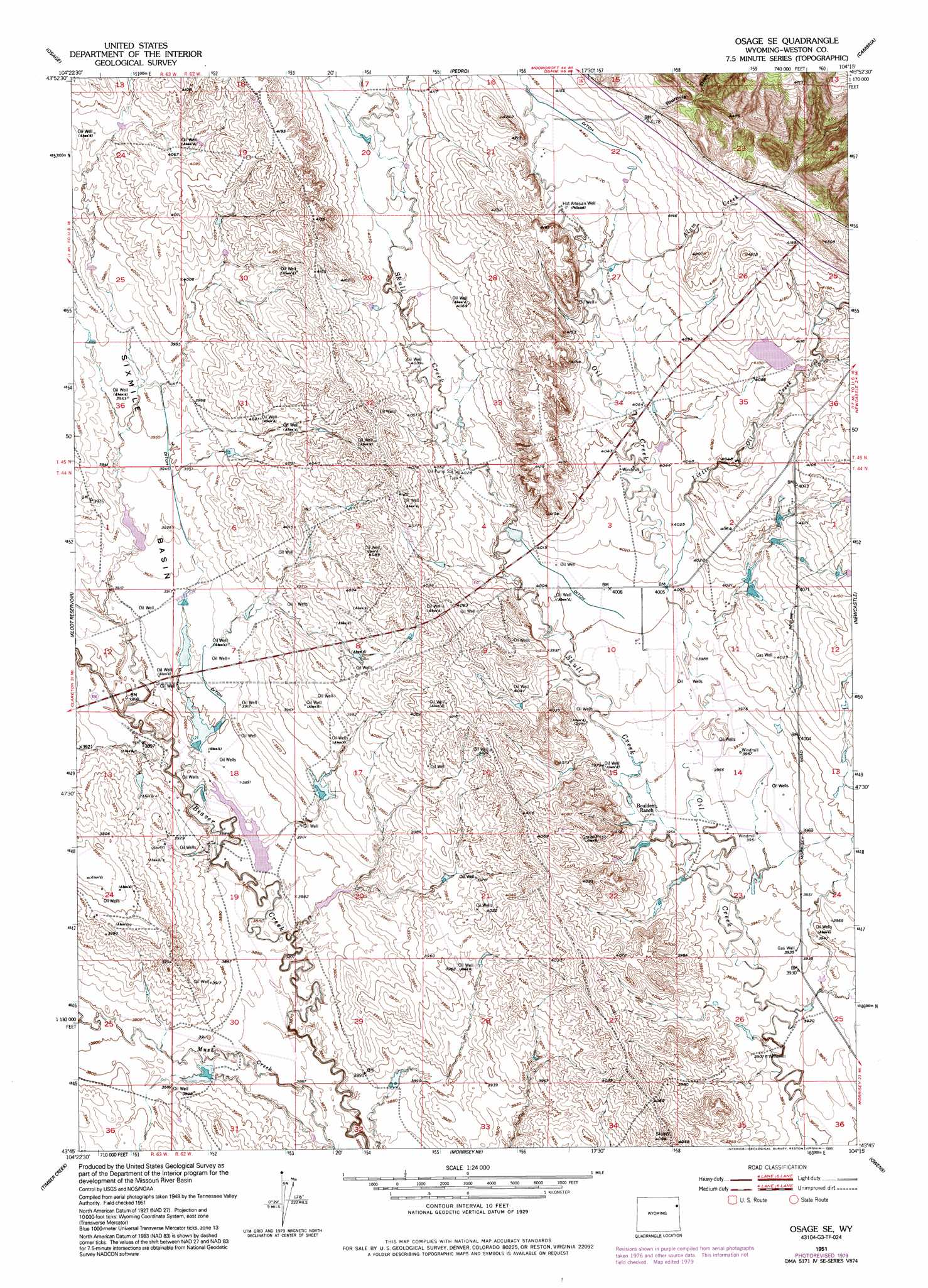
Osage Se Topo Map Wyoming
To zoom in, hover over the map of Osage Se
USGS Topo Quad 43104g3 - 1:24,000 scale
| Topo Map Name: | Osage Se |
| USGS Topo Quad ID: | 43104g3 |
| Print Size: | ca. 21 1/4" wide x 27" high |
| Southeast Coordinates: | 43.75° N latitude / 104.25° W longitude |
| Map Center Coordinates: | 43.8125° N latitude / 104.3125° W longitude |
| U.S. State: | WY |
| Filename: | o43104g3.jpg |
| Download Map JPG Image: | Osage Se topo map 1:24,000 scale |
| Map Type: | Topographic |
| Topo Series: | 7.5´ |
| Map Scale: | 1:24,000 |
| Source of Map Images: | United States Geological Survey (USGS) |
| Alternate Map Versions: |
Osage SE WY 1951, updated 1953 Download PDF Buy paper map Osage SE WY 1951, updated 1977 Download PDF Buy paper map Osage SE WY 1951, updated 1979 Download PDF Buy paper map Osage SE WY 1951, updated 1995 Download PDF Buy paper map Osage SE WY 2012 Download PDF Buy paper map Osage SE WY 2015 Download PDF Buy paper map |
| FStopo: | US Forest Service topo Osage SE is available: Download FStopo PDF Download FStopo TIF |
1:24,000 Topo Quads surrounding Osage Se
Upton East |
Clay Spur |
Skull Creek |
Four Corners |
Parmlee Canyon |
Sheep Canyon Creek East |
Osage |
Pedro |
Cambria |
Moon |
Lassen Creek |
Klodt Reservoir |
Osage Se |
Newcastle |
Fanny Peak |
Dupont Creek |
Timber Creek |
Morrisey Ne |
Owens |
Clifton |
The Nose East |
Morrisey |
Morrisey Se |
Dewey Sw |
Dewey |
> Back to 43104e1 at 1:100,000 scale
> Back to 43104a1 at 1:250,000 scale
> Back to U.S. Topo Maps home
Osage Se topo map: Gazetteer
Osage Se: Basins
Sixmile Basin elevation 1201m 3940′Osage Se: Dams
Elliot Dam elevation 1230m 4035′Michaels Dam elevation 1186m 3891′
Nelson Dam elevation 1229m 4032′
Shostak Dam elevation 1199m 3933′
State Dam elevation 1183m 3881′
Osage Se: Reservoirs
Elliot Reservoir elevation 1230m 4035′Michaels Reservoir elevation 1186m 3891′
Nelson Reservoir elevation 1229m 4032′
Shostak Reservoir elevation 1199m 3933′
State Reservoir elevation 1183m 3881′
Osage Se: Streams
Alum Creek elevation 1247m 4091′Little Oil Creek elevation 1221m 4005′
Skull Creek elevation 1202m 3943′
Osage Se: Valleys
Fourmile Draw elevation 1273m 4176′Osage Se digital topo map on disk
Buy this Osage Se topo map showing relief, roads, GPS coordinates and other geographical features, as a high-resolution digital map file on DVD:
Eastern Wyoming & Western South Dakota
Buy digital topo maps: Eastern Wyoming & Western South Dakota