Lassen Creek Topo Map Wyoming
To zoom in, hover over the map of Lassen Creek
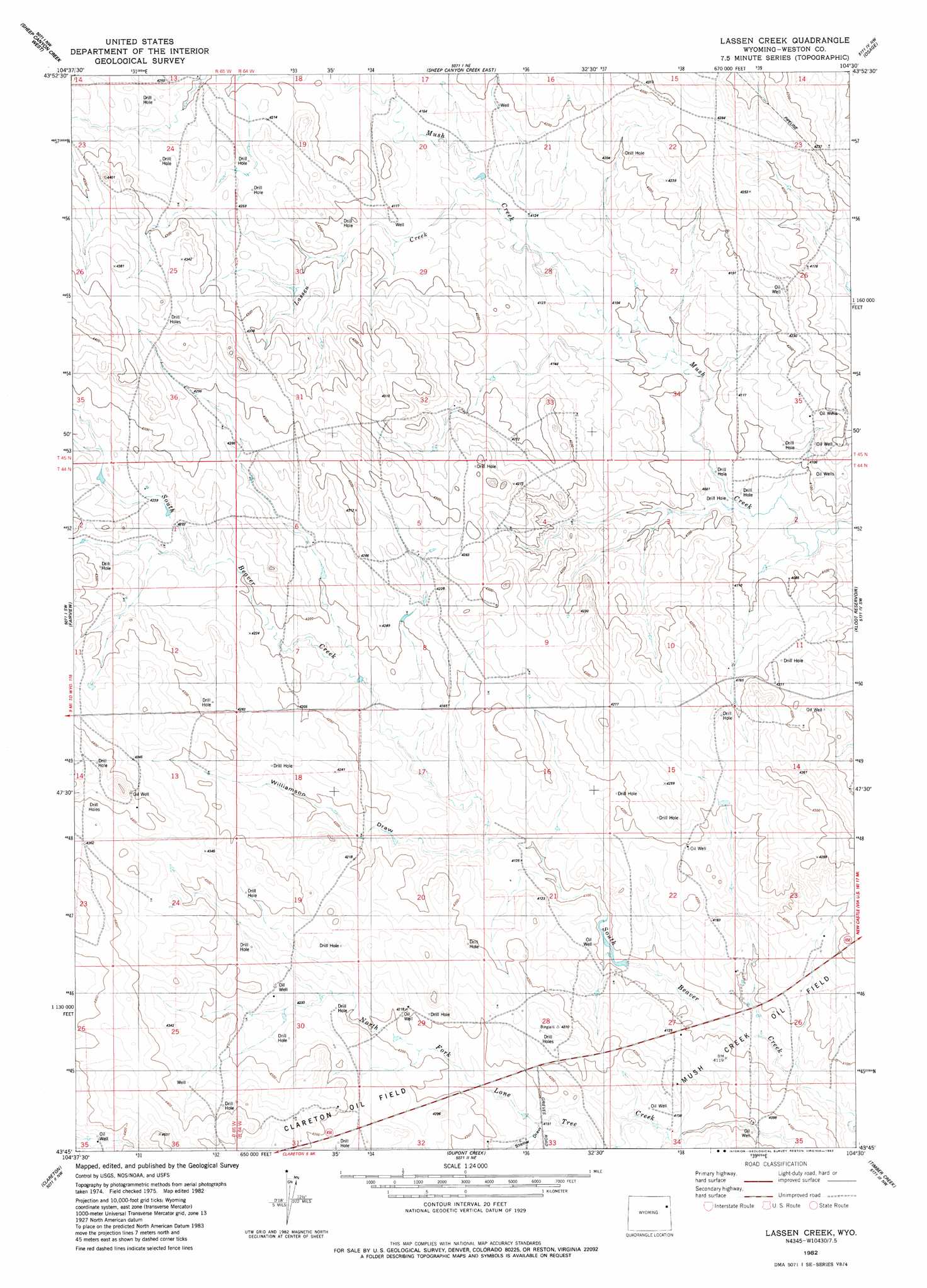
USGS Topo Quad 43104g5 - 1:24,000 scale
| Topo Map Name: | Lassen Creek |
| USGS Topo Quad ID: | 43104g5 |
| Print Size: | ca. 21 1/4" wide x 27" high |
| Southeast Coordinates: | 43.75° N latitude / 104.5° W longitude |
| Map Center Coordinates: | 43.8125° N latitude / 104.5625° W longitude |
| U.S. State: | WY |
| Filename: | o43104g5.jpg |
| Download Map JPG Image: | Lassen Creek topo map 1:24,000 scale |
| Map Type: | Topographic |
| Topo Series: | 7.5´ |
| Map Scale: | 1:24,000 |
| Source of Map Images: | United States Geological Survey (USGS) |
| Alternate Map Versions: |
Lassen Creek WY 1982, updated 1982 Download PDF Buy paper map Lassen Creek WY 2012 Download PDF Buy paper map Lassen Creek WY 2015 Download PDF Buy paper map |
| FStopo: | US Forest Service topo Lassen Creek is available: Download FStopo PDF Download FStopo TIF |
1:24,000 Topo Quads surrounding Lassen Creek
Soda Butte |
Upton West |
Upton East |
Clay Spur |
Skull Creek |
West Fork Buffalo Creek |
Sheep Canyon Creek West |
Sheep Canyon Creek East |
Osage |
Pedro |
Wildlife Draw East |
Fairview |
Lassen Creek |
Klodt Reservoir |
Osage Se |
Darlington Draw East |
Clareton |
Dupont Creek |
Timber Creek |
Morrisey Ne |
Poddy Creek |
The Nose West |
The Nose East |
Morrisey |
Morrisey Se |
> Back to 43104e1 at 1:100,000 scale
> Back to 43104a1 at 1:250,000 scale
> Back to U.S. Topo Maps home
Lassen Creek topo map: Gazetteer
Lassen Creek: Dams
Cummings Number 9-328-2 Dam elevation 1275m 4183′Lassen Creek: Reservoirs
Cummings F S 9-328-2 Reservoir elevation 1275m 4183′Lassen Creek: Streams
Lassen Creek elevation 1261m 4137′Middle Fork Lassen Creek elevation 1278m 4192′
South Fork Lassen Creek elevation 1274m 4179′
Lassen Creek: Valleys
Statler Draw elevation 1264m 4146′Williamson Draw elevation 1256m 4120′
Lassen Creek digital topo map on disk
Buy this Lassen Creek topo map showing relief, roads, GPS coordinates and other geographical features, as a high-resolution digital map file on DVD:
Eastern Wyoming & Western South Dakota
Buy digital topo maps: Eastern Wyoming & Western South Dakota