Fairview Topo Map Wyoming
To zoom in, hover over the map of Fairview
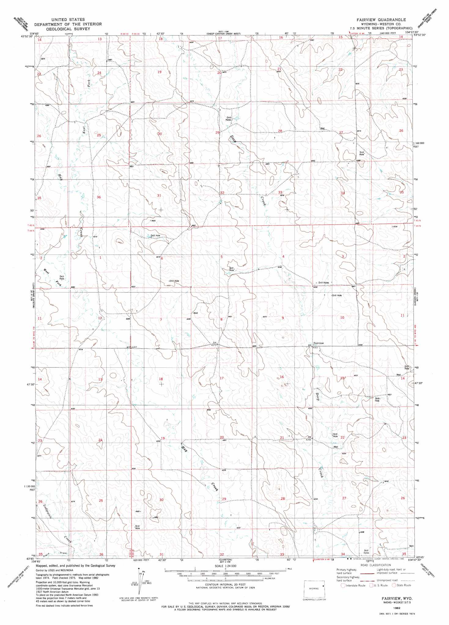
USGS Topo Quad 43104g6 - 1:24,000 scale
| Topo Map Name: | Fairview |
| USGS Topo Quad ID: | 43104g6 |
| Print Size: | ca. 21 1/4" wide x 27" high |
| Southeast Coordinates: | 43.75° N latitude / 104.625° W longitude |
| Map Center Coordinates: | 43.8125° N latitude / 104.6875° W longitude |
| U.S. State: | WY |
| Filename: | o43104g6.jpg |
| Download Map JPG Image: | Fairview topo map 1:24,000 scale |
| Map Type: | Topographic |
| Topo Series: | 7.5´ |
| Map Scale: | 1:24,000 |
| Source of Map Images: | United States Geological Survey (USGS) |
| Alternate Map Versions: |
Fairview WY 1982, updated 1982 Download PDF Buy paper map Fairview WY 2012 Download PDF Buy paper map Fairview WY 2015 Download PDF Buy paper map |
| FStopo: | US Forest Service topo Fairview is available: Download FStopo PDF Download FStopo TIF |
1:24,000 Topo Quads surrounding Fairview
Cedar Draw |
Soda Butte |
Upton West |
Upton East |
Clay Spur |
Raven |
West Fork Buffalo Creek |
Sheep Canyon Creek West |
Sheep Canyon Creek East |
Osage |
Wildlife Draw West |
Wildlife Draw East |
Fairview |
Lassen Creek |
Klodt Reservoir |
Darlington Draw West |
Darlington Draw East |
Clareton |
Dupont Creek |
Timber Creek |
Lion Creek |
Poddy Creek |
The Nose West |
The Nose East |
Morrisey |
> Back to 43104e1 at 1:100,000 scale
> Back to 43104a1 at 1:250,000 scale
> Back to U.S. Topo Maps home
Fairview topo map: Gazetteer
Fairview: Populated Places
Fairview elevation 1314m 4311′Fairview: Streams
East Fork Hay Creek elevation 1316m 4317′West Fork Hay Creek elevation 1307m 4288′
Fairview: Valleys
Field Draw elevation 1287m 4222′Fairview digital topo map on disk
Buy this Fairview topo map showing relief, roads, GPS coordinates and other geographical features, as a high-resolution digital map file on DVD:
Eastern Wyoming & Western South Dakota
Buy digital topo maps: Eastern Wyoming & Western South Dakota