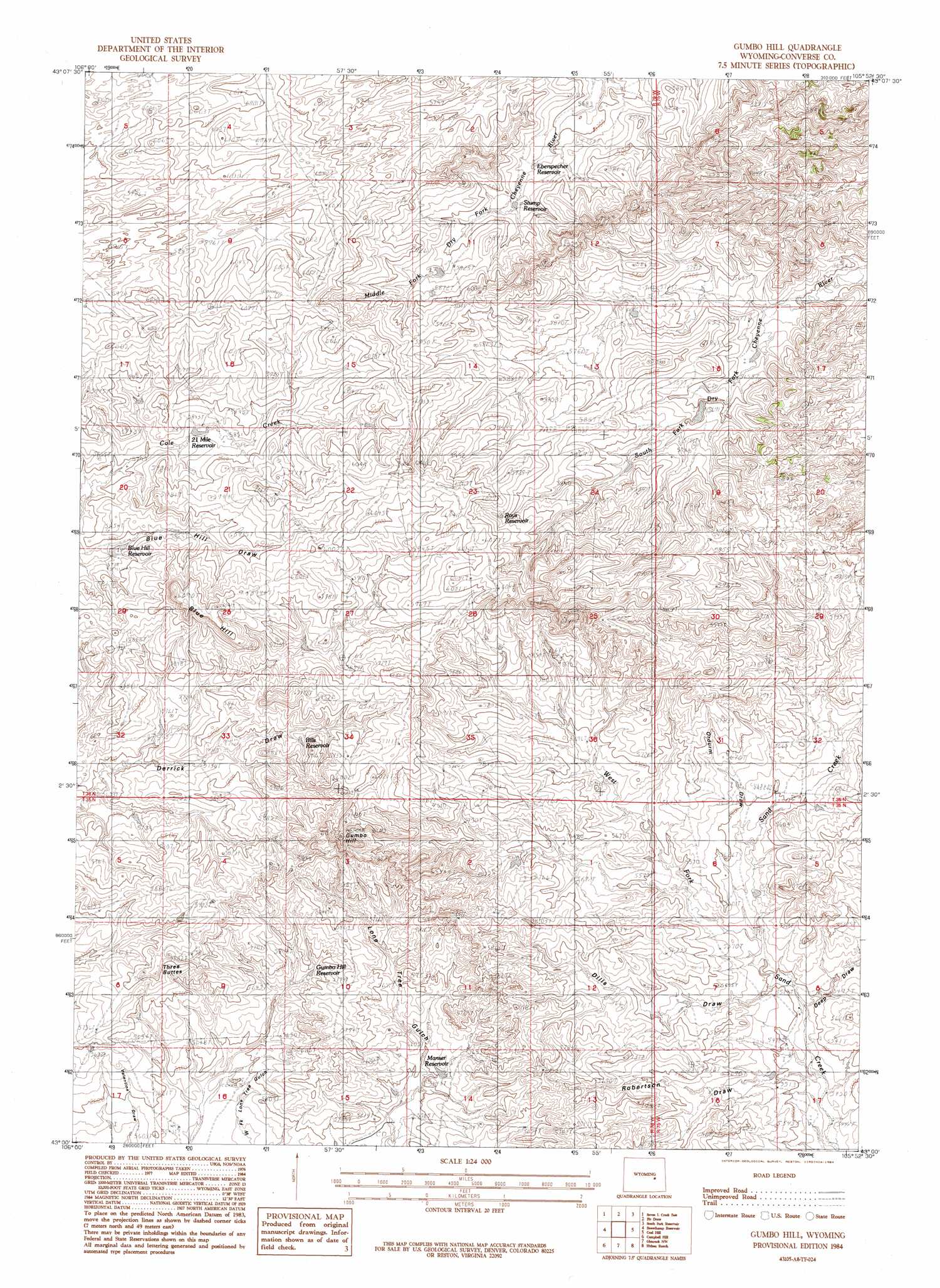
Gumbo Hill Topo Map Wyoming
To zoom in, hover over the map of Gumbo Hill
USGS Topo Quad 43105a8 - 1:24,000 scale
| Topo Map Name: | Gumbo Hill |
| USGS Topo Quad ID: | 43105a8 |
| Print Size: | ca. 21 1/4" wide x 27" high |
| Southeast Coordinates: | 43° N latitude / 105.875° W longitude |
| Map Center Coordinates: | 43.0625° N latitude / 105.9375° W longitude |
| U.S. State: | WY |
| Filename: | o43105a8.jpg |
| Download Map JPG Image: | Gumbo Hill topo map 1:24,000 scale |
| Map Type: | Topographic |
| Topo Series: | 7.5´ |
| Map Scale: | 1:24,000 |
| Source of Map Images: | United States Geological Survey (USGS) |
| Alternate Map Versions: |
Gumbo Hill WY 1984, updated 1984 Download PDF Buy paper map Gumbo Hill WY 2012 Download PDF Buy paper map Gumbo Hill WY 2015 Download PDF Buy paper map |
1:24,000 Topo Quads surrounding Gumbo Hill
Gillam Draw West |
Gillam Draw East |
Marsh Draw |
Thompson Draw |
Bear Creek |
Seven L Creek West |
Seven L Creek East |
Fly Draw |
South Fork Reservoir |
Suicide Hill |
Mckenzie Flat |
Beauchamp Reservoir |
Gumbo Hill |
Coal Hill |
Holdup Hollow |
Pratts Soda Lakes |
Campbell Hill |
Glenrock Nw |
Hylton Ranch |
Leuenberger Ranch |
Brookhurst |
Lockett |
Parkerton |
Glenrock |
Careyhurst |
> Back to 43105a1 at 1:100,000 scale
> Back to 43104a1 at 1:250,000 scale
> Back to U.S. Topo Maps home
Gumbo Hill topo map: Gazetteer
Gumbo Hill: Dams
V-One Dam elevation 1715m 5626′Gumbo Hill: Mines
Badger Creek Mine elevation 1751m 5744′Gumbo Hill: Reservoirs
V-One Reservoir elevation 1715m 5626′Gumbo Hill: Streams
West Fork Sand Creek elevation 1683m 5521′Gumbo Hill: Summits
Blue Hill elevation 1842m 6043′Gumbo Hill: Valleys
Deep Draw elevation 1674m 5492′Dills Draw elevation 1677m 5501′
Ordurm Draw elevation 1696m 5564′
Gumbo Hill digital topo map on disk
Buy this Gumbo Hill topo map showing relief, roads, GPS coordinates and other geographical features, as a high-resolution digital map file on DVD:
Eastern Wyoming & Western South Dakota
Buy digital topo maps: Eastern Wyoming & Western South Dakota