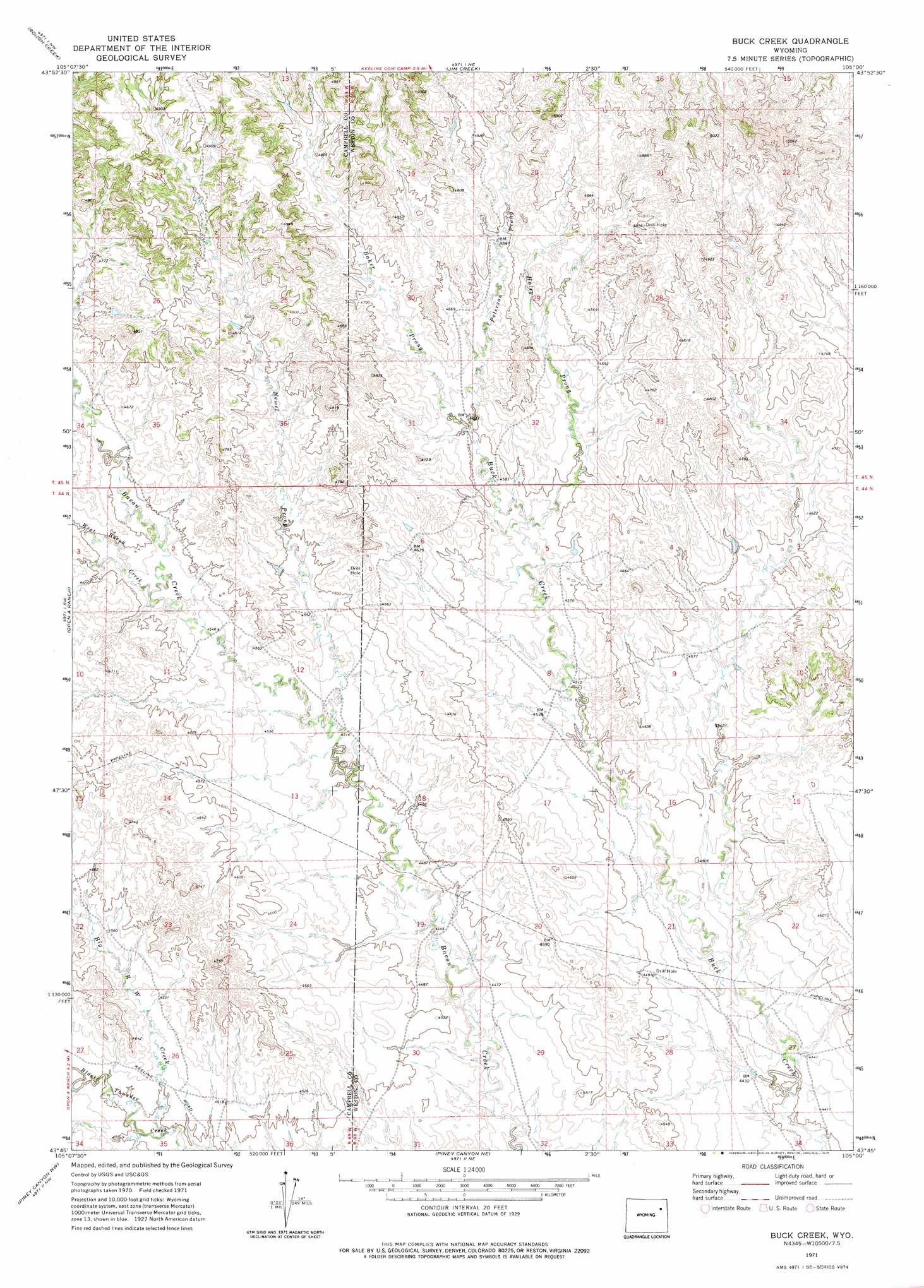
Buck Creek Topo Map Wyoming
To zoom in, hover over the map of Buck Creek
USGS Topo Quad 43105g1 - 1:24,000 scale
| Topo Map Name: | Buck Creek |
| USGS Topo Quad ID: | 43105g1 |
| Print Size: | ca. 21 1/4" wide x 27" high |
| Southeast Coordinates: | 43.75° N latitude / 105° W longitude |
| Map Center Coordinates: | 43.8125° N latitude / 105.0625° W longitude |
| U.S. State: | WY |
| Filename: | o43105g1.jpg |
| Download Map JPG Image: | Buck Creek topo map 1:24,000 scale |
| Map Type: | Topographic |
| Topo Series: | 7.5´ |
| Map Scale: | 1:24,000 |
| Source of Map Images: | United States Geological Survey (USGS) |
| Alternate Map Versions: |
Buck Creek WY 1971, updated 1975 Download PDF Buy paper map Buck Creek WY 2012 Download PDF Buy paper map Buck Creek WY 2015 Download PDF Buy paper map |
| FStopo: | US Forest Service topo Buck Creek is available: Download FStopo PDF Download FStopo TIF |
1:24,000 Topo Quads surrounding Buck Creek
Saddle Horse Butte |
Whitetail Creek |
Whitetail Creek Se |
Cedar Draw |
Soda Butte |
Neil Butte |
Rough Creek |
Jim Creek |
Raven |
West Fork Buffalo Creek |
Hilight |
Open A Ranch |
Buck Creek |
Wildlife Draw West |
Wildlife Draw East |
Reno Reservoir |
Piney Canyon Nw |
Piney Canyon Ne |
Darlington Draw West |
Darlington Draw East |
Teckla |
Piney Canyon Sw |
Piney Canyon Se |
Lion Creek |
Poddy Creek |
> Back to 43105e1 at 1:100,000 scale
> Back to 43104a1 at 1:250,000 scale
> Back to U.S. Topo Maps home
Buck Creek topo map: Gazetteer
Buck Creek: Streams
Baker Prong elevation 1402m 4599′Big R W Creek elevation 1366m 4481′
Haley Prong elevation 1391m 4563′
Newel Prong elevation 1378m 4520′
Peterson Prong elevation 1404m 4606′
West Bacon Creek elevation 1393m 4570′
Buck Creek digital topo map on disk
Buy this Buck Creek topo map showing relief, roads, GPS coordinates and other geographical features, as a high-resolution digital map file on DVD:
Eastern Wyoming & Western South Dakota
Buy digital topo maps: Eastern Wyoming & Western South Dakota