Mcpherson Draw Topo Map Wyoming
To zoom in, hover over the map of Mcpherson Draw
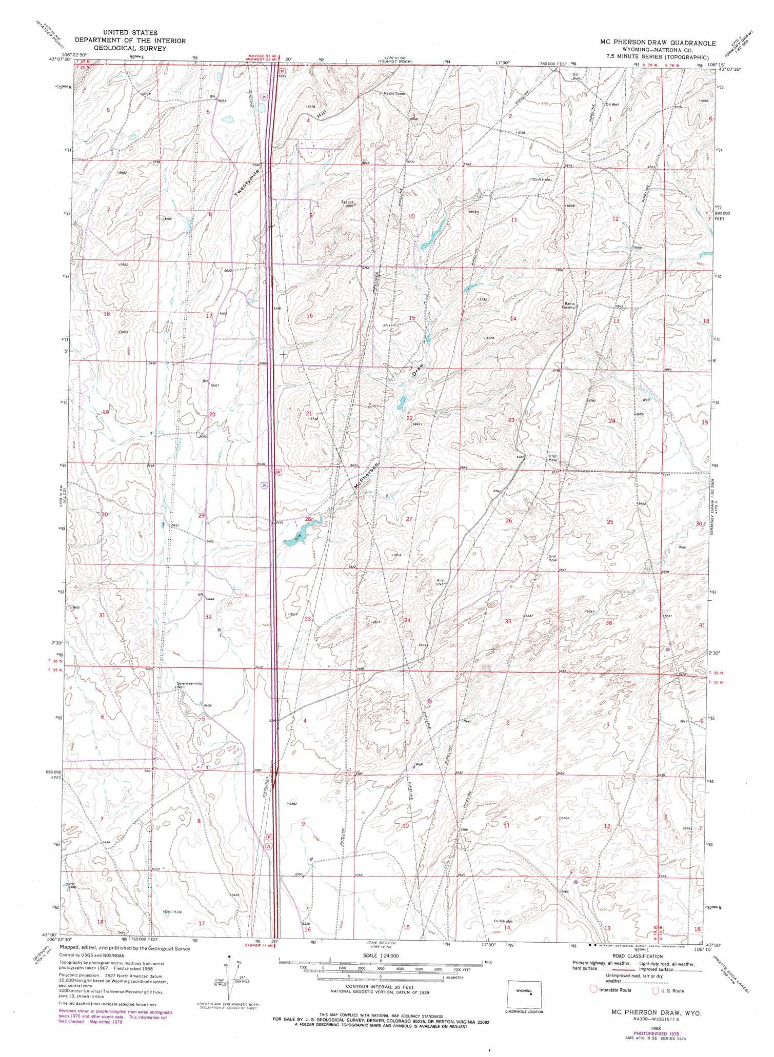
USGS Topo Quad 43106a3 - 1:24,000 scale
| Topo Map Name: | Mcpherson Draw |
| USGS Topo Quad ID: | 43106a3 |
| Print Size: | ca. 21 1/4" wide x 27" high |
| Southeast Coordinates: | 43° N latitude / 106.25° W longitude |
| Map Center Coordinates: | 43.0625° N latitude / 106.3125° W longitude |
| U.S. State: | WY |
| Filename: | o43106a3.jpg |
| Download Map JPG Image: | Mcpherson Draw topo map 1:24,000 scale |
| Map Type: | Topographic |
| Topo Series: | 7.5´ |
| Map Scale: | 1:24,000 |
| Source of Map Images: | United States Geological Survey (USGS) |
| Alternate Map Versions: |
Mc Pherson Draw WY 1968, updated 1972 Download PDF Buy paper map McPherson Draw WY 1968, updated 1978 Download PDF Buy paper map McPherson Draw WY 2012 Download PDF Buy paper map McPherson Draw WY 2015 Download PDF Buy paper map |
1:24,000 Topo Quads surrounding Mcpherson Draw
Camel Hump Reservoir |
Big Gulch |
Salt Creek |
Gillam Draw West |
Gillam Draw East |
Merino |
Statzer Point |
Teapot Rock |
Seven L Creek West |
Seven L Creek East |
Smith Flats |
Illco |
Mcpherson Draw |
Mckenzie Flat |
Beauchamp Reservoir |
Emigrant Gap Ne |
Bishop |
The Reefs |
Pratts Soda Lakes |
Campbell Hill |
Emigrant Gap |
Goose Egg |
Casper |
Brookhurst |
Lockett |
> Back to 43106a1 at 1:100,000 scale
> Back to 43106a1 at 1:250,000 scale
> Back to U.S. Topo Maps home
Mcpherson Draw topo map: Gazetteer
Mcpherson Draw: Populated Places
Antelope Hills elevation 1744m 5721′Mcpherson Draw: Summits
Twentymile Hill elevation 1780m 5839′Mcpherson Draw: Valleys
McPherson Draw elevation 1646m 5400′Mcpherson Draw: Wells
Seventeenmile Well elevation 1652m 5419′Mcpherson Draw digital topo map on disk
Buy this Mcpherson Draw topo map showing relief, roads, GPS coordinates and other geographical features, as a high-resolution digital map file on DVD:
Eastern Wyoming & Western South Dakota
Buy digital topo maps: Eastern Wyoming & Western South Dakota