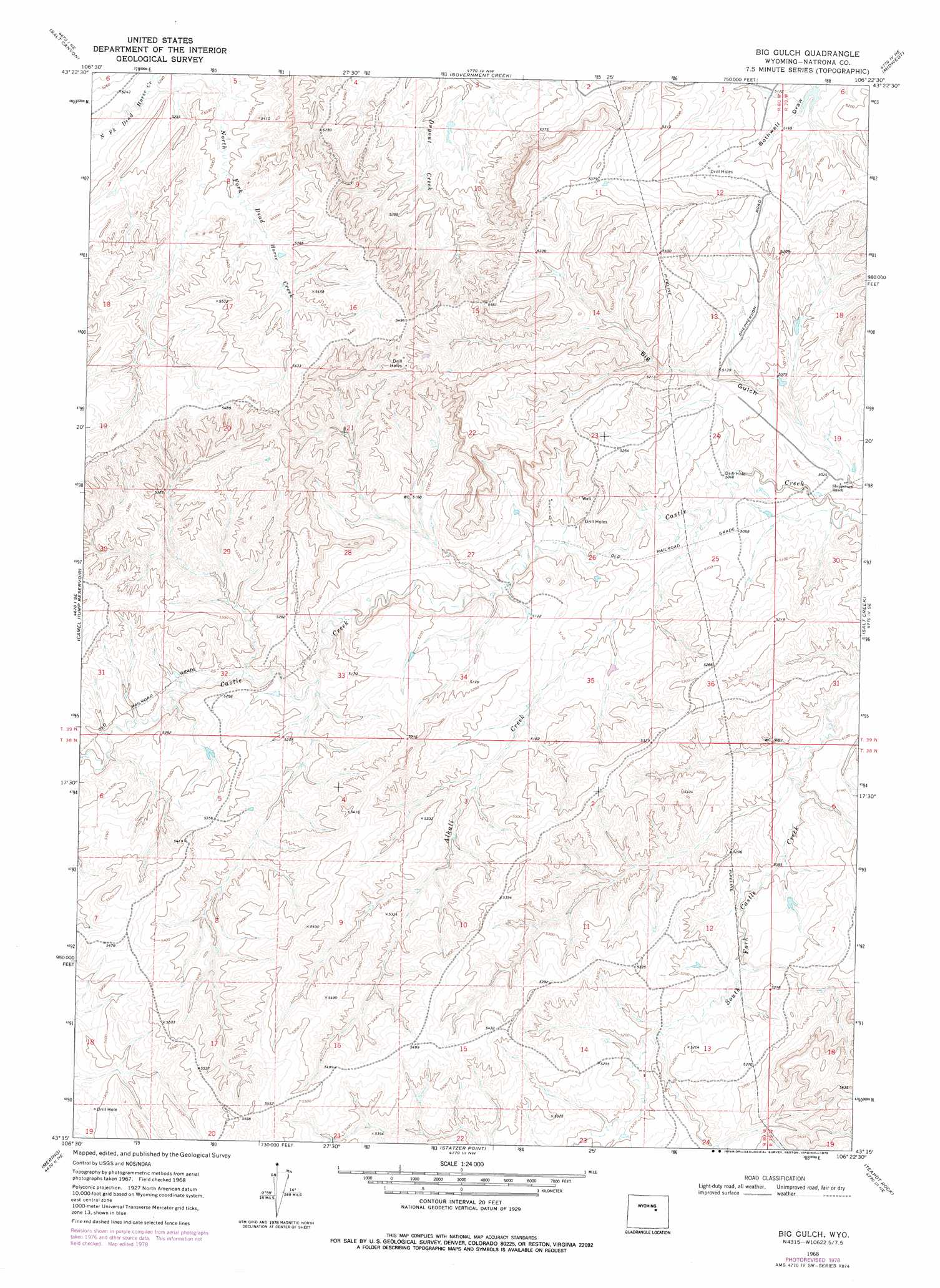
Big Gulch Topo Map Wyoming
To zoom in, hover over the map of Big Gulch
USGS Topo Quad 43106c4 - 1:24,000 scale
| Topo Map Name: | Big Gulch |
| USGS Topo Quad ID: | 43106c4 |
| Print Size: | ca. 21 1/4" wide x 27" high |
| Southeast Coordinates: | 43.25° N latitude / 106.375° W longitude |
| Map Center Coordinates: | 43.3125° N latitude / 106.4375° W longitude |
| U.S. State: | WY |
| Filename: | o43106c4.jpg |
| Download Map JPG Image: | Big Gulch topo map 1:24,000 scale |
| Map Type: | Topographic |
| Topo Series: | 7.5´ |
| Map Scale: | 1:24,000 |
| Source of Map Images: | United States Geological Survey (USGS) |
| Alternate Map Versions: |
Big Gulch WY 1968, updated 1972 Download PDF Buy paper map Big Gulch WY 1968, updated 1978 Download PDF Buy paper map Big Gulch WY 2012 Download PDF Buy paper map Big Gulch WY 2015 Download PDF Buy paper map |
1:24,000 Topo Quads surrounding Big Gulch
T T T Ranch |
Wall Creek |
Dugout Ranch |
Dead Woman Crossing |
Linch |
Broken Horn Creek |
Salt Canyon |
Government Creek |
Midwest |
Edgerton |
Fiftymile Flat |
Camel Hump Reservoir |
Big Gulch |
Salt Creek |
Gillam Draw West |
Reynolds Reservoir |
Merino |
Statzer Point |
Teapot Rock |
Seven L Creek West |
Burlington Lake |
Smith Flats |
Illco |
Mcpherson Draw |
Mckenzie Flat |
> Back to 43106a1 at 1:100,000 scale
> Back to 43106a1 at 1:250,000 scale
> Back to U.S. Topo Maps home
Big Gulch topo map: Gazetteer
Big Gulch: Dams
Colonel Dam elevation 1617m 5305′Big Gulch: Reservoirs
Colonel Reservoir elevation 1617m 5305′Big Gulch: Streams
Alkali Creek elevation 1536m 5039′Big Gulch: Valleys
Big Gulch elevation 1526m 5006′Big Gulch digital topo map on disk
Buy this Big Gulch topo map showing relief, roads, GPS coordinates and other geographical features, as a high-resolution digital map file on DVD:
Eastern Wyoming & Western South Dakota
Buy digital topo maps: Eastern Wyoming & Western South Dakota