Edgerton Topo Map Wyoming
To zoom in, hover over the map of Edgerton
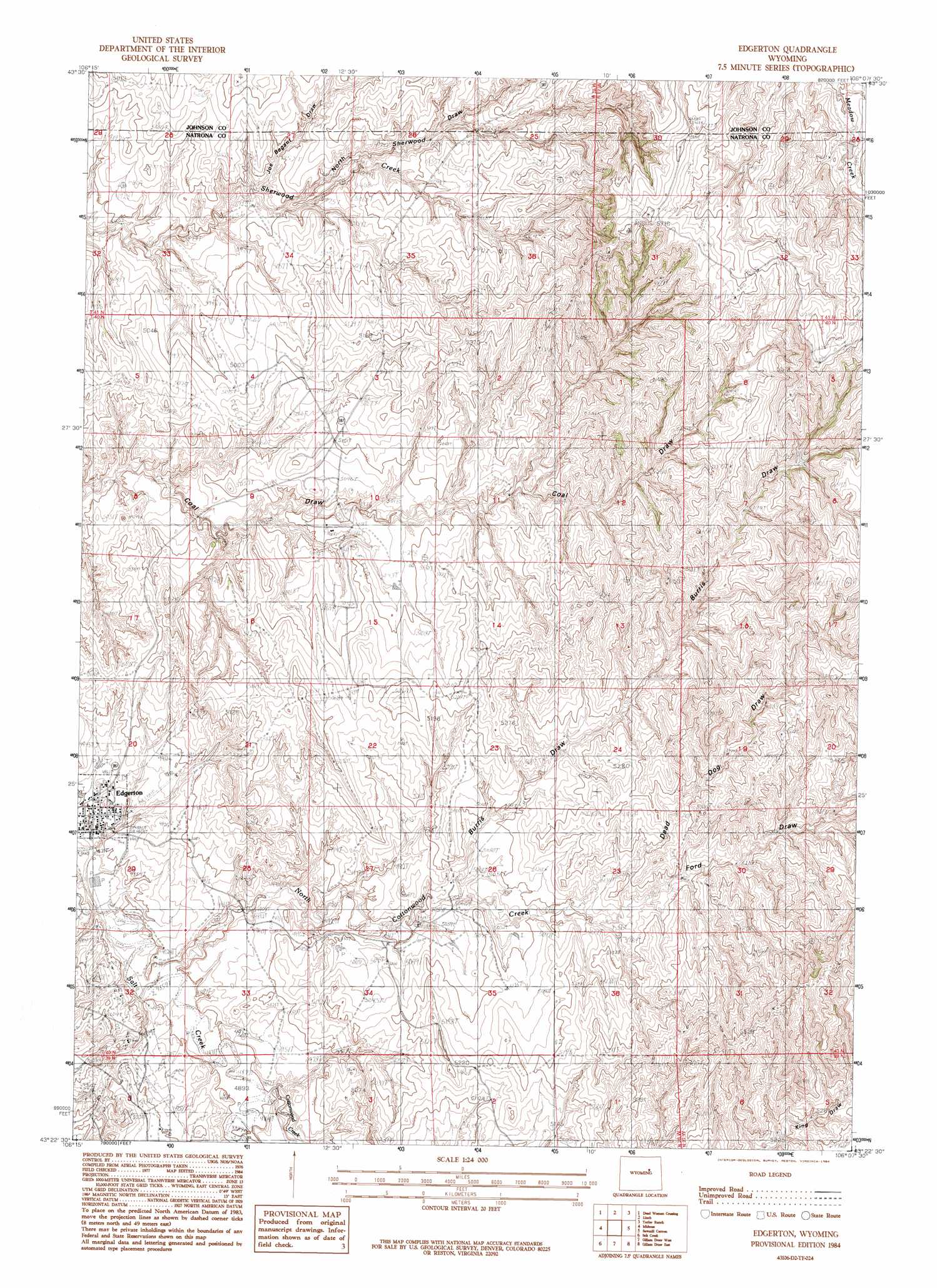
USGS Topo Quad 43106d2 - 1:24,000 scale
| Topo Map Name: | Edgerton |
| USGS Topo Quad ID: | 43106d2 |
| Print Size: | ca. 21 1/4" wide x 27" high |
| Southeast Coordinates: | 43.375° N latitude / 106.125° W longitude |
| Map Center Coordinates: | 43.4375° N latitude / 106.1875° W longitude |
| U.S. State: | WY |
| Filename: | o43106d2.jpg |
| Download Map JPG Image: | Edgerton topo map 1:24,000 scale |
| Map Type: | Topographic |
| Topo Series: | 7.5´ |
| Map Scale: | 1:24,000 |
| Source of Map Images: | United States Geological Survey (USGS) |
| Alternate Map Versions: |
Edgerton WY 1984, updated 1984 Download PDF Buy paper map Edgerton WY 2012 Download PDF Buy paper map Edgerton WY 2015 Download PDF Buy paper map |
1:24,000 Topo Quads surrounding Edgerton
Figure 8 Reservoir |
Sussex |
House Creek |
Dry Fork Ranch |
Rolling Pin Ranch |
Dugout Ranch |
Dead Woman Crossing |
Linch |
Taylor Ranch |
Artesian Draw |
Government Creek |
Midwest |
Edgerton |
Sawmill Canyon |
Ross |
Big Gulch |
Salt Creek |
Gillam Draw West |
Gillam Draw East |
Marsh Draw |
Statzer Point |
Teapot Rock |
Seven L Creek West |
Seven L Creek East |
Fly Draw |
> Back to 43106a1 at 1:100,000 scale
> Back to 43106a1 at 1:250,000 scale
> Back to U.S. Topo Maps home
Edgerton topo map: Gazetteer
Edgerton: Dams
Meadow Creek Dam elevation 1664m 5459′Western States Number 1 Dam elevation 1532m 5026′
Edgerton: Oilfields
East Salt Creek Oil Field elevation 1533m 5029′Edgerton: Populated Places
Edgerton elevation 1493m 4898′Edgerton: Reservoirs
Meadow Creek Reservoir elevation 1664m 5459′Western States Number 1 Reservoir elevation 1532m 5026′
Edgerton: Streams
Cottonwood Creek elevation 1492m 4895′North Cottonwood Creek elevation 1487m 4878′
Edgerton: Valleys
Burris Draw elevation 1532m 5026′Dead Dog Draw elevation 1555m 5101′
Ford Draw elevation 1573m 5160′
Joe Begant Draw elevation 1500m 4921′
King Draw elevation 1603m 5259′
North Sherwood Draw elevation 1695m 5561′
Edgerton digital topo map on disk
Buy this Edgerton topo map showing relief, roads, GPS coordinates and other geographical features, as a high-resolution digital map file on DVD:
Eastern Wyoming & Western South Dakota
Buy digital topo maps: Eastern Wyoming & Western South Dakota