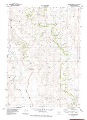
Hole-In-The-Wall Topo Map Wyoming
To zoom in, hover over the map of Hole-In-The-Wall
USGS Topo Quad 43106e7 - 1:24,000 scale
| Topo Map Name: | Hole-In-The-Wall |
| USGS Topo Quad ID: | 43106e7 |
| Print Size: | ca. 21 1/4" wide x 27" high |
| Southeast Coordinates: | 43.5° N latitude / 106.75° W longitude |
| Map Center Coordinates: | 43.5625° N latitude / 106.8125° W longitude |
| U.S. State: | WY |
| Filename: | o43106e7.jpg |
| Download Map JPG Image: | Hole-In-The-Wall topo map 1:24,000 scale |
| Map Type: | Topographic |
| Topo Series: | 7.5´ |
| Map Scale: | 1:24,000 |
| Source of Map Images: | United States Geological Survey (USGS) |
| Alternate Map Versions: |
Hole-in-the-wall WY 1984, updated 1984 Download PDF Buy paper map Hole-in-the-Wall WY 2012 Download PDF Buy paper map Hole-in-the-Wall WY 2015 Download PDF Buy paper map |
1:24,000 Topo Quads surrounding Hole-In-The-Wall
> Back to 43106e1 at 1:100,000 scale
> Back to 43106a1 at 1:250,000 scale
> Back to U.S. Topo Maps home
Hole-In-The-Wall topo map: Gazetteer
Hole-In-The-Wall: Canals
Lea Ditch elevation 1653m 5423′Hole-In-The-Wall: Dams
Albert Number 2 Dam elevation 1613m 5291′Hole-In-The-Wall: Gaps
Bar C Gap elevation 1605m 5265′Hole-In-The-Wall: Mines
Murphy Creek Area Mine elevation 1621m 5318′Peterson Draw Mine elevation 1623m 5324′
Spring Creek Mine elevation 1684m 5524′
Hole-In-The-Wall: Reservoirs
Albert Number 2 Reservoir elevation 1613m 5291′Keith Reservoir elevation 1623m 5324′
Hole-In-The-Wall: Springs
Shearing Pens Spring elevation 1645m 5396′Taylor Spring elevation 1623m 5324′
Hole-In-The-Wall: Streams
Buffalo Creek elevation 1698m 5570′Buffalo Creek elevation 1686m 5531′
North Poker Creek elevation 1577m 5173′
Poker Creek elevation 1618m 5308′
Spring Creek elevation 1651m 5416′
Hole-In-The-Wall: Summits
Castle Rock elevation 1604m 5262′Poker Butte elevation 1662m 5452′
Steamboat Rock elevation 1659m 5442′
Hole-In-The-Wall: Valleys
Bar C Draw elevation 1584m 5196′Hole-in-the-Wall elevation 1648m 5406′
Rocky Draw elevation 1567m 5141′
Shirk Draw elevation 1652m 5419′
Trough Draw elevation 1554m 5098′
Hole-In-The-Wall digital topo map on disk
Buy this Hole-In-The-Wall topo map showing relief, roads, GPS coordinates and other geographical features, as a high-resolution digital map file on DVD:
Eastern Wyoming & Western South Dakota
Buy digital topo maps: Eastern Wyoming & Western South Dakota


