Fourmile Reservoir Topo Map Wyoming
To zoom in, hover over the map of Fourmile Reservoir
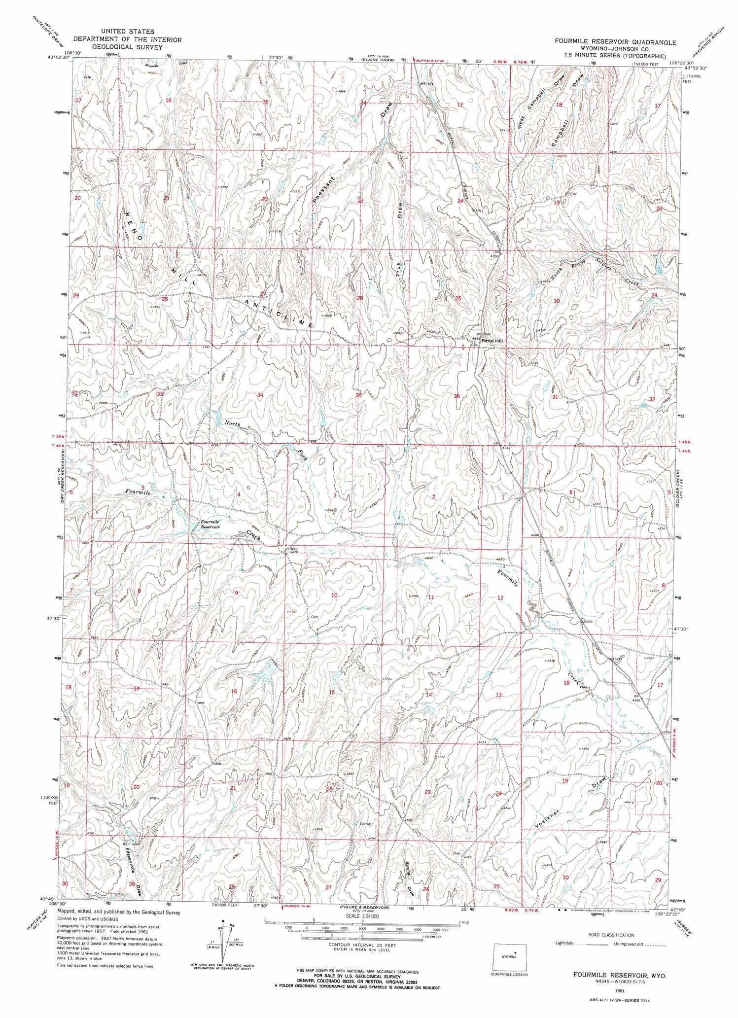
USGS Topo Quad 43106g4 - 1:24,000 scale
| Topo Map Name: | Fourmile Reservoir |
| USGS Topo Quad ID: | 43106g4 |
| Print Size: | ca. 21 1/4" wide x 27" high |
| Southeast Coordinates: | 43.75° N latitude / 106.375° W longitude |
| Map Center Coordinates: | 43.8125° N latitude / 106.4375° W longitude |
| U.S. State: | WY |
| Filename: | o43106g4.jpg |
| Download Map JPG Image: | Fourmile Reservoir topo map 1:24,000 scale |
| Map Type: | Topographic |
| Topo Series: | 7.5´ |
| Map Scale: | 1:24,000 |
| Source of Map Images: | United States Geological Survey (USGS) |
| Alternate Map Versions: |
Fourmile Reservoir WY 1961, updated 1964 Download PDF Buy paper map Fourmile Reservoir WY 2012 Download PDF Buy paper map Fourmile Reservoir WY 2015 Download PDF Buy paper map |
1:24,000 Topo Quads surrounding Fourmile Reservoir
Purdy Reservoir |
Trabing |
Brown Ranch |
Boon |
Bowman Flat |
Schlicht Draw |
Antelope Draw |
Elaine Draw |
Provence Ranch |
Hoe Ranch |
Hibbard Draw |
Dry Creek Reservoir |
Fourmile Reservoir |
Soldier Creek |
Fort Reno |
Kaycee |
Kaycee Ne |
Figure 8 Reservoir |
Sussex |
House Creek |
T T T Ranch |
Wall Creek |
Dugout Ranch |
Dead Woman Crossing |
Linch |
> Back to 43106e1 at 1:100,000 scale
> Back to 43106a1 at 1:250,000 scale
> Back to U.S. Topo Maps home
Fourmile Reservoir topo map: Gazetteer
Fourmile Reservoir: Cliffs
Reno Hill Anticline elevation 1483m 4865′Fourmile Reservoir: Dams
Four Mile Dam elevation 1439m 4721′Fourmile Reservoir: Mines
Campbell Number One Mine elevation 1400m 4593′Fourmile Reservoir: Reservoirs
Four Mile Reservoir elevation 1439m 4721′Fourmile Reservoir elevation 1441m 4727′
Fourmile Reservoir: Streams
North Fork Fourmile Creek elevation 1420m 4658′Fourmile Reservoir: Summits
Reno Hill elevation 1478m 4849′Fourmile Reservoir: Valleys
Taylor Draw elevation 1457m 4780′Truk Draw elevation 1396m 4580′
Voelkner Draw elevation 1395m 4576′
Fourmile Reservoir digital topo map on disk
Buy this Fourmile Reservoir topo map showing relief, roads, GPS coordinates and other geographical features, as a high-resolution digital map file on DVD:
Eastern Wyoming & Western South Dakota
Buy digital topo maps: Eastern Wyoming & Western South Dakota