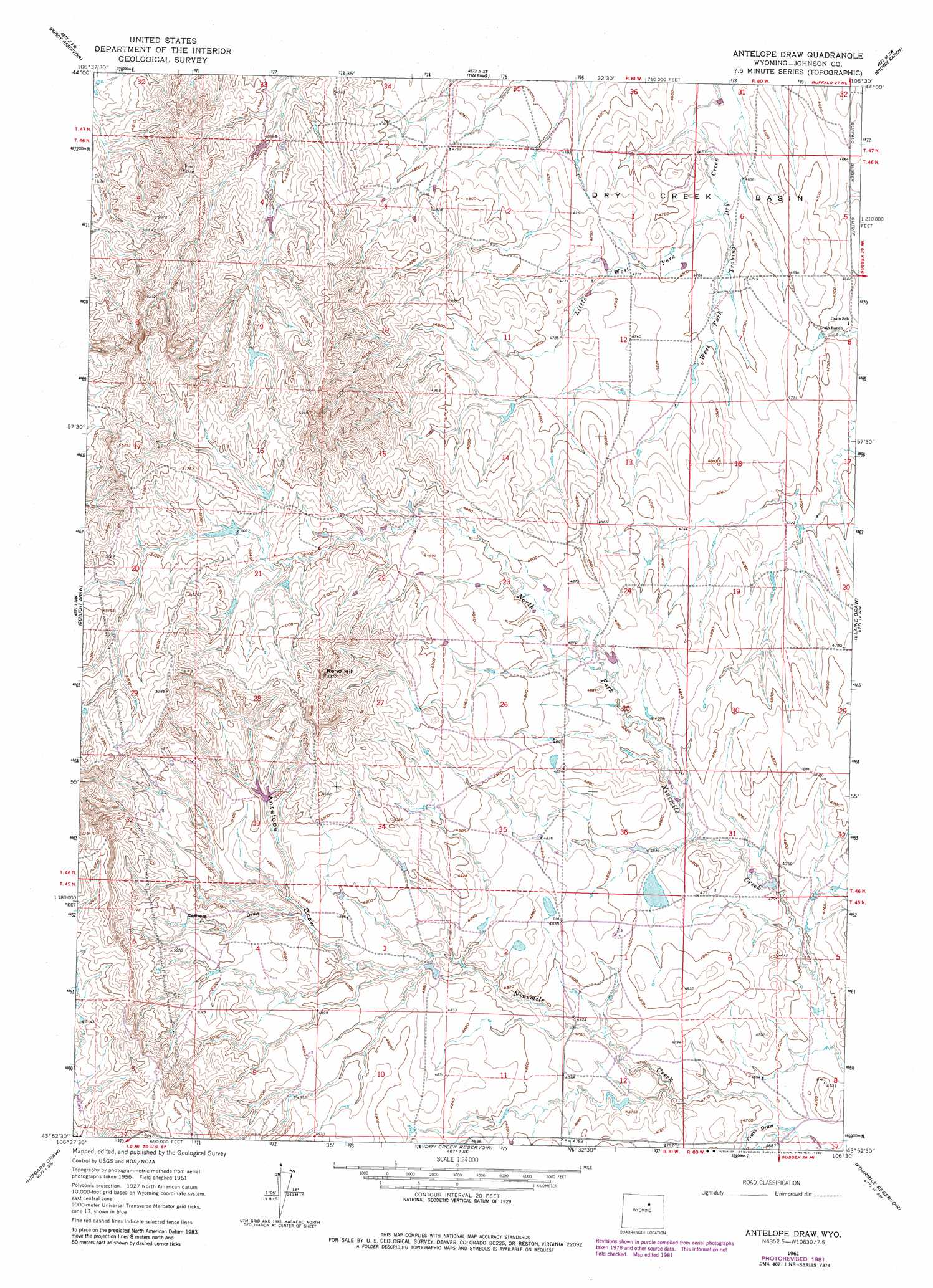
Antelope Draw Topo Map Wyoming
To zoom in, hover over the map of Antelope Draw
USGS Topo Quad 43106h5 - 1:24,000 scale
| Topo Map Name: | Antelope Draw |
| USGS Topo Quad ID: | 43106h5 |
| Print Size: | ca. 21 1/4" wide x 27" high |
| Southeast Coordinates: | 43.875° N latitude / 106.5° W longitude |
| Map Center Coordinates: | 43.9375° N latitude / 106.5625° W longitude |
| U.S. State: | WY |
| Filename: | o43106h5.jpg |
| Download Map JPG Image: | Antelope Draw topo map 1:24,000 scale |
| Map Type: | Topographic |
| Topo Series: | 7.5´ |
| Map Scale: | 1:24,000 |
| Source of Map Images: | United States Geological Survey (USGS) |
| Alternate Map Versions: |
Antelope Draw WY 1961, updated 1964 Download PDF Buy paper map Antelope Draw WY 1961, updated 1982 Download PDF Buy paper map Antelope Draw WY 1981, updated 1982 Download PDF Buy paper map Antelope Draw WY 2012 Download PDF Buy paper map Antelope Draw WY 2015 Download PDF Buy paper map |
1:24,000 Topo Quads surrounding Antelope Draw
Klondike Ranch |
T A Ranch |
Ta Ranch Ne |
Crazy Woman Ranch |
Ploessers Draw |
Robinson Canyon |
Purdy Reservoir |
Trabing |
Brown Ranch |
Boon |
The Horn |
Schlicht Draw |
Antelope Draw |
Elaine Draw |
Provence Ranch |
Mayoworth |
Hibbard Draw |
Dry Creek Reservoir |
Fourmile Reservoir |
Soldier Creek |
Red Fork Powder River |
Kaycee |
Kaycee Ne |
Figure 8 Reservoir |
Sussex |
> Back to 43106e1 at 1:100,000 scale
> Back to 43106a1 at 1:250,000 scale
> Back to U.S. Topo Maps home
Antelope Draw topo map: Gazetteer
Antelope Draw: Dams
Crain Dam elevation 1423m 4668′Antelope Draw: Reservoirs
Crain Reservoir elevation 1423m 4668′Antelope Draw: Streams
Little West Fork Trabing Dry Creek elevation 1419m 4655′Antelope Draw: Summits
Reno Hill elevation 1631m 5351′Antelope Draw: Valleys
Antelope Draw elevation 1478m 4849′Cathers Draw elevation 1493m 4898′
Frost Draw elevation 1423m 4668′
Antelope Draw digital topo map on disk
Buy this Antelope Draw topo map showing relief, roads, GPS coordinates and other geographical features, as a high-resolution digital map file on DVD:
Eastern Wyoming & Western South Dakota
Buy digital topo maps: Eastern Wyoming & Western South Dakota