Seventy One Reservoir Topo Map Wyoming
To zoom in, hover over the map of Seventy One Reservoir
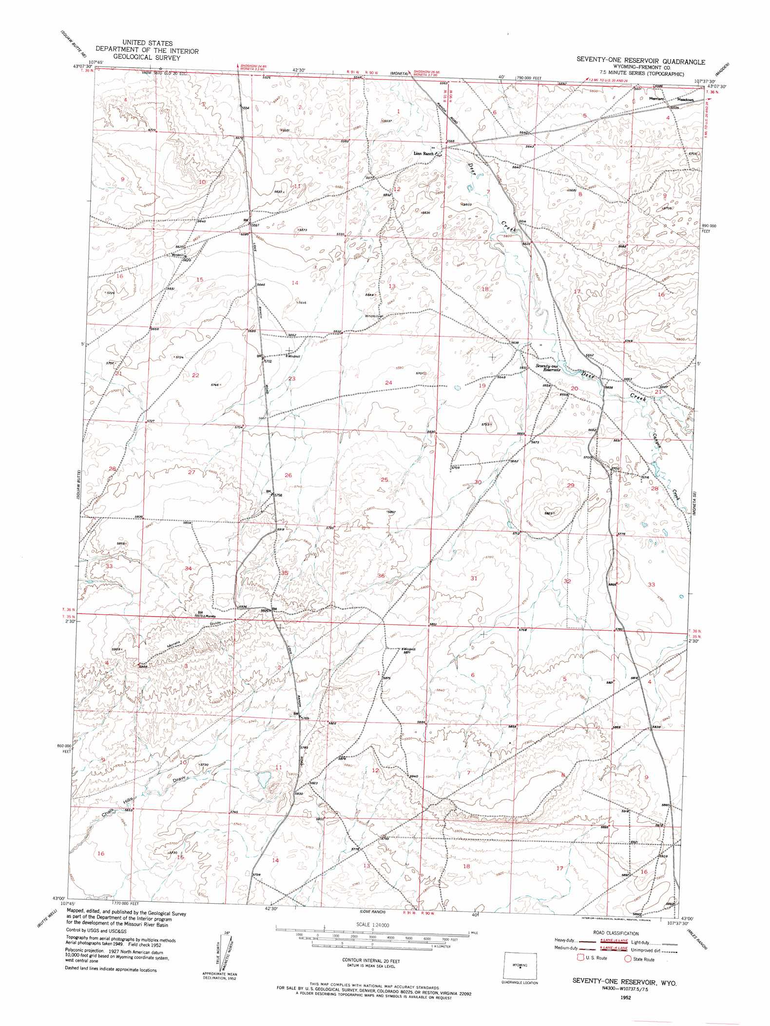
USGS Topo Quad 43107a6 - 1:24,000 scale
| Topo Map Name: | Seventy One Reservoir |
| USGS Topo Quad ID: | 43107a6 |
| Print Size: | ca. 21 1/4" wide x 27" high |
| Southeast Coordinates: | 43° N latitude / 107.625° W longitude |
| Map Center Coordinates: | 43.0625° N latitude / 107.6875° W longitude |
| U.S. State: | WY |
| Filename: | o43107a6.jpg |
| Download Map JPG Image: | Seventy One Reservoir topo map 1:24,000 scale |
| Map Type: | Topographic |
| Topo Series: | 7.5´ |
| Map Scale: | 1:24,000 |
| Source of Map Images: | United States Geological Survey (USGS) |
| Alternate Map Versions: |
Seventy-one Reservoir WY 1952 Download PDF Buy paper map Seventy-one Reservoir WY 1952, updated 1953 Download PDF Buy paper map Seventy One Reservoir WY 2012 Download PDF Buy paper map Seventy One Reservoir WY 2015 Download PDF Buy paper map |
1:24,000 Topo Quads surrounding Seventy One Reservoir
Picard Ranch |
Gates Butte |
Lysite |
Lysite Se |
Badwater |
Ocla Draw |
Squaw Butte Ne |
Moneta |
Madden |
Arminto Nw |
Haybarn Hill |
Squaw Butte |
Seventy One Reservoir |
Moneta Se |
Arminto Sw |
Double Butte |
Butte Well |
Love Ranch |
Miles Ranch |
Ervay Basin |
Rongis Reservoir |
Rongis Reservoir Se |
Puddle Springs |
Gas Hills |
Ervay Basin Sw |
> Back to 43107a1 at 1:100,000 scale
> Back to 43106a1 at 1:250,000 scale
> Back to U.S. Topo Maps home
Seventy One Reservoir topo map: Gazetteer
Seventy One Reservoir: Reservoirs
Seventy-one Reservoir elevation 1719m 5639′Seventy One Reservoir: Ridges
Moneta Divide elevation 1818m 5964′Seventy One Reservoir: Streams
Canyon Creek elevation 1732m 5682′Seventy One Reservoir digital topo map on disk
Buy this Seventy One Reservoir topo map showing relief, roads, GPS coordinates and other geographical features, as a high-resolution digital map file on DVD:
Eastern Wyoming & Western South Dakota
Buy digital topo maps: Eastern Wyoming & Western South Dakota