Haybarn Hill Topo Map Wyoming
To zoom in, hover over the map of Haybarn Hill
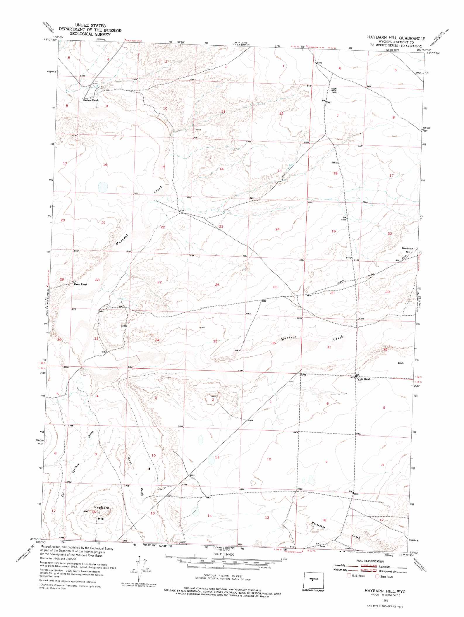
USGS Topo Quad 43107a8 - 1:24,000 scale
| Topo Map Name: | Haybarn Hill |
| USGS Topo Quad ID: | 43107a8 |
| Print Size: | ca. 21 1/4" wide x 27" high |
| Southeast Coordinates: | 43° N latitude / 107.875° W longitude |
| Map Center Coordinates: | 43.0625° N latitude / 107.9375° W longitude |
| U.S. State: | WY |
| Filename: | o43107a8.jpg |
| Download Map JPG Image: | Haybarn Hill topo map 1:24,000 scale |
| Map Type: | Topographic |
| Topo Series: | 7.5´ |
| Map Scale: | 1:24,000 |
| Source of Map Images: | United States Geological Survey (USGS) |
| Alternate Map Versions: |
Haybarn Hill WY 1952, updated 1953 Download PDF Buy paper map Haybarn Hill WY 1952, updated 1976 Download PDF Buy paper map Haybarn Hill WY 2012 Download PDF Buy paper map Haybarn Hill WY 2015 Download PDF Buy paper map |
1:24,000 Topo Quads surrounding Haybarn Hill
Bonneville Sw |
Bonneville |
Picard Ranch |
Gates Butte |
Lysite |
Hidden Valley |
Shoshoni |
Ocla Draw |
Squaw Butte Ne |
Moneta |
Indian Butte |
Fuller Reservoir |
Haybarn Hill |
Squaw Butte |
Seventy One Reservoir |
Alkali Butte |
Campbell Ridge |
Double Butte |
Butte Well |
Love Ranch |
Sand Draw |
Blue Gulch |
Rongis Reservoir |
Rongis Reservoir Se |
Puddle Springs |
> Back to 43107a1 at 1:100,000 scale
> Back to 43106a1 at 1:250,000 scale
> Back to U.S. Topo Maps home
Haybarn Hill topo map: Gazetteer
Haybarn Hill: Mines
Muskrat Creek Mine elevation 1610m 5282′Haybarn Hill: Streams
Conant Creek elevation 1580m 5183′Oil Springs Creek elevation 1580m 5183′
Haybarn Hill: Summits
Deadman Hill elevation 1688m 5538′Haybarn Hill elevation 1660m 5446′
Haybarn Hill digital topo map on disk
Buy this Haybarn Hill topo map showing relief, roads, GPS coordinates and other geographical features, as a high-resolution digital map file on DVD:
Eastern Wyoming & Western South Dakota
Buy digital topo maps: Eastern Wyoming & Western South Dakota