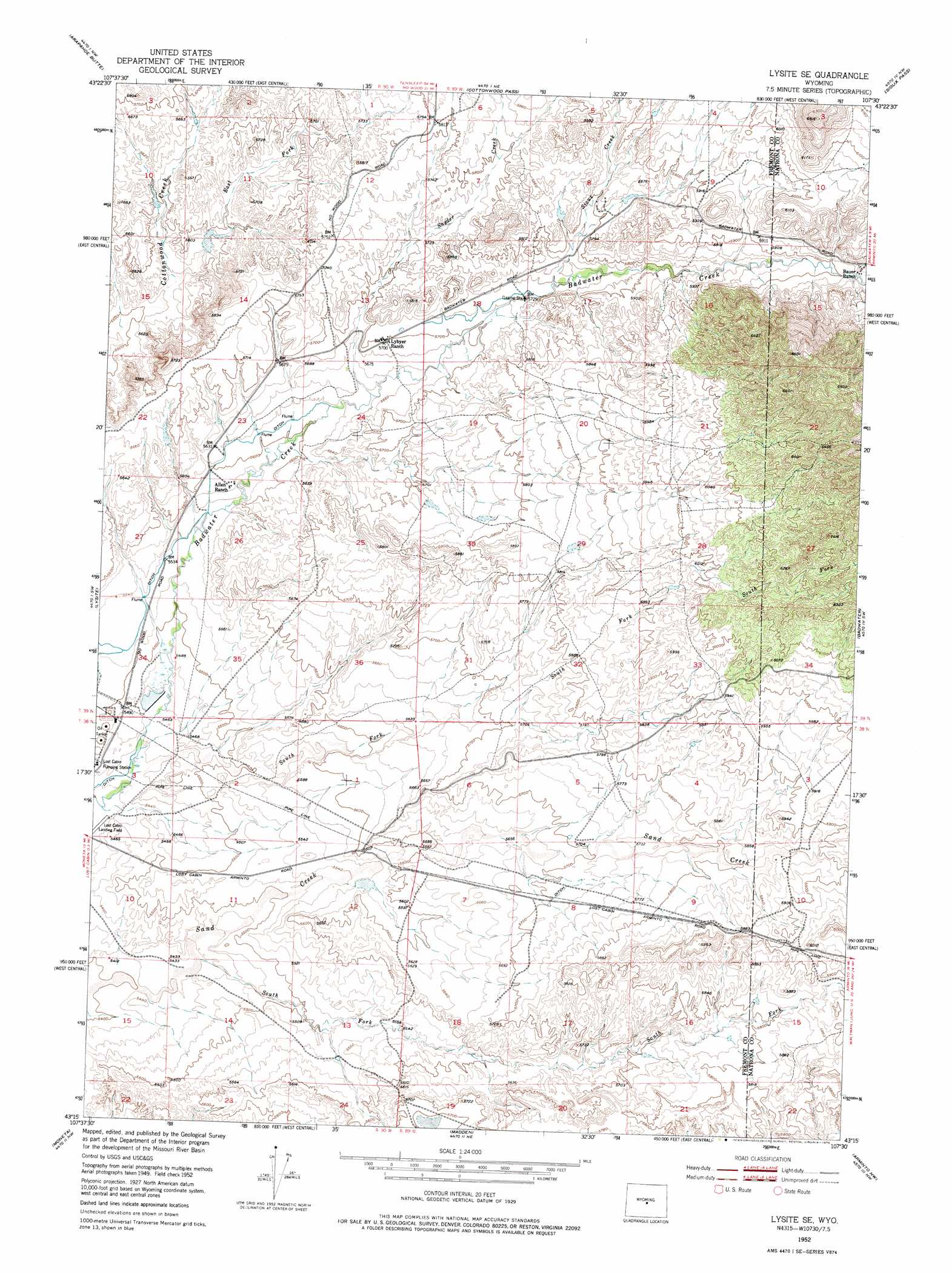
Lysite Se Topo Map Wyoming
To zoom in, hover over the map of Lysite Se
USGS Topo Quad 43107c5 - 1:24,000 scale
| Topo Map Name: | Lysite Se |
| USGS Topo Quad ID: | 43107c5 |
| Print Size: | ca. 21 1/4" wide x 27" high |
| Southeast Coordinates: | 43.25° N latitude / 107.5° W longitude |
| Map Center Coordinates: | 43.3125° N latitude / 107.5625° W longitude |
| U.S. State: | WY |
| Filename: | o43107c5.jpg |
| Download Map JPG Image: | Lysite Se topo map 1:24,000 scale |
| Map Type: | Topographic |
| Topo Series: | 7.5´ |
| Map Scale: | 1:24,000 |
| Source of Map Images: | United States Geological Survey (USGS) |
| Alternate Map Versions: |
Lysite SE WY 1952, updated 1953 Download PDF Buy paper map Lysite SE WY 1952, updated 1976 Download PDF Buy paper map Lysite SE WY 2012 Download PDF Buy paper map Lysite SE WY 2015 Download PDF Buy paper map |
1:24,000 Topo Quads surrounding Lysite Se
Rathbun Ranch |
Bull Mountain |
Battle Mountain |
Cornell Gulch |
Lost Creek |
De Pass |
Arapahoe Butte |
Cottonwood Pass |
Sioux Pass |
Badwater Ne |
Gates Butte |
Lysite |
Lysite Se |
Badwater |
Badwater Se |
Squaw Butte Ne |
Moneta |
Madden |
Arminto Nw |
Arminto |
Squaw Butte |
Seventy One Reservoir |
Moneta Se |
Arminto Sw |
Hiland |
> Back to 43107a1 at 1:100,000 scale
> Back to 43106a1 at 1:250,000 scale
> Back to U.S. Topo Maps home
Lysite Se topo map: Gazetteer
Lysite Se: Dams
Okie Dam elevation 1664m 5459′Snyder Creek Detention Dam elevation 1760m 5774′
Lysite Se: Mines
Gas Hills Mine elevation 1875m 6151′Lysite Se: Reservoirs
Okie Reservoir elevation 1664m 5459′Snyder Creek Reservoir elevation 1760m 5774′
Lysite Se: Streams
Sioux Creek elevation 1751m 5744′Snyder Creek elevation 1721m 5646′
South Fork Badwater Creek elevation 1658m 5439′
South Fork Sand Creek elevation 1658m 5439′
Lysite Se digital topo map on disk
Buy this Lysite Se topo map showing relief, roads, GPS coordinates and other geographical features, as a high-resolution digital map file on DVD:
Eastern Wyoming & Western South Dakota
Buy digital topo maps: Eastern Wyoming & Western South Dakota