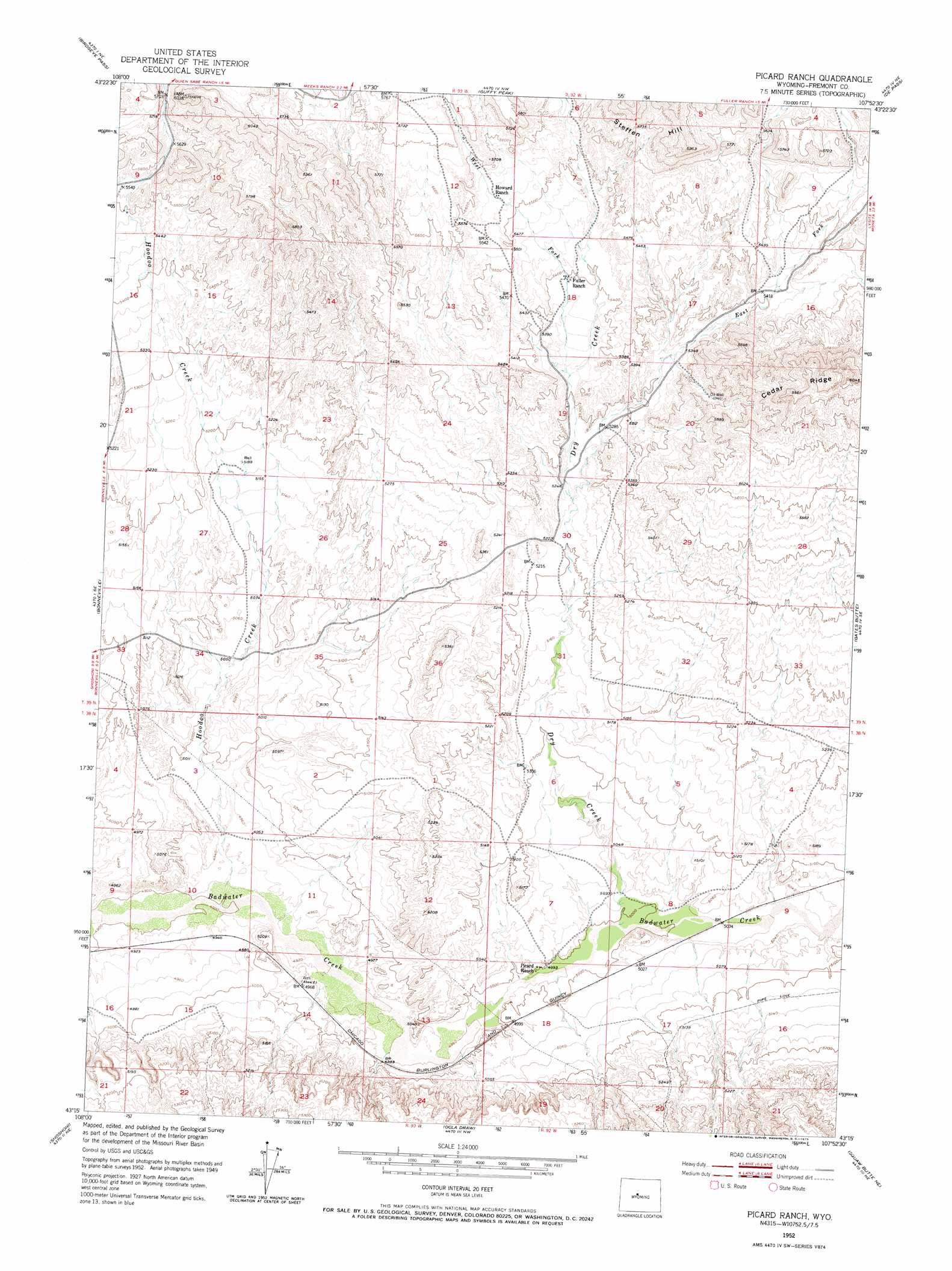
Picard Ranch Topo Map Wyoming
To zoom in, hover over the map of Picard Ranch
USGS Topo Quad 43107c8 - 1:24,000 scale
| Topo Map Name: | Picard Ranch |
| USGS Topo Quad ID: | 43107c8 |
| Print Size: | ca. 21 1/4" wide x 27" high |
| Southeast Coordinates: | 43.25° N latitude / 107.875° W longitude |
| Map Center Coordinates: | 43.3125° N latitude / 107.9375° W longitude |
| U.S. State: | WY |
| Filename: | o43107c8.jpg |
| Download Map JPG Image: | Picard Ranch topo map 1:24,000 scale |
| Map Type: | Topographic |
| Topo Series: | 7.5´ |
| Map Scale: | 1:24,000 |
| Source of Map Images: | United States Geological Survey (USGS) |
| Alternate Map Versions: |
Picard Ranch WY 1952, updated 1953 Download PDF Buy paper map Picard Ranch WY 1952, updated 1973 Download PDF Buy paper map Picard Ranch WY 2012 Download PDF Buy paper map Picard Ranch WY 2015 Download PDF Buy paper map |
1:24,000 Topo Quads surrounding Picard Ranch
Wedding Of The Waters |
Devil Slide |
Blue Hill |
Rathbun Ranch |
Bull Mountain |
Boysen |
Birdseye Pass |
Guffy Peak |
De Pass |
Arapahoe Butte |
Bonneville Sw |
Bonneville |
Picard Ranch |
Gates Butte |
Lysite |
Hidden Valley |
Shoshoni |
Ocla Draw |
Squaw Butte Ne |
Moneta |
Indian Butte |
Fuller Reservoir |
Haybarn Hill |
Squaw Butte |
Seventy One Reservoir |
> Back to 43107a1 at 1:100,000 scale
> Back to 43106a1 at 1:250,000 scale
> Back to U.S. Topo Maps home
Picard Ranch topo map: Gazetteer
Picard Ranch: Mines
Gem Number One Mine elevation 1641m 5383′H G F Number Seven Mine elevation 1584m 5196′
Phillips Number Twenty-five Mine elevation 1750m 5741′
Picard Ranch: Streams
Dry Creek elevation 1524m 5000′East Fork Dry Creek elevation 1592m 5223′
Hoodoo Creek elevation 1496m 4908′
West Fork Dry Creek elevation 1621m 5318′
Picard Ranch digital topo map on disk
Buy this Picard Ranch topo map showing relief, roads, GPS coordinates and other geographical features, as a high-resolution digital map file on DVD:
Eastern Wyoming & Western South Dakota
Buy digital topo maps: Eastern Wyoming & Western South Dakota