Cherry Creek Hill Topo Map Wyoming
To zoom in, hover over the map of Cherry Creek Hill
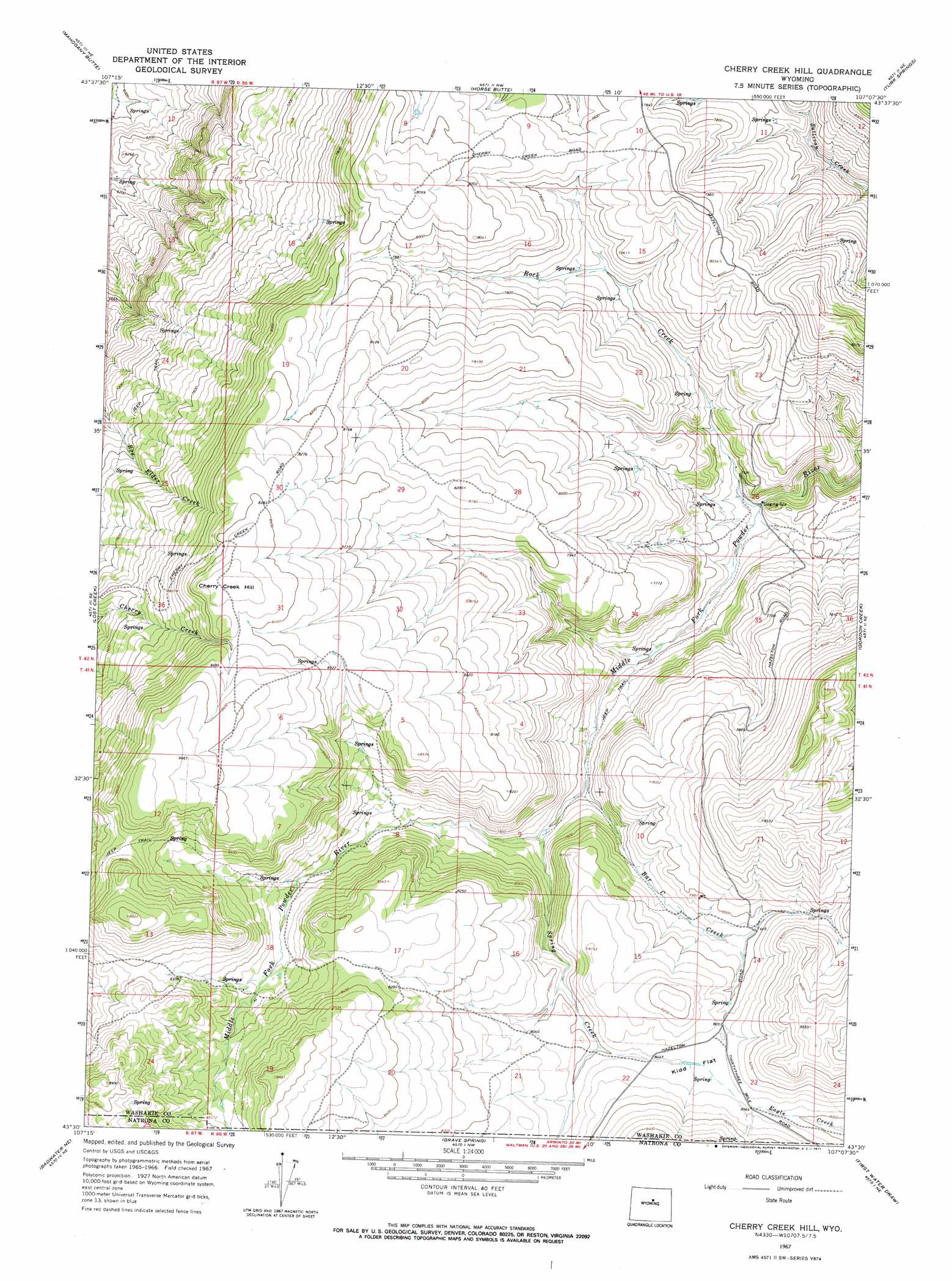
USGS Topo Quad 43107e2 - 1:24,000 scale
| Topo Map Name: | Cherry Creek Hill |
| USGS Topo Quad ID: | 43107e2 |
| Print Size: | ca. 21 1/4" wide x 27" high |
| Southeast Coordinates: | 43.5° N latitude / 107.125° W longitude |
| Map Center Coordinates: | 43.5625° N latitude / 107.1875° W longitude |
| U.S. State: | WY |
| Filename: | o43107e2.jpg |
| Download Map JPG Image: | Cherry Creek Hill topo map 1:24,000 scale |
| Map Type: | Topographic |
| Topo Series: | 7.5´ |
| Map Scale: | 1:24,000 |
| Source of Map Images: | United States Geological Survey (USGS) |
| Alternate Map Versions: |
Cherry Creek Hill WY 1967, updated 1971 Download PDF Buy paper map Cherry Creek Hill WY 2012 Download PDF Buy paper map Cherry Creek Hill WY 2015 Download PDF Buy paper map |
1:24,000 Topo Quads surrounding Cherry Creek Hill
Indian Creek |
Big Trails |
Tallon Spring |
Tabletop |
Fraker Mountain |
Lightning Ridge |
Mahogany Butte |
Horse Butte |
Turk Springs |
Barnum |
Cornell Gulch |
Lost Creek |
Cherry Creek Hill |
Gordon Creek |
Poker Butte |
Sioux Pass |
Badwater Ne |
Grave Spring |
First Water Draw |
Roughlock Hill |
Badwater |
Badwater Se |
Deadman Butte |
Three Buttes |
Flat Top Hill |
> Back to 43107e1 at 1:100,000 scale
> Back to 43106a1 at 1:250,000 scale
> Back to U.S. Topo Maps home
Cherry Creek Hill topo map: Gazetteer
Cherry Creek Hill: Flats
Kidd Flat elevation 2457m 8061′Cherry Creek Hill: Streams
Bar C Creek elevation 2335m 7660′Rock Creek elevation 2264m 7427′
Spring Creek elevation 2325m 7627′
Cherry Creek Hill: Summits
Cherry Creek Hill elevation 2590m 8497′Cherry Creek Hill digital topo map on disk
Buy this Cherry Creek Hill topo map showing relief, roads, GPS coordinates and other geographical features, as a high-resolution digital map file on DVD:
Eastern Wyoming & Western South Dakota
Buy digital topo maps: Eastern Wyoming & Western South Dakota