Lost Creek Topo Map Wyoming
To zoom in, hover over the map of Lost Creek
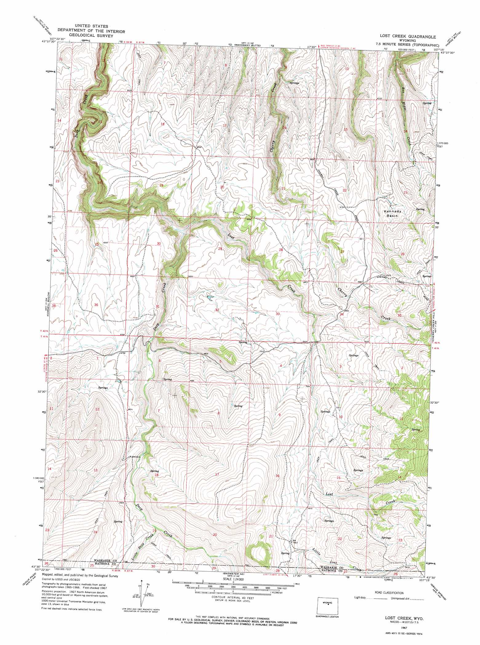
USGS Topo Quad 43107e3 - 1:24,000 scale
| Topo Map Name: | Lost Creek |
| USGS Topo Quad ID: | 43107e3 |
| Print Size: | ca. 21 1/4" wide x 27" high |
| Southeast Coordinates: | 43.5° N latitude / 107.25° W longitude |
| Map Center Coordinates: | 43.5625° N latitude / 107.3125° W longitude |
| U.S. State: | WY |
| Filename: | o43107e3.jpg |
| Download Map JPG Image: | Lost Creek topo map 1:24,000 scale |
| Map Type: | Topographic |
| Topo Series: | 7.5´ |
| Map Scale: | 1:24,000 |
| Source of Map Images: | United States Geological Survey (USGS) |
| Alternate Map Versions: |
Lost Creek WY 1967, updated 1971 Download PDF Buy paper map Lost Creek WY 2012 Download PDF Buy paper map Lost Creek WY 2015 Download PDF Buy paper map |
1:24,000 Topo Quads surrounding Lost Creek
Deadline Draw |
Indian Creek |
Big Trails |
Tallon Spring |
Tabletop |
Sand Point |
Lightning Ridge |
Mahogany Butte |
Horse Butte |
Turk Springs |
Battle Mountain |
Cornell Gulch |
Lost Creek |
Cherry Creek Hill |
Gordon Creek |
Cottonwood Pass |
Sioux Pass |
Badwater Ne |
Grave Spring |
First Water Draw |
Lysite Se |
Badwater |
Badwater Se |
Deadman Butte |
Three Buttes |
> Back to 43107e1 at 1:100,000 scale
> Back to 43106a1 at 1:250,000 scale
> Back to U.S. Topo Maps home
Lost Creek topo map: Gazetteer
Lost Creek: Basins
Kennedy Basin elevation 2013m 6604′Lost Creek: Streams
Little Deep Creek elevation 2106m 6909′Lost Creek elevation 1864m 6115′
Lost Creek digital topo map on disk
Buy this Lost Creek topo map showing relief, roads, GPS coordinates and other geographical features, as a high-resolution digital map file on DVD:
Eastern Wyoming & Western South Dakota
Buy digital topo maps: Eastern Wyoming & Western South Dakota