Turk Springs Topo Map Wyoming
To zoom in, hover over the map of Turk Springs
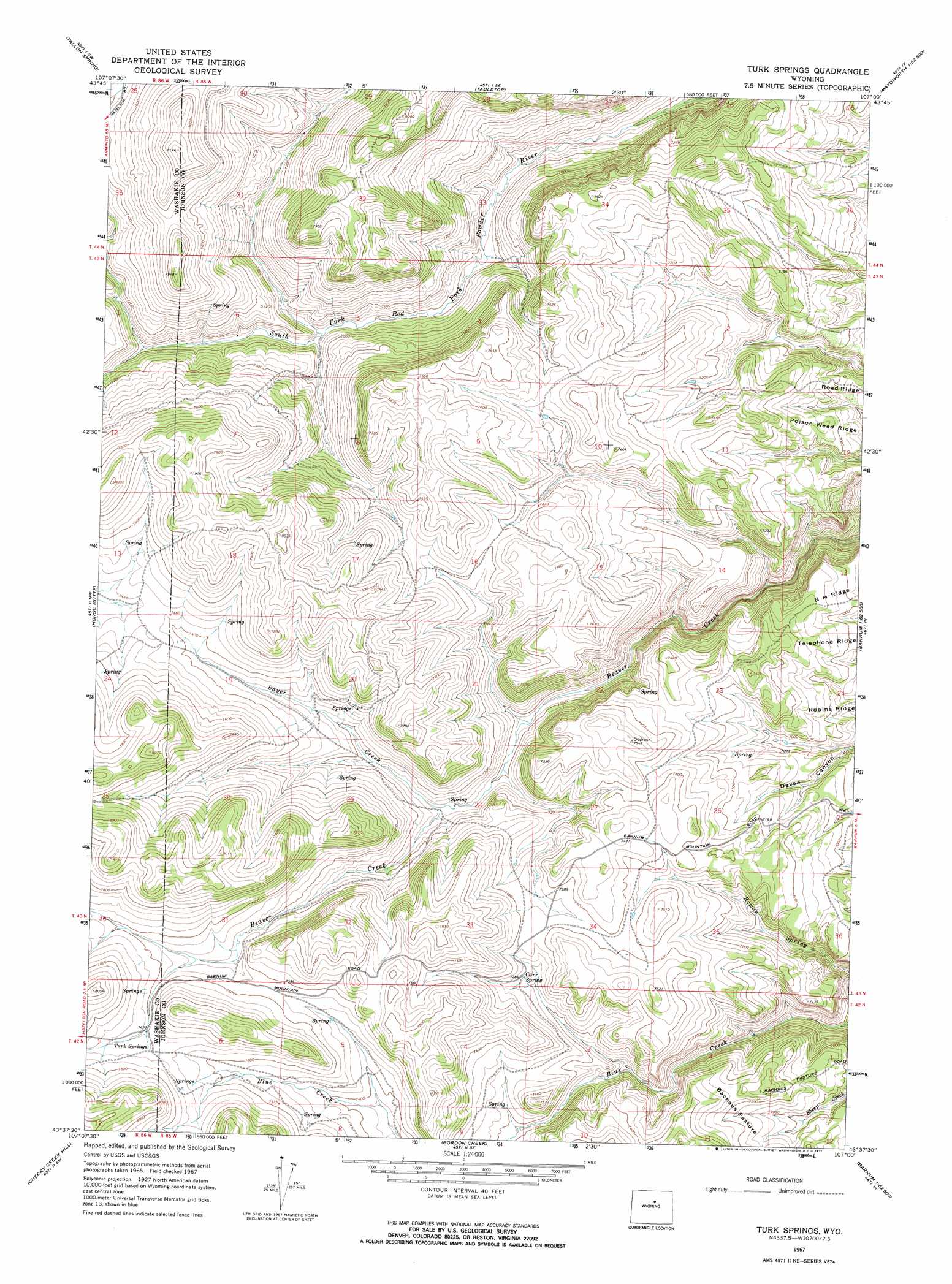
USGS Topo Quad 43107f1 - 1:24,000 scale
| Topo Map Name: | Turk Springs |
| USGS Topo Quad ID: | 43107f1 |
| Print Size: | ca. 21 1/4" wide x 27" high |
| Southeast Coordinates: | 43.625° N latitude / 107° W longitude |
| Map Center Coordinates: | 43.6875° N latitude / 107.0625° W longitude |
| U.S. State: | WY |
| Filename: | o43107f1.jpg |
| Download Map JPG Image: | Turk Springs topo map 1:24,000 scale |
| Map Type: | Topographic |
| Topo Series: | 7.5´ |
| Map Scale: | 1:24,000 |
| Source of Map Images: | United States Geological Survey (USGS) |
| Alternate Map Versions: |
Turk Springs WY 1967, updated 1971 Download PDF Buy paper map Turk Springs WY 2012 Download PDF Buy paper map Turk Springs WY 2015 Download PDF Buy paper map |
1:24,000 Topo Quads surrounding Turk Springs
Big Trails Ne |
Monument Hill |
Beartrap Meadows |
Packsaddle Canyon |
The Horn |
Big Trails |
Tallon Spring |
Tabletop |
Fraker Mountain |
Mayoworth |
Mahogany Butte |
Horse Butte |
Turk Springs |
Barnum |
Red Fork Powder River |
Lost Creek |
Cherry Creek Hill |
Gordon Creek |
Poker Butte |
Hole-In-The-Wall |
Badwater Ne |
Grave Spring |
First Water Draw |
Roughlock Hill |
Willow Creek School |
> Back to 43107e1 at 1:100,000 scale
> Back to 43106a1 at 1:250,000 scale
> Back to U.S. Topo Maps home
Turk Springs topo map: Gazetteer
Turk Springs: Flats
Bachaus Pasture elevation 2164m 7099′Turk Springs: Springs
Carr Spring elevation 2213m 7260′Turk Springs elevation 2343m 7687′
Turk Springs: Streams
Bayer Creek elevation 2151m 7057′Turk Springs digital topo map on disk
Buy this Turk Springs topo map showing relief, roads, GPS coordinates and other geographical features, as a high-resolution digital map file on DVD:
Eastern Wyoming & Western South Dakota
Buy digital topo maps: Eastern Wyoming & Western South Dakota