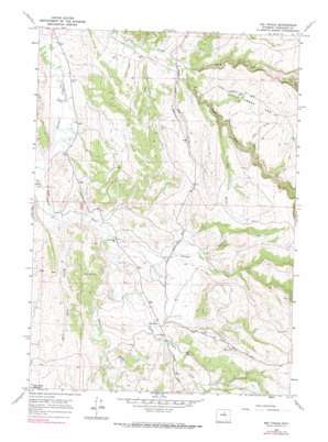
Big Trails Topo Map Wyoming
To zoom in, hover over the map of Big Trails
USGS Topo Quad 43107g3 - 1:24,000 scale
| Topo Map Name: | Big Trails |
| USGS Topo Quad ID: | 43107g3 |
| Print Size: | ca. 21 1/4" wide x 27" high |
| Southeast Coordinates: | 43.75° N latitude / 107.25° W longitude |
| Map Center Coordinates: | 43.8125° N latitude / 107.3125° W longitude |
| U.S. State: | WY |
| Filename: | o43107g3.jpg |
| Download Map JPG Image: | Big Trails topo map 1:24,000 scale |
| Map Type: | Topographic |
| Topo Series: | 7.5´ |
| Map Scale: | 1:24,000 |
| Source of Map Images: | United States Geological Survey (USGS) |
| Alternate Map Versions: |
Big Trails WY 1966, updated 1970 Download PDF Buy paper map Big Trails WY 1966, updated 1990 Download PDF Buy paper map Big Trails WY 2012 Download PDF Buy paper map Big Trails WY 2015 Download PDF Buy paper map |
1:24,000 Topo Quads surrounding Big Trails
> Back to 43107e1 at 1:100,000 scale
> Back to 43106a1 at 1:250,000 scale
> Back to U.S. Topo Maps home
Big Trails topo map: Gazetteer
Big Trails: Airports
Otter Creek Ranch Airport elevation 1424m 4671′Big Trails: Mines
Star Pit elevation 1420m 4658′Big Trails: Springs
Big Spring elevation 1490m 4888′Big Trails: Streams
Buffalo Creek elevation 1415m 4642′Crooked Creek elevation 1425m 4675′
Deer Creek elevation 1570m 5150′
Dry Fork Otter Creek elevation 1590m 5216′
Little Canyon Creek elevation 1433m 4701′
Little Creek elevation 1499m 4917′
North Fork Otter Creek elevation 1451m 4760′
South Fork Otter Creek elevation 1451m 4760′
West Fork Willow Creek elevation 1438m 4717′
Willow Creek elevation 1426m 4678′
Big Trails: Valleys
Dry Gulch elevation 1523m 4996′Red Gulch elevation 1461m 4793′
Rimrock Draw elevation 1636m 5367′
Big Trails digital topo map on disk
Buy this Big Trails topo map showing relief, roads, GPS coordinates and other geographical features, as a high-resolution digital map file on DVD:
Eastern Wyoming & Western South Dakota
Buy digital topo maps: Eastern Wyoming & Western South Dakota


