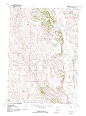
Joe Emge Creek Topo Map Wyoming
To zoom in, hover over the map of Joe Emge Creek
USGS Topo Quad 43107h4 - 1:24,000 scale
| Topo Map Name: | Joe Emge Creek |
| USGS Topo Quad ID: | 43107h4 |
| Print Size: | ca. 21 1/4" wide x 27" high |
| Southeast Coordinates: | 43.875° N latitude / 107.375° W longitude |
| Map Center Coordinates: | 43.9375° N latitude / 107.4375° W longitude |
| U.S. State: | WY |
| Filename: | o43107h4.jpg |
| Download Map JPG Image: | Joe Emge Creek topo map 1:24,000 scale |
| Map Type: | Topographic |
| Topo Series: | 7.5´ |
| Map Scale: | 1:24,000 |
| Source of Map Images: | United States Geological Survey (USGS) |
| Alternate Map Versions: |
Joe Emge Creek WY 1966, updated 1971 Download PDF Buy paper map Joe Emge Creek WY 1966, updated 1991 Download PDF Buy paper map Joe Emge Creek WY 2012 Download PDF Buy paper map Joe Emge Creek WY 2015 Download PDF Buy paper map |
1:24,000 Topo Quads surrounding Joe Emge Creek
> Back to 43107e1 at 1:100,000 scale
> Back to 43106a1 at 1:250,000 scale
> Back to U.S. Topo Maps home
Joe Emge Creek topo map: Gazetteer
Joe Emge Creek: Mines
Bud Kimball Creek Mine elevation 1439m 4721′Dugout Creek Deposit elevation 1458m 4783′
Extended Breer Number Two Mine elevation 1410m 4625′
Joe Emge Creek: Reservoirs
Bunning Reservoir elevation 1463m 4799′Chimney Reservoir elevation 1475m 4839′
Flagstone Reservoir elevation 1445m 4740′
Last Hope Reservoir elevation 1447m 4747′
Paul Reservoir elevation 1410m 4625′
Right Angle Reservoir elevation 1452m 4763′
Warner Reservoir elevation 1399m 4589′
Joe Emge Creek: Streams
Alkali Creek elevation 1354m 4442′Bud Kimball Creek elevation 1371m 4498′
Joe Emge Creek elevation 1356m 4448′
North Fork Bud Kimball Creek elevation 1426m 4678′
Otter Creek elevation 1395m 4576′
Spring Creek elevation 1371m 4498′
Joe Emge Creek: Valleys
Chimney Springs Draw elevation 1408m 4619′Fiscus Gulch elevation 1407m 4616′
Horton Draw elevation 1397m 4583′
Mud Gulch elevation 1391m 4563′
Taylor Draw elevation 1383m 4537′
Woods Gulch elevation 1367m 4484′
Joe Emge Creek digital topo map on disk
Buy this Joe Emge Creek topo map showing relief, roads, GPS coordinates and other geographical features, as a high-resolution digital map file on DVD:
Eastern Wyoming & Western South Dakota
Buy digital topo maps: Eastern Wyoming & Western South Dakota


