Riverton West Topo Map Wyoming
To zoom in, hover over the map of Riverton West
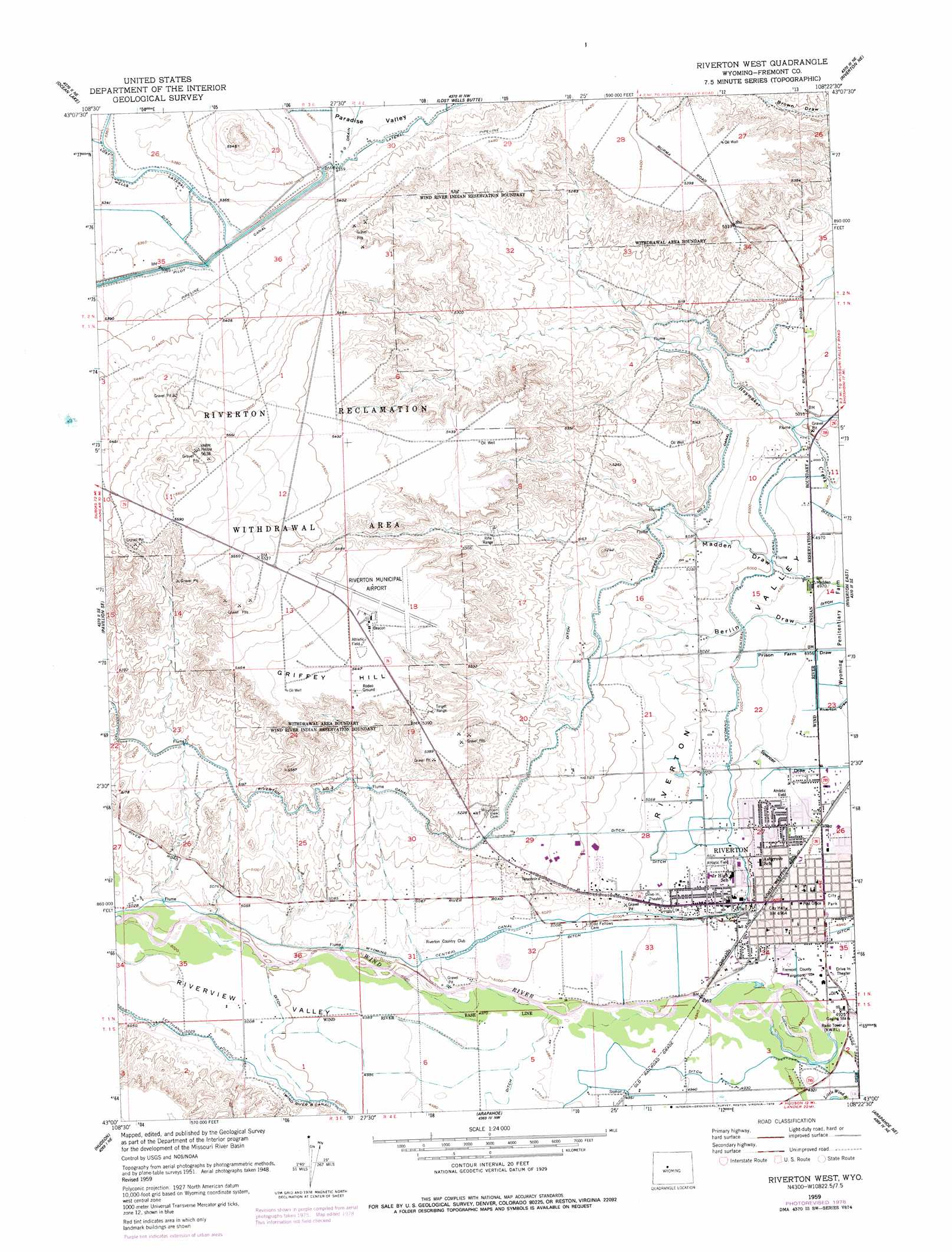
USGS Topo Quad 43108a4 - 1:24,000 scale
| Topo Map Name: | Riverton West |
| USGS Topo Quad ID: | 43108a4 |
| Print Size: | ca. 21 1/4" wide x 27" high |
| Southeast Coordinates: | 43° N latitude / 108.375° W longitude |
| Map Center Coordinates: | 43.0625° N latitude / 108.4375° W longitude |
| U.S. State: | WY |
| Filename: | o43108a4.jpg |
| Download Map JPG Image: | Riverton West topo map 1:24,000 scale |
| Map Type: | Topographic |
| Topo Series: | 7.5´ |
| Map Scale: | 1:24,000 |
| Source of Map Images: | United States Geological Survey (USGS) |
| Alternate Map Versions: |
Riverton West WY 1951, updated 1953 Download PDF Buy paper map Riverton West WY 1959, updated 1961 Download PDF Buy paper map Riverton West WY 1959, updated 1979 Download PDF Buy paper map Riverton West WY 2012 Download PDF Buy paper map Riverton West WY 2015 Download PDF Buy paper map |
1:24,000 Topo Quads surrounding Riverton West
Pavillion Butte |
Harris Bridge |
Mexican Pass Sw |
Mexican Pass Se |
Bonneville Sw |
Pavillion |
Ocean Lake |
Lost Wells Butte |
Riverton Ne |
Hidden Valley |
Mule Butte |
Pavillion Se |
Riverton West |
Riverton East |
Indian Butte |
Lander Nw |
Hudson |
Arapahoe |
Arapahoe Ne |
Alkali Butte |
Lander |
Lander Se |
Ninemile Hill |
Bringolf Ranch |
Sand Draw |
> Back to 43108a1 at 1:100,000 scale
> Back to 43108a1 at 1:250,000 scale
> Back to U.S. Topo Maps home
Riverton West topo map: Gazetteer
Riverton West: Airports
Riverton Memorial Hospital Heliport elevation 1535m 5036′Riverton Regional Airport elevation 1667m 5469′
Riverton West: Canals
Wyoming Central Canal elevation 1527m 5009′Riverton West: Mines
Crusher Number 1-35 Mine elevation 1518m 4980′Fremont Jade Quarry elevation 1513m 4963′
Riverton Acid Plant Mine elevation 1525m 5003′
Riverton Airport Pit elevation 1685m 5528′
Riverton Pit elevation 1542m 5059′
Riverton West: Populated Places
Riverton elevation 1509m 4950′Riverton West: Valleys
Berlin Draw elevation 1510m 4954′Riverview Valley elevation 1508m 4947′
Riverton West digital topo map on disk
Buy this Riverton West topo map showing relief, roads, GPS coordinates and other geographical features, as a high-resolution digital map file on DVD: