Mexican Pass Sw Topo Map Wyoming
To zoom in, hover over the map of Mexican Pass Sw
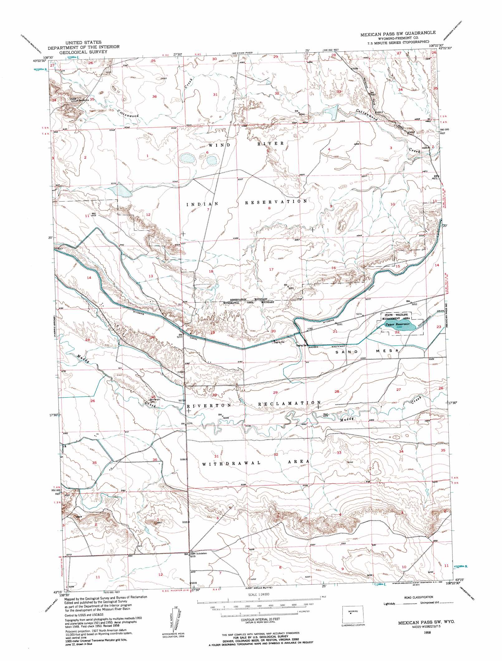
USGS Topo Quad 43108c4 - 1:24,000 scale
| Topo Map Name: | Mexican Pass Sw |
| USGS Topo Quad ID: | 43108c4 |
| Print Size: | ca. 21 1/4" wide x 27" high |
| Southeast Coordinates: | 43.25° N latitude / 108.375° W longitude |
| Map Center Coordinates: | 43.3125° N latitude / 108.4375° W longitude |
| U.S. State: | WY |
| Filename: | o43108c4.jpg |
| Download Map JPG Image: | Mexican Pass Sw topo map 1:24,000 scale |
| Map Type: | Topographic |
| Topo Series: | 7.5´ |
| Map Scale: | 1:24,000 |
| Source of Map Images: | United States Geological Survey (USGS) |
| Alternate Map Versions: |
Mexican Pass SW WY 1950, updated 1952 Download PDF Buy paper map Mexican Pass SW WY 1958, updated 1959 Download PDF Buy paper map Mexican Pass SW WY 2012 Download PDF Buy paper map Mexican Pass SW WY 2015 Download PDF Buy paper map |
1:24,000 Topo Quads surrounding Mexican Pass Sw
Sheep Ridge |
Kates Basin |
Potato Butte |
Nostrum Mountain |
Wedding Of The Waters |
Shotgun Butte |
Jenkins Mountain |
Mexican Pass |
Morrison Canyon |
Boysen |
Pavillion Butte |
Harris Bridge |
Mexican Pass Sw |
Mexican Pass Se |
Bonneville Sw |
Pavillion |
Ocean Lake |
Lost Wells Butte |
Riverton Ne |
Hidden Valley |
Mule Butte |
Pavillion Se |
Riverton West |
Riverton East |
Indian Butte |
> Back to 43108a1 at 1:100,000 scale
> Back to 43108a1 at 1:250,000 scale
> Back to U.S. Topo Maps home
Mexican Pass Sw topo map: Gazetteer
Mexican Pass Sw: Canals
Badger Wasteway elevation 1548m 5078′Mexican Pass Sw: Dams
Upper Cottonwood Dam elevation 1533m 5029′Mexican Pass Sw: Reservoirs
Upper Cottonwood Reservoir elevation 1533m 5029′Upper Reservoir elevation 1534m 5032′
Mexican Pass Sw: Valleys
Red Springs Draw elevation 1504m 4934′Mexican Pass Sw digital topo map on disk
Buy this Mexican Pass Sw topo map showing relief, roads, GPS coordinates and other geographical features, as a high-resolution digital map file on DVD: