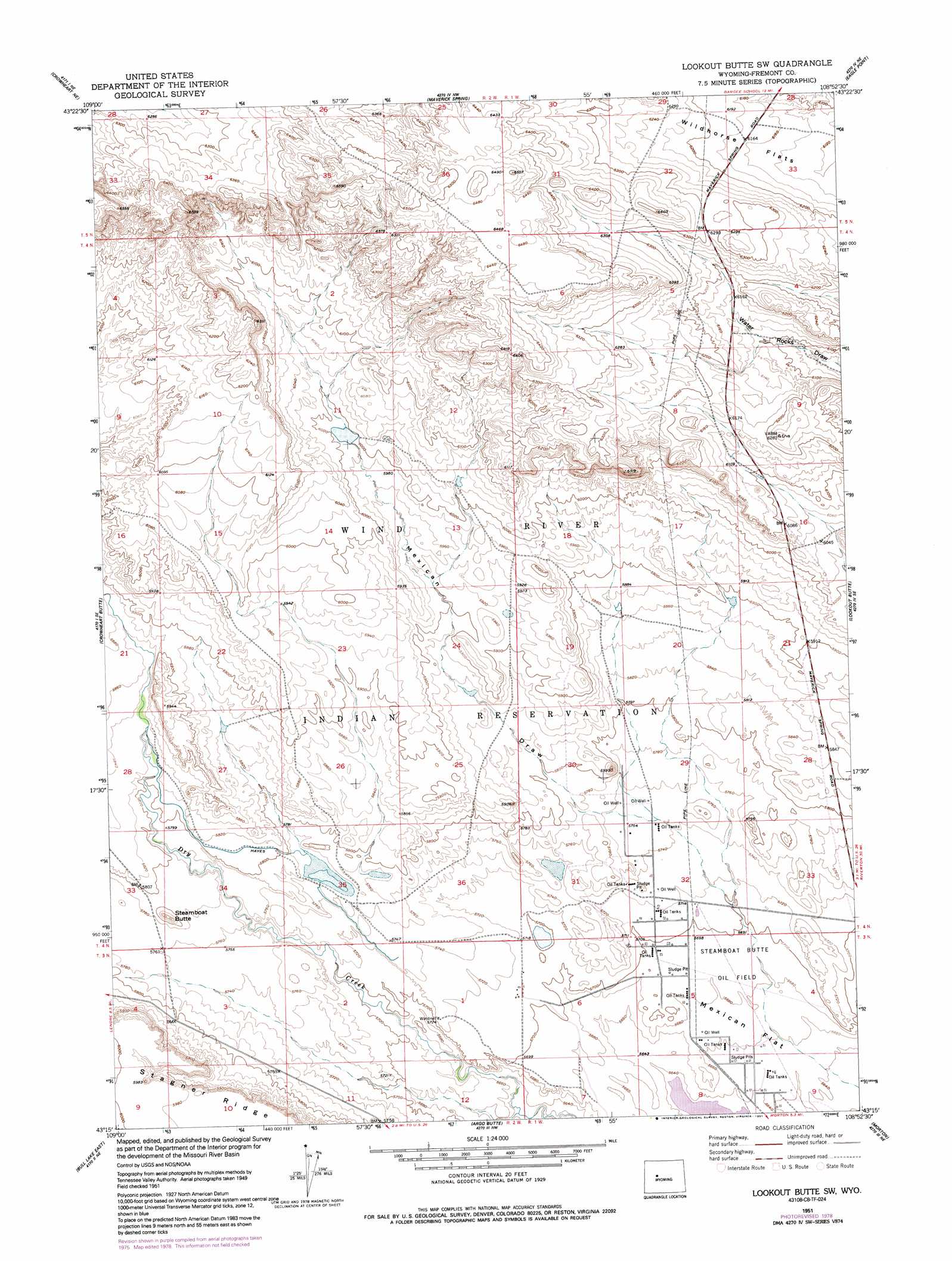
Lookout Butte Sw Topo Map Wyoming
To zoom in, hover over the map of Lookout Butte Sw
USGS Topo Quad 43108c8 - 1:24,000 scale
| Topo Map Name: | Lookout Butte Sw |
| USGS Topo Quad ID: | 43108c8 |
| Print Size: | ca. 21 1/4" wide x 27" high |
| Southeast Coordinates: | 43.25° N latitude / 108.875° W longitude |
| Map Center Coordinates: | 43.3125° N latitude / 108.9375° W longitude |
| U.S. State: | WY |
| Filename: | o43108c8.jpg |
| Download Map JPG Image: | Lookout Butte Sw topo map 1:24,000 scale |
| Map Type: | Topographic |
| Topo Series: | 7.5´ |
| Map Scale: | 1:24,000 |
| Source of Map Images: | United States Geological Survey (USGS) |
| Alternate Map Versions: |
Lookout Butte SW WY 1951, updated 1952 Download PDF Buy paper map Lookout Butte SW WY 1951, updated 1991 Download PDF Buy paper map Lookout Butte SW WY 2012 Download PDF Buy paper map Lookout Butte SW WY 2015 Download PDF Buy paper map |
1:24,000 Topo Quads surrounding Lookout Butte Sw
Johnson Draw |
Circle Ridge |
Antelope Ridge |
Bargee |
Sheep Ridge |
Crowheart Nw |
Crowheart Ne |
Maverick Spring |
Eagle Point |
Shotgun Butte |
Crowheart |
Crowheart Butte |
Lookout Butte Sw |
Lookout Butte |
Pavillion Butte |
Bull Lake West |
Bull Lake East |
Argo Butte |
Morton |
Pavillion |
Saint Lawrence Basin |
Wise Flat |
Fort Washakie |
Ethete |
Mule Butte |
> Back to 43108a1 at 1:100,000 scale
> Back to 43108a1 at 1:250,000 scale
> Back to U.S. Topo Maps home
Lookout Butte Sw topo map: Gazetteer
Lookout Butte Sw: Canals
Hayes Ditch elevation 1772m 5813′Lookout Butte Sw: Dams
Hays Dam elevation 1754m 5754′Lookout Butte Sw: Oilfields
Steamboat Butte Oil Field elevation 1734m 5688′Lookout Butte Sw: Reservoirs
Hays Reservoir elevation 1754m 5754′Lookout Butte Sw: Ridges
Stagner Ridge elevation 1793m 5882′Lookout Butte Sw: Summits
Steamboat Butte elevation 1791m 5875′Lookout Butte Sw: Valleys
Mexican Draw elevation 1759m 5770′Lookout Butte Sw digital topo map on disk
Buy this Lookout Butte Sw topo map showing relief, roads, GPS coordinates and other geographical features, as a high-resolution digital map file on DVD: