Anchor Reservoir Topo Map Wyoming
To zoom in, hover over the map of Anchor Reservoir
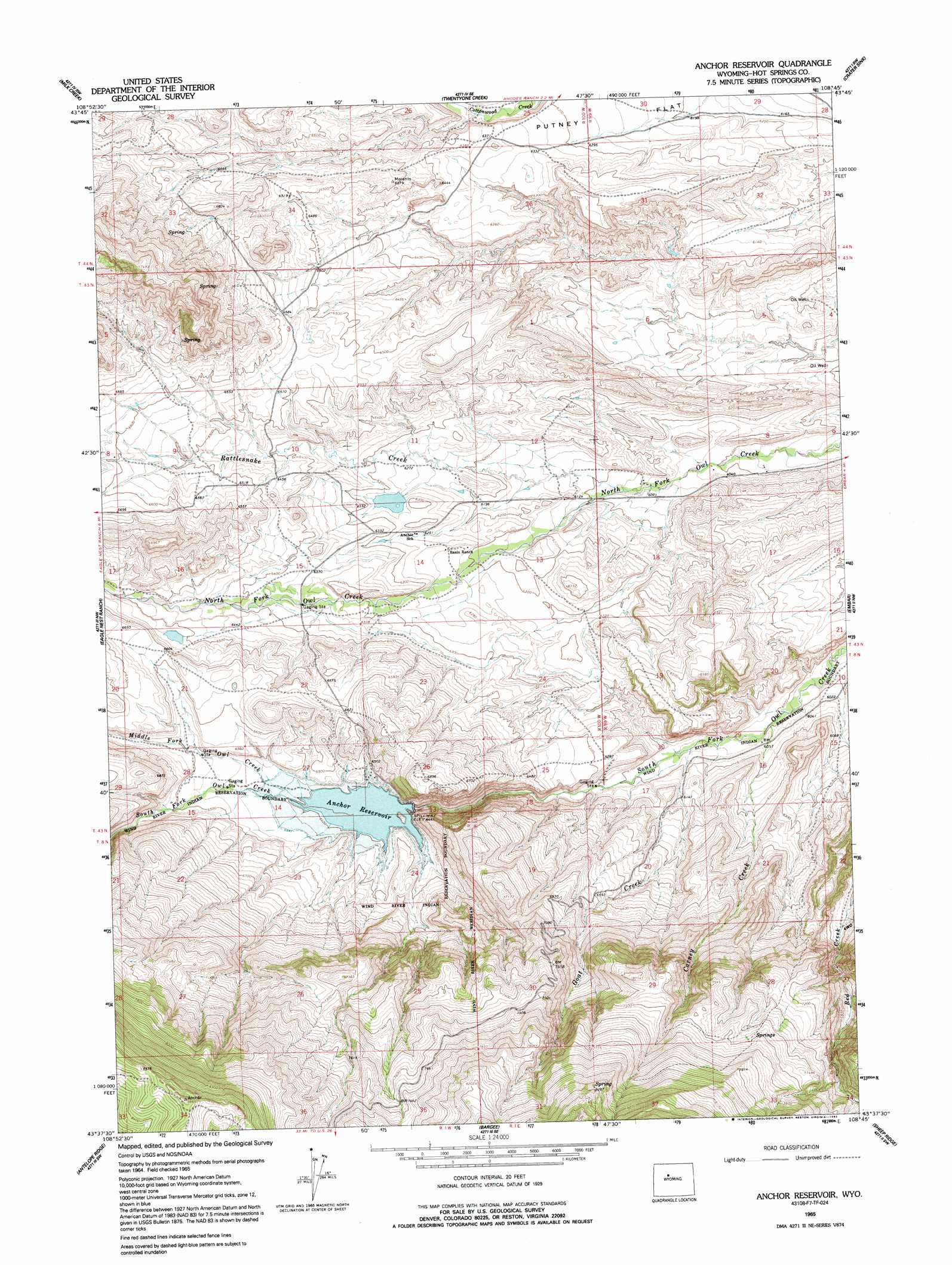
USGS Topo Quad 43108f7 - 1:24,000 scale
| Topo Map Name: | Anchor Reservoir |
| USGS Topo Quad ID: | 43108f7 |
| Print Size: | ca. 21 1/4" wide x 27" high |
| Southeast Coordinates: | 43.625° N latitude / 108.75° W longitude |
| Map Center Coordinates: | 43.6875° N latitude / 108.8125° W longitude |
| U.S. State: | WY |
| Filename: | o43108f7.jpg |
| Download Map JPG Image: | Anchor Reservoir topo map 1:24,000 scale |
| Map Type: | Topographic |
| Topo Series: | 7.5´ |
| Map Scale: | 1:24,000 |
| Source of Map Images: | United States Geological Survey (USGS) |
| Alternate Map Versions: |
Anchor Reservoir WY 1965, updated 1992 Download PDF Buy paper map Anchor Reservoir WY 2012 Download PDF Buy paper map Anchor Reservoir WY 2015 Download PDF Buy paper map |
1:24,000 Topo Quads surrounding Anchor Reservoir
Noon Point |
Soapy Dale Peak |
Adam Weiss Peak |
Grass Creek |
Red Ridge |
Cottonwood Peak |
Milk Creek |
Twentyone Creek |
Crater Sink |
Hamilton Dome |
Willow Creek |
Eagle Nest Ranch |
Anchor Reservoir |
Embar |
Arapahoe Ranch |
Circle Ridge |
Antelope Ridge |
Bargee |
Sheep Ridge |
Kates Basin |
Crowheart Ne |
Maverick Spring |
Eagle Point |
Shotgun Butte |
Jenkins Mountain |
> Back to 43108e1 at 1:100,000 scale
> Back to 43108a1 at 1:250,000 scale
> Back to U.S. Topo Maps home
Anchor Reservoir topo map: Gazetteer
Anchor Reservoir: Dams
Adams Number 2 Dam elevation 1916m 6286′Anchor Dam elevation 1962m 6437′
Blonde Dam elevation 1986m 6515′
Anchor Reservoir: Reservoirs
Adams Number 2 Reservoir elevation 1916m 6286′Anchor Reservoir elevation 1951m 6400′
Blonde Reservoir elevation 1986m 6515′
Anchor Reservoir: Streams
Carney Creek elevation 1831m 6007′Goat Creek elevation 1846m 6056′
Middle Fork Owl Creek elevation 1951m 6400′
Rattlesnake Creek elevation 1849m 6066′
Anchor Reservoir digital topo map on disk
Buy this Anchor Reservoir topo map showing relief, roads, GPS coordinates and other geographical features, as a high-resolution digital map file on DVD: