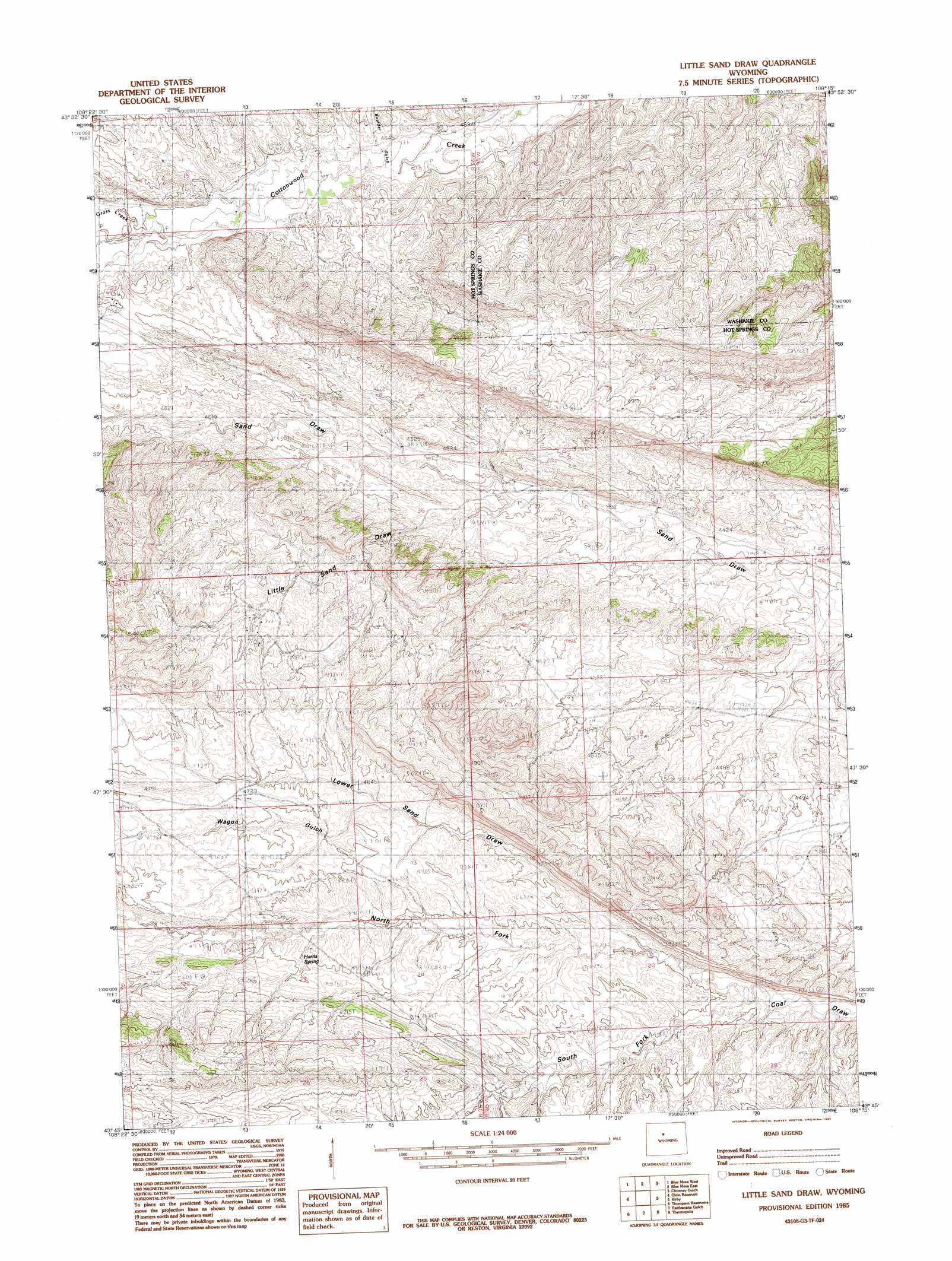
Little Sand Draw Topo Map Wyoming
To zoom in, hover over the map of Little Sand Draw
USGS Topo Quad 43108g3 - 1:24,000 scale
| Topo Map Name: | Little Sand Draw |
| USGS Topo Quad ID: | 43108g3 |
| Print Size: | ca. 21 1/4" wide x 27" high |
| Southeast Coordinates: | 43.75° N latitude / 108.25° W longitude |
| Map Center Coordinates: | 43.8125° N latitude / 108.3125° W longitude |
| U.S. State: | WY |
| Filename: | o43108g3.jpg |
| Download Map JPG Image: | Little Sand Draw topo map 1:24,000 scale |
| Map Type: | Topographic |
| Topo Series: | 7.5´ |
| Map Scale: | 1:24,000 |
| Source of Map Images: | United States Geological Survey (USGS) |
| Alternate Map Versions: |
Little Sand Draw WY 1985, updated 1985 Download PDF Buy paper map Little Sand Draw WY 2012 Download PDF Buy paper map Little Sand Draw WY 2015 Download PDF Buy paper map |
1:24,000 Topo Quads surrounding Little Sand Draw
Gillies Draw |
Dutch Nick Flat Sw |
Dutch Nick Flat |
Schuster Flats |
Schuster Flats Se |
Red Ridge |
Blue Mesa West |
Blue Mesa East |
Chimney Gulch |
Neiber |
Hamilton Dome |
Gloin Reservoir |
Little Sand Draw |
Kirby |
Cedar Mountain |
Arapahoe Ranch |
Thompson Reservoirs |
Rattlesnake Gulch |
Thermoplis |
Red Hole |
Kates Basin |
Potato Butte |
Nostrum Mountain |
Wedding Of The Waters |
Devil Slide |
> Back to 43108e1 at 1:100,000 scale
> Back to 43108a1 at 1:250,000 scale
> Back to U.S. Topo Maps home
Little Sand Draw topo map: Gazetteer
Little Sand Draw: Mines
Burnell Number Five Mine elevation 1406m 4612′Burnell Number Four Mine elevation 1368m 4488′
Burnell Number Six Mine elevation 1357m 4452′
Burnell Number Three Mine elevation 1376m 4514′
Little Sand Draw: Springs
Harris Spring elevation 1421m 4662′Little Sand Draw: Streams
Grass Creek elevation 1435m 4708′Little Sand Draw: Valleys
Boulder Gulch elevation 1404m 4606′North Fork Coal Draw elevation 1355m 4445′
South Fork Coal Draw elevation 1354m 4442′
Little Sand Draw digital topo map on disk
Buy this Little Sand Draw topo map showing relief, roads, GPS coordinates and other geographical features, as a high-resolution digital map file on DVD: