Gloin Reservoir Topo Map Wyoming
To zoom in, hover over the map of Gloin Reservoir
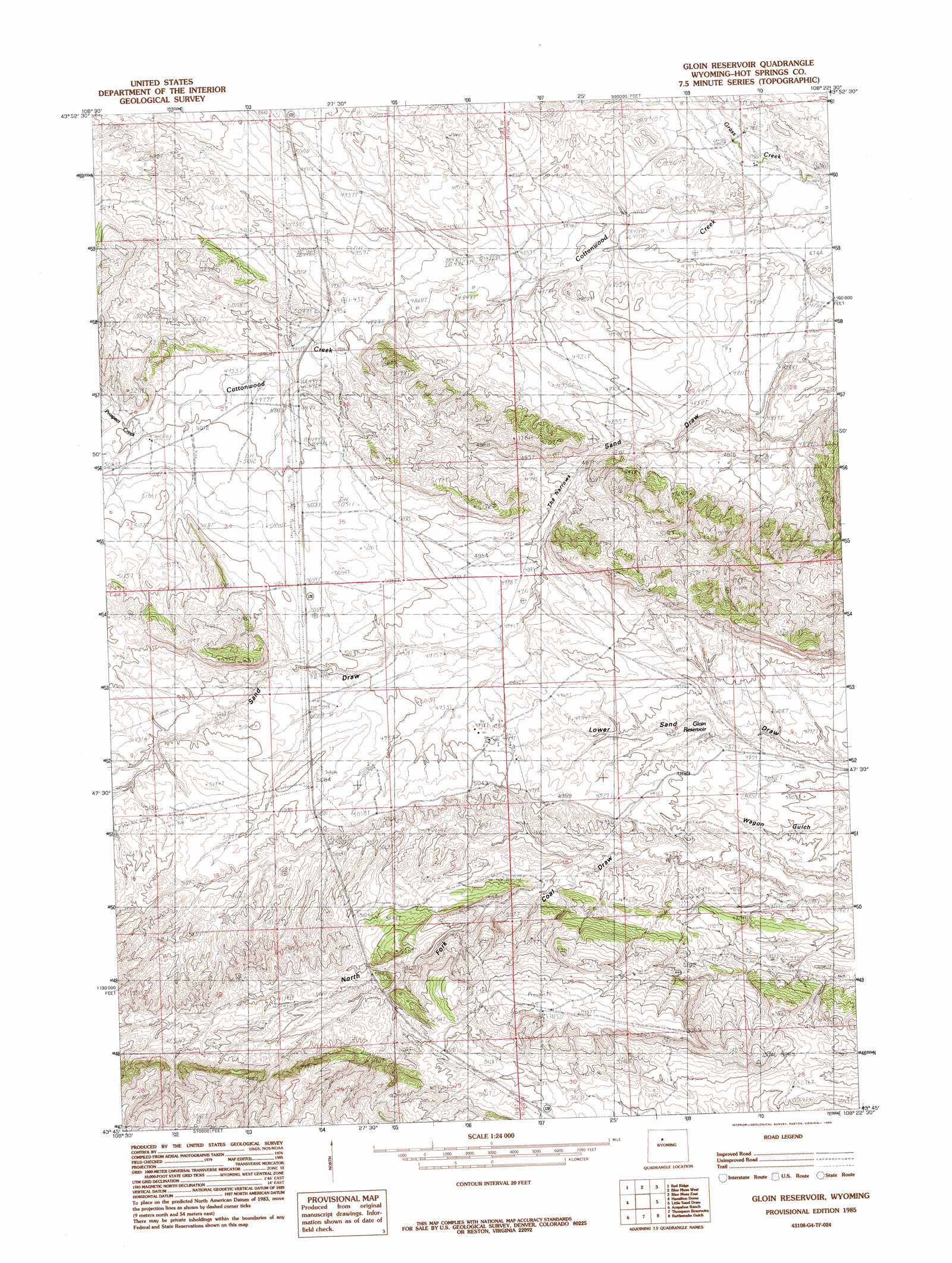
USGS Topo Quad 43108g4 - 1:24,000 scale
| Topo Map Name: | Gloin Reservoir |
| USGS Topo Quad ID: | 43108g4 |
| Print Size: | ca. 21 1/4" wide x 27" high |
| Southeast Coordinates: | 43.75° N latitude / 108.375° W longitude |
| Map Center Coordinates: | 43.8125° N latitude / 108.4375° W longitude |
| U.S. State: | WY |
| Filename: | o43108g4.jpg |
| Download Map JPG Image: | Gloin Reservoir topo map 1:24,000 scale |
| Map Type: | Topographic |
| Topo Series: | 7.5´ |
| Map Scale: | 1:24,000 |
| Source of Map Images: | United States Geological Survey (USGS) |
| Alternate Map Versions: |
Gloin Reservoir WY 1985, updated 1985 Download PDF Buy paper map Gloin Reservoir WY 2012 Download PDF Buy paper map Gloin Reservoir WY 2015 Download PDF Buy paper map |
1:24,000 Topo Quads surrounding Gloin Reservoir
Hillberry Rim |
Gillies Draw |
Dutch Nick Flat Sw |
Dutch Nick Flat |
Schuster Flats |
Grass Creek |
Red Ridge |
Blue Mesa West |
Blue Mesa East |
Chimney Gulch |
Crater Sink |
Hamilton Dome |
Gloin Reservoir |
Little Sand Draw |
Kirby |
Embar |
Arapahoe Ranch |
Thompson Reservoirs |
Rattlesnake Gulch |
Thermoplis |
Sheep Ridge |
Kates Basin |
Potato Butte |
Nostrum Mountain |
Wedding Of The Waters |
> Back to 43108e1 at 1:100,000 scale
> Back to 43108a1 at 1:250,000 scale
> Back to U.S. Topo Maps home
Gloin Reservoir topo map: Gazetteer
Gloin Reservoir: Mines
Cottonwood Creek Mine elevation 1552m 5091′Gloin Reservoir: Streams
Prospect Creek elevation 1520m 4986′Gloin Reservoir digital topo map on disk
Buy this Gloin Reservoir topo map showing relief, roads, GPS coordinates and other geographical features, as a high-resolution digital map file on DVD: