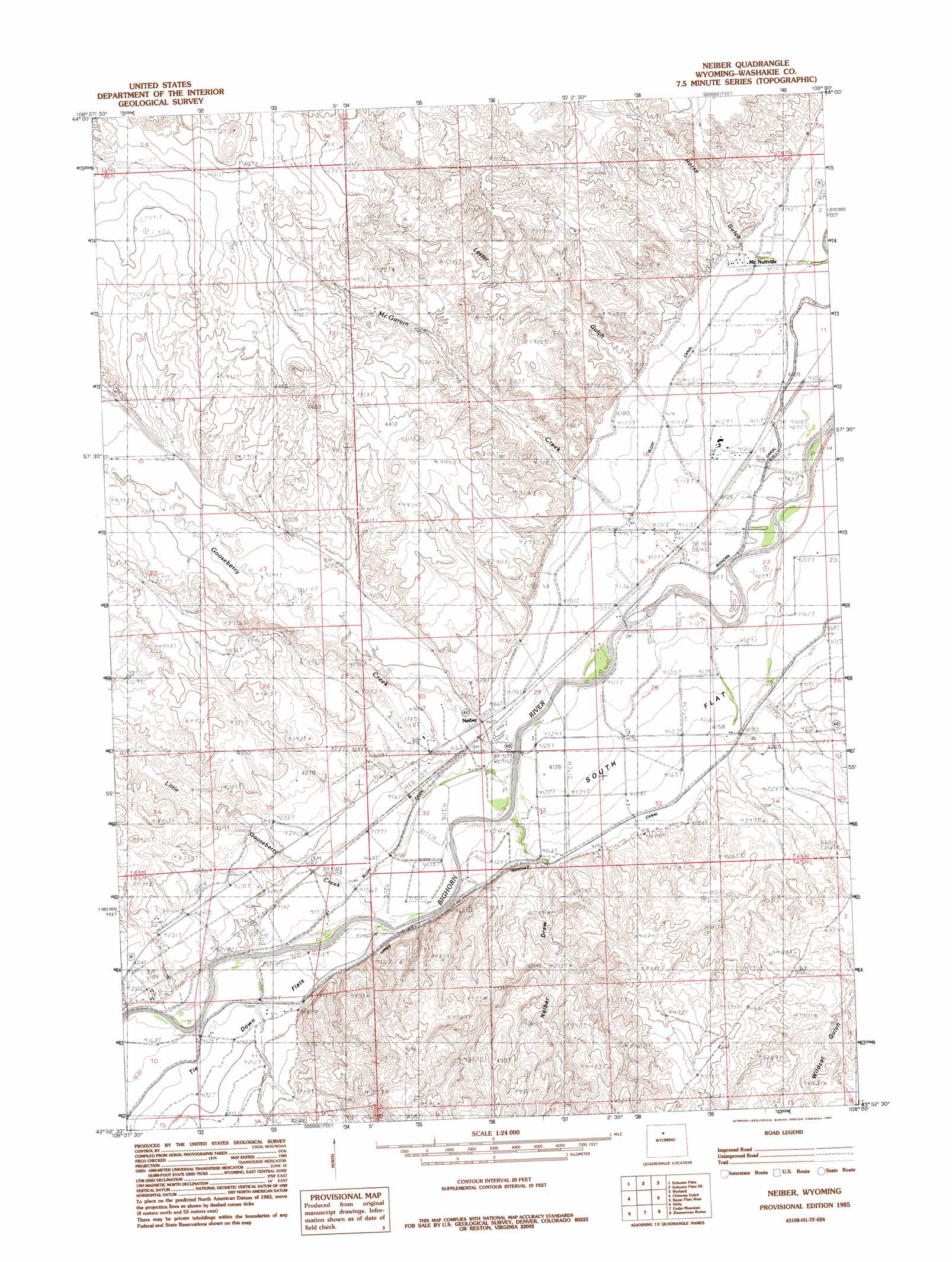
Neiber Topo Map Wyoming
To zoom in, hover over the map of Neiber
USGS Topo Quad 43108h1 - 1:24,000 scale
| Topo Map Name: | Neiber |
| USGS Topo Quad ID: | 43108h1 |
| Print Size: | ca. 21 1/4" wide x 27" high |
| Southeast Coordinates: | 43.875° N latitude / 108° W longitude |
| Map Center Coordinates: | 43.9375° N latitude / 108.0625° W longitude |
| U.S. State: | WY |
| Filename: | o43108h1.jpg |
| Download Map JPG Image: | Neiber topo map 1:24,000 scale |
| Map Type: | Topographic |
| Topo Series: | 7.5´ |
| Map Scale: | 1:24,000 |
| Source of Map Images: | United States Geological Survey (USGS) |
| Alternate Map Versions: |
Neiber WY 1985, updated 1985 Download PDF Buy paper map Neiber WY 2012 Download PDF Buy paper map Neiber WY 2015 Download PDF Buy paper map |
1:24,000 Topo Quads surrounding Neiber
Sucker Dam |
Schuster Flats Nw |
Schuster Flats Ne |
Rairden |
Mcdermotts Butte |
Dutch Nick Flat |
Schuster Flats |
Schuster Flats Se |
Worland |
Worland Se |
Blue Mesa East |
Chimney Gulch |
Neiber |
Banjo Flats West |
Banjo Flats East |
Little Sand Draw |
Kirby |
Cedar Mountain |
Zimmerman Buttes |
Henry Draw |
Rattlesnake Gulch |
Thermoplis |
Red Hole |
Coyote Hill |
Packsaddle Creek |
> Back to 43108e1 at 1:100,000 scale
> Back to 43108a1 at 1:250,000 scale
> Back to U.S. Topo Maps home
Neiber topo map: Gazetteer
Neiber: Canals
Bluff Ditch elevation 1266m 4153′Neiber: Flats
Tie Down Flats elevation 1281m 4202′Neiber: Populated Places
Colter elevation 1255m 4117′South Flat elevation 1276m 4186′
Neiber: Streams
Gooseberry Creek elevation 1256m 4120′Little Gooseberry Creek elevation 1261m 4137′
Neiber: Valleys
Neiber Draw elevation 1261m 4137′Neiber digital topo map on disk
Buy this Neiber topo map showing relief, roads, GPS coordinates and other geographical features, as a high-resolution digital map file on DVD: