Blue Mesa East Topo Map Wyoming
To zoom in, hover over the map of Blue Mesa East
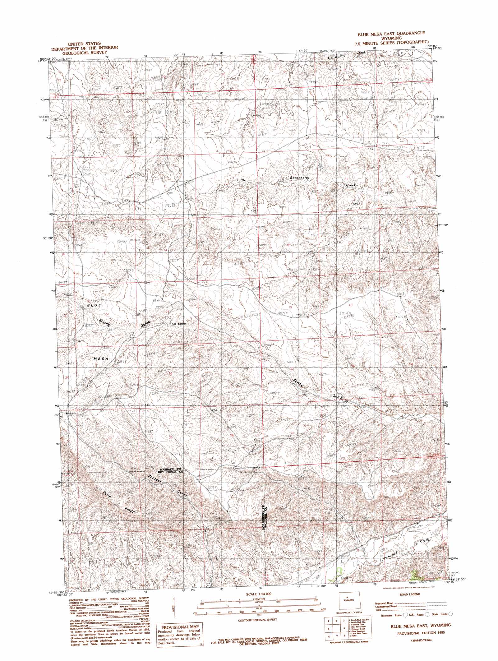
USGS Topo Quad 43108h3 - 1:24,000 scale
| Topo Map Name: | Blue Mesa East |
| USGS Topo Quad ID: | 43108h3 |
| Print Size: | ca. 21 1/4" wide x 27" high |
| Southeast Coordinates: | 43.875° N latitude / 108.25° W longitude |
| Map Center Coordinates: | 43.9375° N latitude / 108.3125° W longitude |
| U.S. State: | WY |
| Filename: | o43108h3.jpg |
| Download Map JPG Image: | Blue Mesa East topo map 1:24,000 scale |
| Map Type: | Topographic |
| Topo Series: | 7.5´ |
| Map Scale: | 1:24,000 |
| Source of Map Images: | United States Geological Survey (USGS) |
| Alternate Map Versions: |
Blue Mesa East WY 1985, updated 1985 Download PDF Buy paper map Blue Mesa East WY 2012 Download PDF Buy paper map Blue Mesa East WY 2015 Download PDF Buy paper map |
1:24,000 Topo Quads surrounding Blue Mesa East
Dead Indian Hill |
Dutch Nick Flat Nw |
Sucker Dam |
Schuster Flats Nw |
Schuster Flats Ne |
Gillies Draw |
Dutch Nick Flat Sw |
Dutch Nick Flat |
Schuster Flats |
Schuster Flats Se |
Red Ridge |
Blue Mesa West |
Blue Mesa East |
Chimney Gulch |
Neiber |
Hamilton Dome |
Gloin Reservoir |
Little Sand Draw |
Kirby |
Cedar Mountain |
Arapahoe Ranch |
Thompson Reservoirs |
Rattlesnake Gulch |
Thermoplis |
Red Hole |
> Back to 43108e1 at 1:100,000 scale
> Back to 43108a1 at 1:250,000 scale
> Back to U.S. Topo Maps home
Blue Mesa East topo map: Gazetteer
Blue Mesa East: Springs
Keg Spring elevation 1568m 5144′Blue Mesa East: Summits
Blue Mesa elevation 1635m 5364′Blue Mesa East digital topo map on disk
Buy this Blue Mesa East topo map showing relief, roads, GPS coordinates and other geographical features, as a high-resolution digital map file on DVD: