Alpine Lake Topo Map Wyoming
To zoom in, hover over the map of Alpine Lake
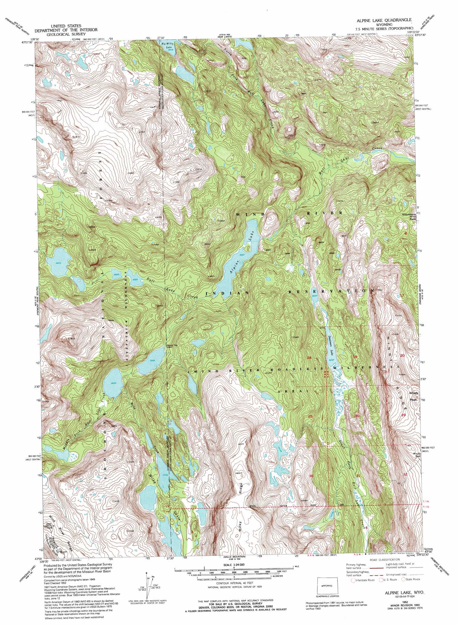
USGS Topo Quad 43109a4 - 1:24,000 scale
| Topo Map Name: | Alpine Lake |
| USGS Topo Quad ID: | 43109a4 |
| Print Size: | ca. 21 1/4" wide x 27" high |
| Southeast Coordinates: | 43° N latitude / 109.375° W longitude |
| Map Center Coordinates: | 43.0625° N latitude / 109.4375° W longitude |
| U.S. State: | WY |
| Filename: | o43109a4.jpg |
| Download Map JPG Image: | Alpine Lake topo map 1:24,000 scale |
| Map Type: | Topographic |
| Topo Series: | 7.5´ |
| Map Scale: | 1:24,000 |
| Source of Map Images: | United States Geological Survey (USGS) |
| Alternate Map Versions: |
Alpine Lake WY 1952, updated 1993 Download PDF Buy paper map Alpine Lake WY 1991, updated 1997 Download PDF Buy paper map Alpine Lake WY 2012 Download PDF Buy paper map Alpine Lake WY 2015 Download PDF Buy paper map |
| FStopo: | US Forest Service topo Alpine Lake is available: Download FStopo PDF Download FStopo TIF |
1:24,000 Topo Quads surrounding Alpine Lake
Downs Mountain |
Ink Wells |
Hays Park |
Burris |
Crowheart |
Gannett Peak |
Fremont Peak North |
Bob Lakes |
Kirkland Park |
Bull Lake West |
Bridger Lakes |
Fremont Peak South |
Alpine Lake |
Paradise Basin |
Saint Lawrence Basin |
Fayette Lake |
Horseshoe Lake |
Halls Mountain |
Roberts Mountain |
Washakie Park |
Boulder Lake |
Scab Creek |
Raid Lake |
Mount Bonneville |
Lizard Head Peak |
> Back to 43109a1 at 1:100,000 scale
> Back to 43108a1 at 1:250,000 scale
> Back to U.S. Topo Maps home
Alpine Lake topo map: Gazetteer
Alpine Lake: Gaps
Windy Gap elevation 3544m 11627′Alpine Lake: Lakes
Alpine Lake elevation 2732m 8963′Deadman Lake elevation 2823m 9261′
Milky Lakes elevation 3150m 10334′
Alpine Lake: Ridges
Milky Ridge elevation 3557m 11669′Alpine Lake: Streams
Middle Fork Bull Lake Creek elevation 2758m 9048′Milky Creek elevation 2887m 9471′
North Fork Bull Lake Creek elevation 2531m 8303′
South Fork Bull Lake Creek elevation 2646m 8681′
Alpine Lake: Summits
Windy Peak elevation 3529m 11578′Wittombona Peak elevation 2897m 9504′
Alpine Lake digital topo map on disk
Buy this Alpine Lake topo map showing relief, roads, GPS coordinates and other geographical features, as a high-resolution digital map file on DVD: