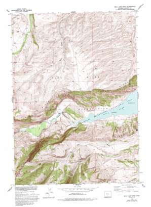
Bull Lake West Topo Map Wyoming
To zoom in, hover over the map of Bull Lake West
USGS Topo Quad 43109b2 - 1:24,000 scale
| Topo Map Name: | Bull Lake West |
| USGS Topo Quad ID: | 43109b2 |
| Print Size: | ca. 21 1/4" wide x 27" high |
| Southeast Coordinates: | 43.125° N latitude / 109.125° W longitude |
| Map Center Coordinates: | 43.1875° N latitude / 109.1875° W longitude |
| U.S. State: | WY |
| Filename: | o43109b2.jpg |
| Download Map JPG Image: | Bull Lake West topo map 1:24,000 scale |
| Map Type: | Topographic |
| Topo Series: | 7.5´ |
| Map Scale: | 1:24,000 |
| Source of Map Images: | United States Geological Survey (USGS) |
| Alternate Map Versions: |
Bull Lake West WY 1952, updated 1954 Download PDF Buy paper map Bull Lake West WY 1952, updated 1977 Download PDF Buy paper map Bull Lake West WY 1952, updated 1977 Download PDF Buy paper map Bull Lake West WY 1952, updated 1993 Download PDF Buy paper map Bull Lake West WY 2012 Download PDF Buy paper map Bull Lake West WY 2015 Download PDF Buy paper map |
1:24,000 Topo Quads surrounding Bull Lake West
> Back to 43109a1 at 1:100,000 scale
> Back to 43108a1 at 1:250,000 scale
> Back to U.S. Topo Maps home
Bull Lake West topo map: Gazetteer
Bull Lake West: Bridges
Sheep Bridge elevation 1817m 5961′Bull Lake West: Capes
Sand Point elevation 1774m 5820′Washakie Point elevation 2088m 6850′
Bull Lake West: Dams
Ocean Lake Habitat Number 5 Dam elevation 1866m 6122′Bull Lake West: Falls
Bull Lake Falls elevation 1787m 5862′Bull Lake West: Mines
Bull Ridge Mine elevation 1775m 5823′Bull Lake West: Reservoirs
Ocean Lake Habitat Reservoir Number 5 elevation 1866m 6122′Bull Lake West: Springs
Austin Spring elevation 2578m 8458′Bull Lake West: Trails
Yellow Trail elevation 2089m 6853′Bull Lake West digital topo map on disk
Buy this Bull Lake West topo map showing relief, roads, GPS coordinates and other geographical features, as a high-resolution digital map file on DVD:


