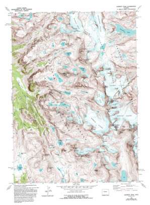
Gannett Peak Topo Map Wyoming
To zoom in, hover over the map of Gannett Peak
USGS Topo Quad 43109b6 - 1:24,000 scale
| Topo Map Name: | Gannett Peak |
| USGS Topo Quad ID: | 43109b6 |
| Print Size: | ca. 21 1/4" wide x 27" high |
| Southeast Coordinates: | 43.125° N latitude / 109.625° W longitude |
| Map Center Coordinates: | 43.1875° N latitude / 109.6875° W longitude |
| U.S. State: | WY |
| Filename: | o43109b6.jpg |
| Download Map JPG Image: | Gannett Peak topo map 1:24,000 scale |
| Map Type: | Topographic |
| Topo Series: | 7.5´ |
| Map Scale: | 1:24,000 |
| Source of Map Images: | United States Geological Survey (USGS) |
| Alternate Map Versions: |
Gannett Peak WY 1968, updated 1973 Download PDF Buy paper map Gannett Peak WY 1968, updated 1975 Download PDF Buy paper map Gannett Peak WY 1968, updated 1993 Download PDF Buy paper map Gannett Peak WY 1991, updated 1997 Download PDF Buy paper map Gannett Peak WY 1991, updated 1997 Download PDF Buy paper map Gannett Peak WY 2012 Download PDF Buy paper map Gannett Peak WY 2015 Download PDF Buy paper map |
| FStopo: | US Forest Service topo Gannett Peak is available: Download FStopo PDF Download FStopo TIF |
1:24,000 Topo Quads surrounding Gannett Peak
> Back to 43109a1 at 1:100,000 scale
> Back to 43108a1 at 1:250,000 scale
> Back to U.S. Topo Maps home
Gannett Peak topo map: Gazetteer
Gannett Peak: Flats
Three Forks Park elevation 2532m 8307′Trail Creek Park elevation 2836m 9304′
Gannett Peak: Gaps
Bonney Pass elevation 3911m 12831′Cube Rock Pass elevation 3268m 10721′
Glacier Pass elevation 3953m 12969′
Green River Pass elevation 3168m 10393′
Knapsack Col elevation 3737m 12260′
Shannon Pass elevation 3402m 11161′
Stone Pillar Pass elevation 3742m 12276′
Vista Pass elevation 3092m 10144′
Gannett Peak: Glaciers
Baby Glacier elevation 3565m 11696′Dinwoody Glacier elevation 3531m 11584′
Dinwoody Glaciers elevation 3666m 12027′
Gannett Glacier elevation 3602m 11817′
Gooseneck Glacier elevation 3772m 12375′
Grasshopper Glacier elevation 3571m 11715′
J Glacier elevation 3620m 11876′
Mammoth Glacier elevation 3623m 11886′
Minor Glacier elevation 3672m 12047′
Sourdough Glacier elevation 3595m 11794′
Stroud Glacier elevation 3555m 11663′
Twins Glacier elevation 3517m 11538′
Gannett Peak: Lakes
Dale Lake elevation 3264m 10708′Golden Lakes elevation 3376m 11076′
Klondike Lake elevation 3420m 11220′
Summer Ice Lake elevation 3406m 11174′
Upper Jean Lake elevation 3293m 10803′
Gannett Peak: Pillars
Gooseneck Pinnacle elevation 3965m 13008′Gannett Peak: Reservoirs
Peak Lake elevation 3207m 10521′Scott Lake elevation 3207m 10521′
Stonehammer Lake elevation 3129m 10265′
Summit Lake elevation 3148m 10328′
Gannett Peak: Ridges
Pinnacle Ridge elevation 3674m 12053′Gannett Peak: Streams
Clark Creek elevation 2826m 9271′Tourist Creek elevation 2538m 8326′
Trail Creek elevation 2611m 8566′
Wells Creek elevation 2536m 8320′
Gannett Peak: Summits
American Legion Peak elevation 4002m 13129′Bastion Peak elevation 4103m 13461′
Bobs Towers elevation 3963m 13001′
Bow Mountain elevation 3957m 12982′
Brimstone Mountain elevation 3878m 12723′
Desolation Peak elevation 4000m 13123′
Dinwoody Peak elevation 4115m 13500′
Doublet Peak elevation 4143m 13592′
Flagstone Peak elevation 4079m 13382′
Gannett Peak elevation 4206m 13799′
Henderson Peak elevation 3977m 13047′
Klondike Peak elevation 3977m 13047′
Ladd Peak elevation 3946m 12946′
Miriam Peak elevation 3994m 13103′
Mount Arrowhead elevation 3930m 12893′
Mount Helen elevation 4128m 13543′
Mount Koven elevation 3975m 13041′
Mount Oeneis elevation 3726m 12224′
Mount Solitude elevation 3832m 12572′
Mount Warren elevation 4093m 13428′
Mount Whitecap elevation 3952m 12965′
Mount Woodrow Wilson elevation 4094m 13431′
Pedestal Peak elevation 4064m 13333′
Philsmith Peak elevation 3841m 12601′
Rampart Peak elevation 4054m 13300′
Sky Pilot Peak elevation 3694m 12119′
Skyline Peak elevation 3917m 12851′
Split Mountain elevation 3989m 13087′
Stroud Peak elevation 3708m 12165′
Sulphur Peak elevation 3904m 12808′
The Sphinx elevation 4024m 13202′
Twin Peaks elevation 3965m 13008′
West Sentinel elevation 3829m 12562′
Winifred Peak elevation 3886m 12749′
Gannett Peak: Trails
Glacier Trail elevation 3292m 10800′Shannon Pass Trail elevation 3394m 11135′
Gannett Peak digital topo map on disk
Buy this Gannett Peak topo map showing relief, roads, GPS coordinates and other geographical features, as a high-resolution digital map file on DVD:


