Crowheart Nw Topo Map Wyoming
To zoom in, hover over the map of Crowheart Nw
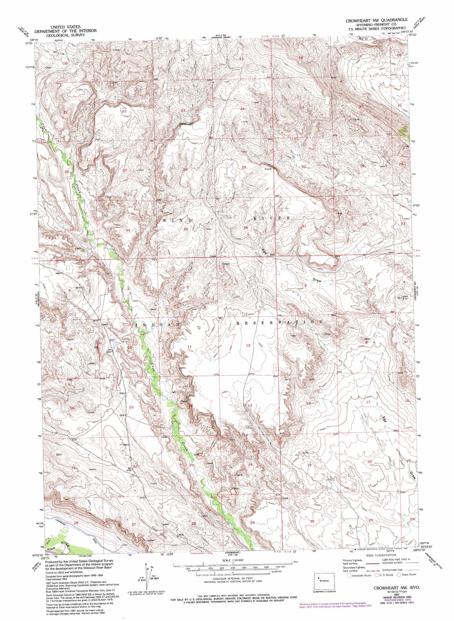
USGS Topo Quad 43109d2 - 1:24,000 scale
| Topo Map Name: | Crowheart Nw |
| USGS Topo Quad ID: | 43109d2 |
| Print Size: | ca. 21 1/4" wide x 27" high |
| Southeast Coordinates: | 43.375° N latitude / 109.125° W longitude |
| Map Center Coordinates: | 43.4375° N latitude / 109.1875° W longitude |
| U.S. State: | WY |
| Filename: | o43109d2.jpg |
| Download Map JPG Image: | Crowheart Nw topo map 1:24,000 scale |
| Map Type: | Topographic |
| Topo Series: | 7.5´ |
| Map Scale: | 1:24,000 |
| Source of Map Images: | United States Geological Survey (USGS) |
| Alternate Map Versions: |
Crowheart NW WY 1952, updated 1954 Download PDF Buy paper map Crowheart NW WY 1952, updated 1973 Download PDF Buy paper map Crowheart NW WY 1952, updated 1979 Download PDF Buy paper map Crowheart NW WY 1952, updated 1993 Download PDF Buy paper map Crowheart NW WY 2012 Download PDF Buy paper map Crowheart NW WY 2015 Download PDF Buy paper map |
1:24,000 Topo Quads surrounding Crowheart Nw
Castle Rock |
East Fork Basin |
Monument Peak |
Willow Creek |
Eagle Nest Ranch |
Bain Draw |
Crow Mountain |
Johnson Draw |
Circle Ridge |
Antelope Ridge |
Blue Holes |
Wilderness |
Crowheart Nw |
Crowheart Ne |
Maverick Spring |
Hays Park |
Burris |
Crowheart |
Crowheart Butte |
Lookout Butte Sw |
Bob Lakes |
Kirkland Park |
Bull Lake West |
Bull Lake East |
Argo Butte |
> Back to 43109a1 at 1:100,000 scale
> Back to 43108a1 at 1:250,000 scale
> Back to U.S. Topo Maps home
Crowheart Nw digital topo map on disk
Buy this Crowheart Nw topo map showing relief, roads, GPS coordinates and other geographical features, as a high-resolution digital map file on DVD: