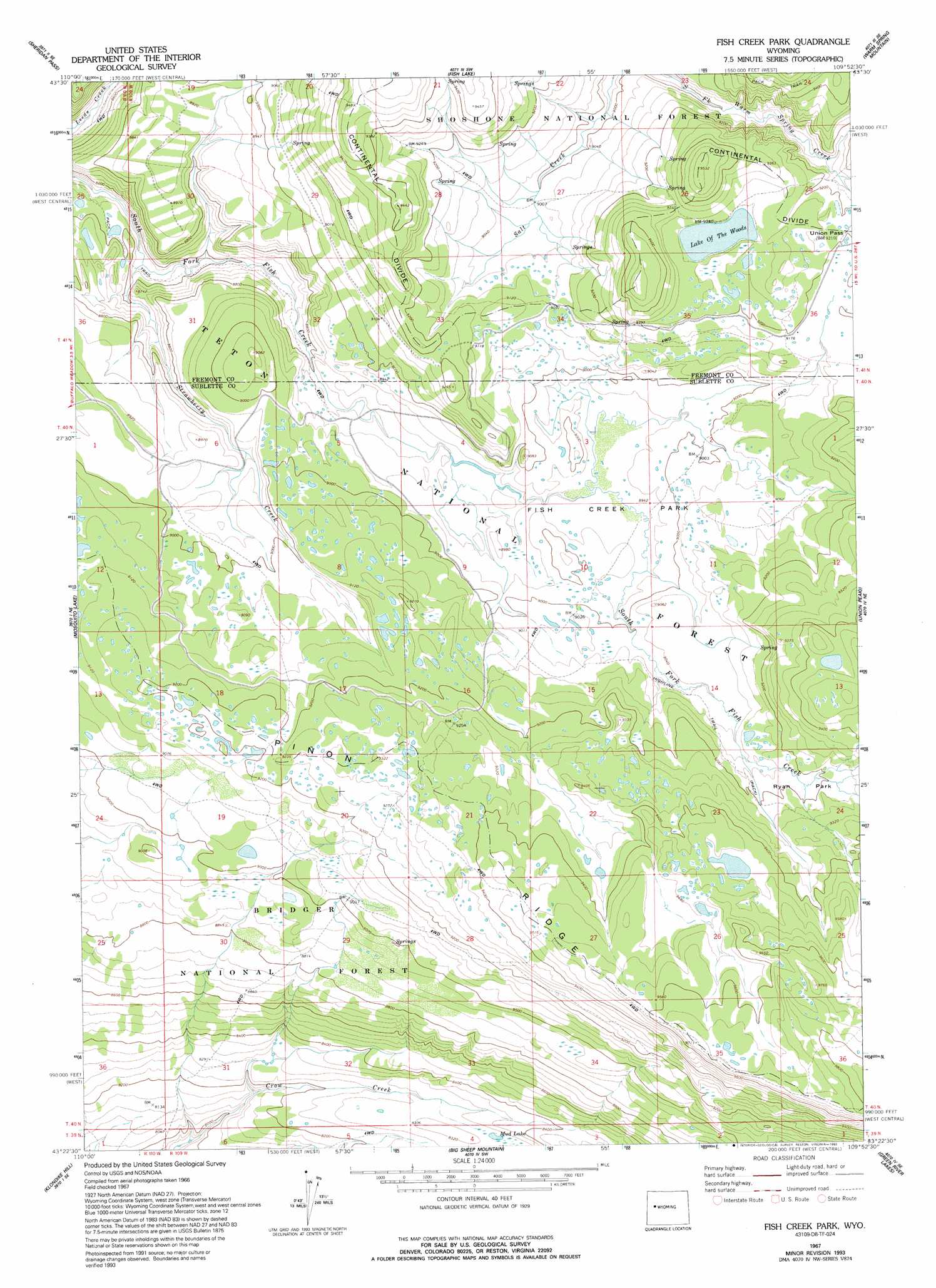
Fish Creek Park Topo Map Wyoming
To zoom in, hover over the map of Fish Creek Park
USGS Topo Quad 43109d8 - 1:24,000 scale
| Topo Map Name: | Fish Creek Park |
| USGS Topo Quad ID: | 43109d8 |
| Print Size: | ca. 21 1/4" wide x 27" high |
| Southeast Coordinates: | 43.375° N latitude / 109.875° W longitude |
| Map Center Coordinates: | 43.4375° N latitude / 109.9375° W longitude |
| U.S. State: | WY |
| Filename: | o43109d8.jpg |
| Download Map JPG Image: | Fish Creek Park topo map 1:24,000 scale |
| Map Type: | Topographic |
| Topo Series: | 7.5´ |
| Map Scale: | 1:24,000 |
| Source of Map Images: | United States Geological Survey (USGS) |
| Alternate Map Versions: |
Fish Creek Park WY 1967, updated 1971 Download PDF Buy paper map Fish Creek Park WY 1967, updated 1990 Download PDF Buy paper map Fish Creek Park WY 1967, updated 1993 Download PDF Buy paper map Fish Creek Park WY 1991, updated 1997 Download PDF Buy paper map Fish Creek Park WY 2012 Download PDF Buy paper map Fish Creek Park WY 2015 Download PDF Buy paper map |
| FStopo: | US Forest Service topo Fish Creek Park is available: Download FStopo PDF Download FStopo TIF |
1:24,000 Topo Quads surrounding Fish Creek Park
Tripod Peak |
Lava Mountain |
Kisinger Lakes |
Esmond Park |
Ramshorn Peak |
Burnt Mountain |
Sheridan Pass |
Fish Lake |
Warm Spring Mountain |
Dubois |
Ouzel Falls |
Mosquito Lake |
Fish Creek Park |
Union Peak |
Simpson Lake |
Tosi Peak |
Klondike Hill |
Big Sheep Mountain |
Green River Lakes |
Downs Mountain |
Pass Peak |
Dodge Butte |
Kendall Mountain |
Squaretop Mountain |
Gannett Peak |
> Back to 43109a1 at 1:100,000 scale
> Back to 43108a1 at 1:250,000 scale
> Back to U.S. Topo Maps home
Fish Creek Park topo map: Gazetteer
Fish Creek Park: Flats
Fish Creek Park elevation 2730m 8956′Ryan Park elevation 2801m 9189′
Fish Creek Park: Gaps
Union Pass elevation 2808m 9212′Fish Creek Park: Lakes
Lake of the Woods elevation 2816m 9238′Mud Lake elevation 2532m 8307′
Fish Creek Park: Ridges
Piñon Ridge elevation 2860m 9383′Fish Creek Park: Streams
Grass Creek elevation 2788m 9146′Strawberry Creek elevation 2604m 8543′
Fish Creek Park: Trails
Lake of the Woods Trail elevation 2898m 9507′Fish Creek Park digital topo map on disk
Buy this Fish Creek Park topo map showing relief, roads, GPS coordinates and other geographical features, as a high-resolution digital map file on DVD: