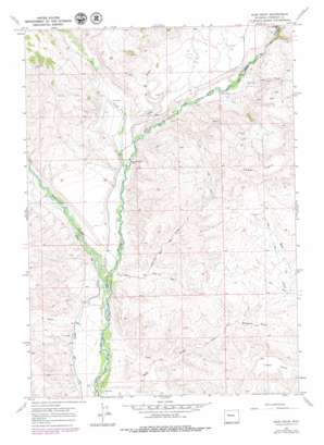
Bain Draw Topo Map Wyoming
To zoom in, hover over the map of Bain Draw
USGS Topo Quad 43109e4 - 1:24,000 scale
| Topo Map Name: | Bain Draw |
| USGS Topo Quad ID: | 43109e4 |
| Print Size: | ca. 21 1/4" wide x 27" high |
| Southeast Coordinates: | 43.5° N latitude / 109.375° W longitude |
| Map Center Coordinates: | 43.5625° N latitude / 109.4375° W longitude |
| U.S. State: | WY |
| Filename: | o43109e4.jpg |
| Download Map JPG Image: | Bain Draw topo map 1:24,000 scale |
| Map Type: | Topographic |
| Topo Series: | 7.5´ |
| Map Scale: | 1:24,000 |
| Source of Map Images: | United States Geological Survey (USGS) |
| Alternate Map Versions: |
Bain Draw WY 1967, updated 1971 Download PDF Buy paper map Bain Draw WY 1967, updated 1972 Download PDF Buy paper map Bain Draw WY 1967, updated 1979 Download PDF Buy paper map Bain Draw WY 2012 Download PDF Buy paper map Bain Draw WY 2015 Download PDF Buy paper map |
1:24,000 Topo Quads surrounding Bain Draw
> Back to 43109e1 at 1:100,000 scale
> Back to 43108a1 at 1:250,000 scale
> Back to U.S. Topo Maps home
Bain Draw topo map: Gazetteer
Bain Draw: Canals
Circle Ditch elevation 2072m 6797′Bain Draw: Dams
Bitterroot Number 1 Dam elevation 2260m 7414′Double Diamond Number 1 Reservoir Dam elevation 2256m 7401′
Bain Draw: Mines
Abernathy Deposit Number Four Mine elevation 2292m 7519′Abernathy Deposit Number Three Mine elevation 2230m 7316′
Bain Draw: Populated Places
Bain Place elevation 2014m 6607′Bain Draw: Reservoirs
Bitterroot Number 1 Reservoir elevation 2260m 7414′Double Diamond Number 1 Reservoir elevation 2256m 7401′
Bain Draw: Streams
Bear Creek elevation 2105m 6906′Spear Creek elevation 2151m 7057′
Spring Creek elevation 2173m 7129′
Wiggins Fork elevation 2047m 6715′
Bain Draw: Summits
Lower Table elevation 2398m 7867′Upper Table elevation 2482m 8143′
Bain Draw: Valleys
Bain Draw elevation 2009m 6591′Harvey Draw elevation 2049m 6722′
Horse Draw elevation 2193m 7194′
Lake Draw elevation 2201m 7221′
Pease Draw elevation 2026m 6646′
Windmill Draw elevation 2170m 7119′
Bain Draw digital topo map on disk
Buy this Bain Draw topo map showing relief, roads, GPS coordinates and other geographical features, as a high-resolution digital map file on DVD:


