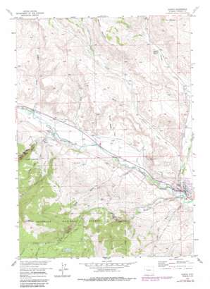
Dubois Topo Map Wyoming
To zoom in, hover over the map of Dubois
USGS Topo Quad 43109e6 - 1:24,000 scale
| Topo Map Name: | Dubois |
| USGS Topo Quad ID: | 43109e6 |
| Print Size: | ca. 21 1/4" wide x 27" high |
| Southeast Coordinates: | 43.5° N latitude / 109.625° W longitude |
| Map Center Coordinates: | 43.5625° N latitude / 109.6875° W longitude |
| U.S. State: | WY |
| Filename: | o43109e6.jpg |
| Download Map JPG Image: | Dubois topo map 1:24,000 scale |
| Map Type: | Topographic |
| Topo Series: | 7.5´ |
| Map Scale: | 1:24,000 |
| Source of Map Images: | United States Geological Survey (USGS) |
| Alternate Map Versions: |
Dubois WY 1956, updated 1958 Download PDF Buy paper map Dubois WY 1956, updated 1966 Download PDF Buy paper map Dubois WY 1956, updated 1980 Download PDF Buy paper map Dubois WY 1956, updated 1985 Download PDF Buy paper map Dubois WY 1991, updated 1997 Download PDF Buy paper map Dubois WY 2012 Download PDF Buy paper map Dubois WY 2015 Download PDF Buy paper map |
| FStopo: | US Forest Service topo Dubois is available: Download FStopo PDF Download FStopo TIF |
1:24,000 Topo Quads surrounding Dubois
> Back to 43109e1 at 1:100,000 scale
> Back to 43108a1 at 1:250,000 scale
> Back to U.S. Topo Maps home
Dubois topo map: Gazetteer
Dubois: Airports
Dubois Municipal Airport elevation 2216m 7270′Dubois: Canals
Green Ditch elevation 2169m 7116′Holmes Number 1 Ditch elevation 2188m 7178′
Norton Ditch elevation 2129m 6984′
Dubois: Dams
Enlargement of Grandy Dam elevation 2716m 8910′Dubois: Mines
Dubois Number One Mine elevation 2241m 7352′Dubois: Populated Places
Dubois elevation 2117m 6945′Dubois: Reservoirs
Enlargement of Grandy Reservoir elevation 2716m 8910′Grandy Reservoir elevation 2712m 8897′
Hart Reservoir elevation 2423m 7949′
Dubois: Springs
Little Warm Spring elevation 2258m 7408′Dubois: Streams
Bachelor Creek elevation 2738m 8982′Geyser Creek elevation 2158m 7080′
Horse Creek elevation 2105m 6906′
Little Warm Spring Creek elevation 2107m 6912′
Pony Creek elevation 2268m 7440′
Spruce Creek elevation 2803m 9196′
Tappan Creek elevation 2129m 6984′
Taylor Creek elevation 2124m 6968′
Warm Spring Creek elevation 2169m 7116′
Dubois: Summits
Bald Mountain elevation 2989m 9806′Dubois: Trails
Geyser Creek Trail elevation 2438m 7998′Dubois: Valleys
Butler Draw elevation 2201m 7221′Chimney Rock Gulch elevation 2149m 7050′
Lime Kiln Gulch elevation 2102m 6896′
Little Warm Spring Canyon elevation 2264m 7427′
Rifle Range Draw elevation 2136m 7007′
Saddle Horse Draw elevation 2199m 7214′
Wagon Gulch elevation 2184m 7165′
Warm Spring Canyon elevation 2192m 7191′
Water Gulch elevation 2130m 6988′
Dubois digital topo map on disk
Buy this Dubois topo map showing relief, roads, GPS coordinates and other geographical features, as a high-resolution digital map file on DVD:


