Willow Creek Topo Map Wyoming
To zoom in, hover over the map of Willow Creek
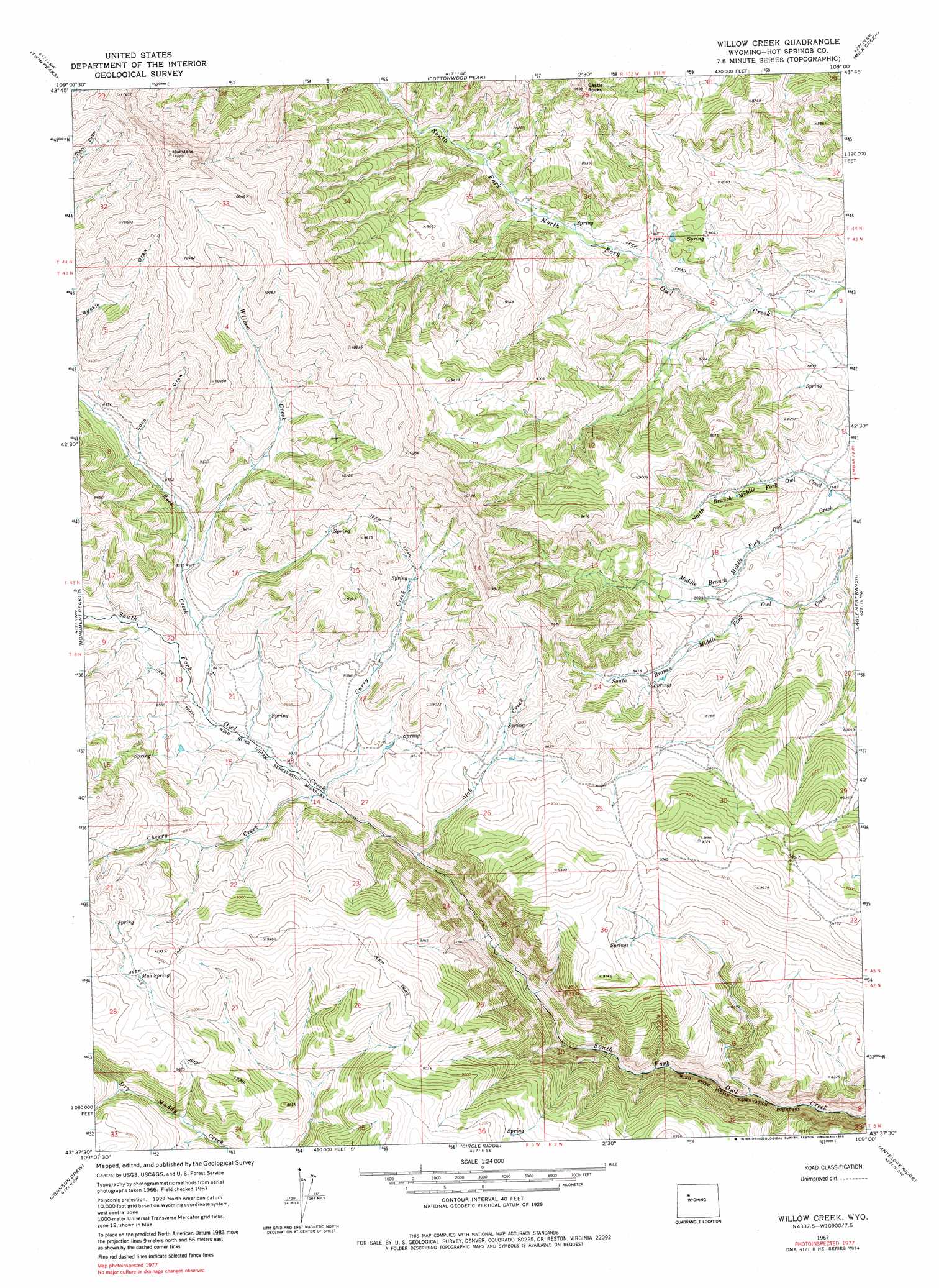
USGS Topo Quad 43109f1 - 1:24,000 scale
| Topo Map Name: | Willow Creek |
| USGS Topo Quad ID: | 43109f1 |
| Print Size: | ca. 21 1/4" wide x 27" high |
| Southeast Coordinates: | 43.625° N latitude / 109° W longitude |
| Map Center Coordinates: | 43.6875° N latitude / 109.0625° W longitude |
| U.S. State: | WY |
| Filename: | o43109f1.jpg |
| Download Map JPG Image: | Willow Creek topo map 1:24,000 scale |
| Map Type: | Topographic |
| Topo Series: | 7.5´ |
| Map Scale: | 1:24,000 |
| Source of Map Images: | United States Geological Survey (USGS) |
| Alternate Map Versions: |
Willow Creek WY 1967, updated 1971 Download PDF Buy paper map Willow Creek WY 1967, updated 1980 Download PDF Buy paper map Willow Creek WY 2012 Download PDF Buy paper map Willow Creek WY 2015 Download PDF Buy paper map |
1:24,000 Topo Quads surrounding Willow Creek
Francs Peak |
Dick Creek Lakes |
Noon Point |
Soapy Dale Peak |
Adam Weiss Peak |
Dunrud Peak |
Twin Peaks |
Cottonwood Peak |
Milk Creek |
Twentyone Creek |
East Fork Basin |
Monument Peak |
Willow Creek |
Eagle Nest Ranch |
Anchor Reservoir |
Crow Mountain |
Johnson Draw |
Circle Ridge |
Antelope Ridge |
Bargee |
Wilderness |
Crowheart Nw |
Crowheart Ne |
Maverick Spring |
Eagle Point |
> Back to 43109e1 at 1:100,000 scale
> Back to 43108a1 at 1:250,000 scale
> Back to U.S. Topo Maps home
Willow Creek topo map: Gazetteer
Willow Creek: Streams
Cherry Creek elevation 2509m 8231′Curry Creek elevation 2508m 8228′
North Branch Middle Fork Owl Creek elevation 2322m 7618′
Rock Creek elevation 2544m 8346′
Slab Creek elevation 2475m 8120′
Willow Creek elevation 2617m 8585′
Willow Creek: Summits
Castle Rocks elevation 2944m 9658′Willow Creek: Valleys
Love Draw elevation 2684m 8805′Willow Creek digital topo map on disk
Buy this Willow Creek topo map showing relief, roads, GPS coordinates and other geographical features, as a high-resolution digital map file on DVD: