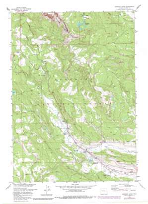
Kisinger Lakes Topo Map Wyoming
To zoom in, hover over the map of Kisinger Lakes
USGS Topo Quad 43109f8 - 1:24,000 scale
| Topo Map Name: | Kisinger Lakes |
| USGS Topo Quad ID: | 43109f8 |
| Print Size: | ca. 21 1/4" wide x 27" high |
| Southeast Coordinates: | 43.625° N latitude / 109.875° W longitude |
| Map Center Coordinates: | 43.6875° N latitude / 109.9375° W longitude |
| U.S. State: | WY |
| Filename: | o43109f8.jpg |
| Download Map JPG Image: | Kisinger Lakes topo map 1:24,000 scale |
| Map Type: | Topographic |
| Topo Series: | 7.5´ |
| Map Scale: | 1:24,000 |
| Source of Map Images: | United States Geological Survey (USGS) |
| Alternate Map Versions: |
Kisinger Lakes WY 1956, updated 1958 Download PDF Buy paper map Kisinger Lakes WY 1956, updated 1972 Download PDF Buy paper map Kisinger Lakes WY 1956, updated 1973 Download PDF Buy paper map Kisinger Lakes WY 1956, updated 1980 Download PDF Buy paper map Kisinger Lakes WY 1991, updated 1997 Download PDF Buy paper map Kisinger Lakes WY 2012 Download PDF Buy paper map Kisinger Lakes WY 2015 Download PDF Buy paper map |
| FStopo: | US Forest Service topo Kisinger Lakes is available: Download FStopo PDF Download FStopo TIF |
1:24,000 Topo Quads surrounding Kisinger Lakes
> Back to 43109e1 at 1:100,000 scale
> Back to 43108a1 at 1:250,000 scale
> Back to U.S. Topo Maps home
Kisinger Lakes topo map: Gazetteer
Kisinger Lakes: Falls
Brooks Lake Creek Falls elevation 2526m 8287′Kisinger Lakes: Flats
Basin Creek Meadows elevation 2862m 9389′Kisinger Lakes: Lakes
Kisinger Lakes elevation 2892m 9488′Mud Lake elevation 2592m 8503′
Kisinger Lakes: Mines
Triangle C Pit elevation 2318m 7604′Kisinger Lakes: Pillars
Tie Hack Historical Monument elevation 2367m 7765′Kisinger Lakes: Ridges
Elk Ridge elevation 2547m 8356′Kisinger Lakes: Streams
Basin Creek elevation 2534m 8313′Brooks Lake Creek elevation 2420m 7939′
Clint Creek elevation 2341m 7680′
Deception Creek elevation 2462m 8077′
Lava Creek elevation 2364m 7755′
Pelham Lake Creek elevation 2401m 7877′
Sheridan Creek elevation 2321m 7614′
Kisinger Lakes: Summits
Pinnacle Buttes elevation 3504m 11496′Kisinger Lakes: Trails
Kisinger Lakes Trail elevation 3057m 10029′Pelham Lake Trail elevation 2655m 8710′
Pinnacle Trail elevation 2887m 9471′
Sheridan Trail elevation 2760m 9055′
Kisinger Lakes digital topo map on disk
Buy this Kisinger Lakes topo map showing relief, roads, GPS coordinates and other geographical features, as a high-resolution digital map file on DVD:


