Five Pockets Topo Map Wyoming
To zoom in, hover over the map of Five Pockets
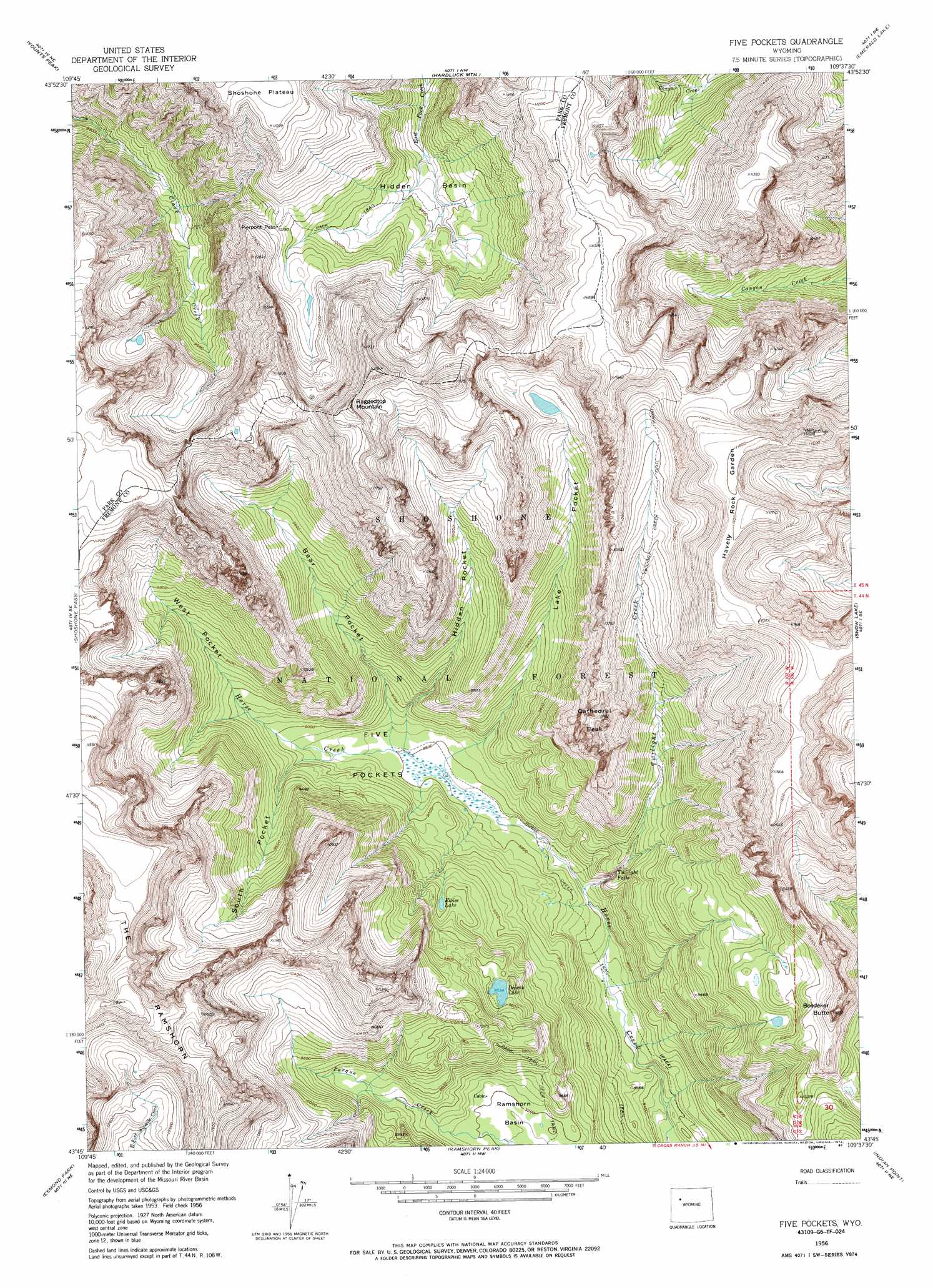
USGS Topo Quad 43109g6 - 1:24,000 scale
| Topo Map Name: | Five Pockets |
| USGS Topo Quad ID: | 43109g6 |
| Print Size: | ca. 21 1/4" wide x 27" high |
| Southeast Coordinates: | 43.75° N latitude / 109.625° W longitude |
| Map Center Coordinates: | 43.8125° N latitude / 109.6875° W longitude |
| U.S. State: | WY |
| Filename: | o43109g6.jpg |
| Download Map JPG Image: | Five Pockets topo map 1:24,000 scale |
| Map Type: | Topographic |
| Topo Series: | 7.5´ |
| Map Scale: | 1:24,000 |
| Source of Map Images: | United States Geological Survey (USGS) |
| Alternate Map Versions: |
Five Pockets WY 1956, updated 1958 Download PDF Buy paper map Five Pockets WY 1956, updated 1974 Download PDF Buy paper map Five Pockets WY 1956, updated 1987 Download PDF Buy paper map Five Pockets WY 1991, updated 1997 Download PDF Buy paper map Five Pockets WY 2012 Download PDF Buy paper map Five Pockets WY 2015 Download PDF Buy paper map |
| FStopo: | US Forest Service topo Five Pockets is available: Download FStopo PDF Download FStopo TIF |
1:24,000 Topo Quads surrounding Five Pockets
Thorofare Plateau |
Yellow Mountain |
Fall Creek |
Needle Mountain |
Irish Rock |
Ferry Lake |
Younts Peak |
Hardluck Mountain |
Emerald Lake |
Mount Burwell |
Dundee Meadows |
Shoshone Pass |
Five Pockets |
Snow Lake |
Wiggins Peak |
Kisinger Lakes |
Esmond Park |
Ramshorn Peak |
Indian Point |
Castle Rock |
Fish Lake |
Warm Spring Mountain |
Dubois |
Mason Draw |
Bain Draw |
> Back to 43109e1 at 1:100,000 scale
> Back to 43108a1 at 1:250,000 scale
> Back to U.S. Topo Maps home
Five Pockets topo map: Gazetteer
Five Pockets: Areas
Havely Rock Garden elevation 3540m 11614′Five Pockets: Basins
Five Pockets elevation 2697m 8848′Hidden Basin elevation 2972m 9750′
Five Pockets: Falls
Twilight Falls elevation 2711m 8894′Five Pockets: Gaps
Pierpont Pass elevation 3146m 10321′Five Pockets: Lakes
Deacon Lake elevation 2908m 9540′Eloise Lake elevation 2852m 9356′
Five Pockets: Streams
Twilight Creek elevation 2626m 8615′Five Pockets: Summits
Boedeker Butte elevation 3193m 10475′Cathedral Peak elevation 3399m 11151′
Raggedtop Mountain elevation 3605m 11827′
The Ramshorn elevation 3625m 11893′
Five Pockets: Trails
Twilight Creek Trail elevation 3175m 10416′Five Pockets: Valleys
Bear Pocket elevation 2711m 8894′Hidden Pocket elevation 2711m 8894′
Lake Pocket elevation 2695m 8841′
South Pocket elevation 2733m 8966′
West Pocket elevation 2748m 9015′
Five Pockets digital topo map on disk
Buy this Five Pockets topo map showing relief, roads, GPS coordinates and other geographical features, as a high-resolution digital map file on DVD: