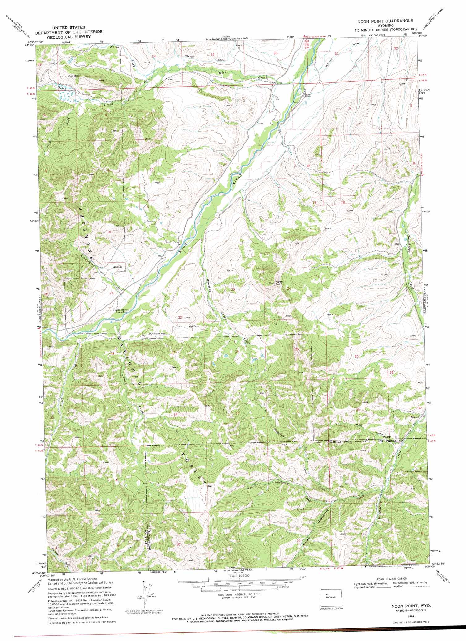
Noon Point Topo Map Wyoming
To zoom in, hover over the map of Noon Point
USGS Topo Quad 43109h1 - 1:24,000 scale
| Topo Map Name: | Noon Point |
| USGS Topo Quad ID: | 43109h1 |
| Print Size: | ca. 21 1/4" wide x 27" high |
| Southeast Coordinates: | 43.875° N latitude / 109° W longitude |
| Map Center Coordinates: | 43.9375° N latitude / 109.0625° W longitude |
| U.S. State: | WY |
| Filename: | o43109h1.jpg |
| Download Map JPG Image: | Noon Point topo map 1:24,000 scale |
| Map Type: | Topographic |
| Topo Series: | 7.5´ |
| Map Scale: | 1:24,000 |
| Source of Map Images: | United States Geological Survey (USGS) |
| Alternate Map Versions: |
Noon Point WY 1969, updated 1972 Download PDF Buy paper map Noon Point WY 1991, updated 1997 Download PDF Buy paper map Noon Point WY 2012 Download PDF Buy paper map Noon Point WY 2015 Download PDF Buy paper map |
| FStopo: | US Forest Service topo Noon Point is available: Download FStopo PDF Download FStopo TIF |
1:24,000 Topo Quads surrounding Noon Point
North Fork Pickett Creek |
Thomas Reservoir |
Tonopah Ridge |
Meeteetse West |
Meeteetse East |
Phelps Mountain |
Pitchfork |
Sunshine Reservoir |
Iron Creek |
Little Buffalo Basin |
Francs Peak |
Dick Creek Lakes |
Noon Point |
Soapy Dale Peak |
Adam Weiss Peak |
Dunrud Peak |
Twin Peaks |
Cottonwood Peak |
Milk Creek |
Twentyone Creek |
East Fork Basin |
Monument Peak |
Willow Creek |
Eagle Nest Ranch |
Anchor Reservoir |
> Back to 43109e1 at 1:100,000 scale
> Back to 43108a1 at 1:250,000 scale
> Back to U.S. Topo Maps home
Noon Point topo map: Gazetteer
Noon Point: Canals
Nelson Ditch elevation 2162m 7093′Noon Point: Cliffs
Noon Point elevation 2592m 8503′Noon Point: Streams
Brown Creek elevation 2169m 7116′Dick Creek elevation 2047m 6715′
Hall Creek elevation 2237m 7339′
Middle Gooseberry Creek elevation 2278m 7473′
North Fork Dick Creek elevation 2131m 6991′
Quaking Aspen Creek elevation 2129m 6984′
Rennerberg Creek elevation 2175m 7135′
South Fork Dick Creek elevation 2239m 7345′
South Fork Wood River elevation 2182m 7158′
Trail Creek elevation 2326m 7631′
West Gooseberry Creek elevation 2336m 7664′
Noon Point: Trails
Gooseberry Trail elevation 2325m 7627′Noon Point digital topo map on disk
Buy this Noon Point topo map showing relief, roads, GPS coordinates and other geographical features, as a high-resolution digital map file on DVD: