Emerald Lake Topo Map Wyoming
To zoom in, hover over the map of Emerald Lake
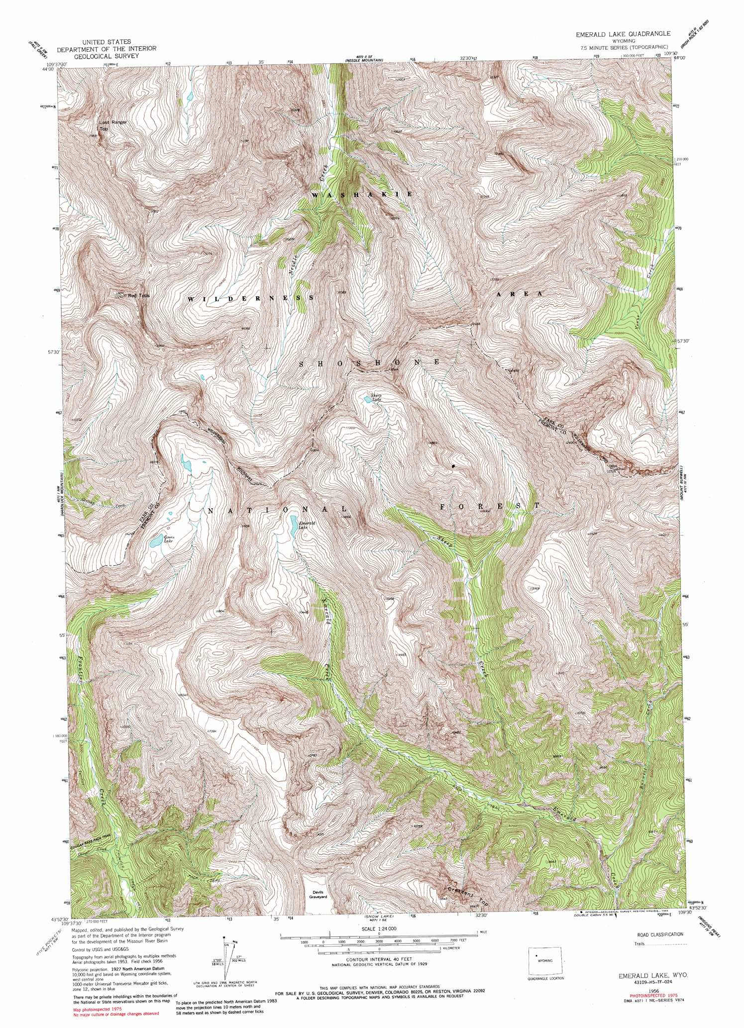
USGS Topo Quad 43109h5 - 1:24,000 scale
| Topo Map Name: | Emerald Lake |
| USGS Topo Quad ID: | 43109h5 |
| Print Size: | ca. 21 1/4" wide x 27" high |
| Southeast Coordinates: | 43.875° N latitude / 109.5° W longitude |
| Map Center Coordinates: | 43.9375° N latitude / 109.5625° W longitude |
| U.S. State: | WY |
| Filename: | o43109h5.jpg |
| Download Map JPG Image: | Emerald Lake topo map 1:24,000 scale |
| Map Type: | Topographic |
| Topo Series: | 7.5´ |
| Map Scale: | 1:24,000 |
| Source of Map Images: | United States Geological Survey (USGS) |
| Alternate Map Versions: |
Emerald Lake WY 1956, updated 1958 Download PDF Buy paper map Emerald Lake WY 1956, updated 1967 Download PDF Buy paper map Emerald Lake WY 1956, updated 1979 Download PDF Buy paper map Emerald Lake WY 1956, updated 1985 Download PDF Buy paper map Emerald Lake WY 1991, updated 1997 Download PDF Buy paper map Emerald Lake WY 2012 Download PDF Buy paper map Emerald Lake WY 2015 Download PDF Buy paper map |
| FStopo: | US Forest Service topo Emerald Lake is available: Download FStopo PDF Download FStopo TIF |
1:24,000 Topo Quads surrounding Emerald Lake
Thorofare Buttes |
Clouds Home Peak |
Valley |
Aldrich Basin |
North Fork Pickett Creek |
Yellow Mountain |
Fall Creek |
Needle Mountain |
Irish Rock |
Phelps Mountain |
Younts Peak |
Hardluck Mountain |
Emerald Lake |
Mount Burwell |
Francs Peak |
Shoshone Pass |
Five Pockets |
Snow Lake |
Wiggins Peak |
Dunrud Peak |
Esmond Park |
Ramshorn Peak |
Indian Point |
Castle Rock |
East Fork Basin |
> Back to 43109e1 at 1:100,000 scale
> Back to 43108a1 at 1:250,000 scale
> Back to U.S. Topo Maps home
Emerald Lake topo map: Gazetteer
Emerald Lake: Lakes
Emerald Lake elevation 3254m 10675′Green Lake elevation 3278m 10754′
Sheep Lake elevation 3437m 11276′
Emerald Lake: Streams
Burwell Creek elevation 2621m 8599′Cougar Creek elevation 2702m 8864′
Sheep Creek elevation 2669m 8756′
South Fork Burwell Creek elevation 2776m 9107′
Emerald Lake: Summits
Devils Graveyard elevation 3509m 11512′Lost Ranger Top elevation 3530m 11581′
Red Tops elevation 3717m 12194′
Emerald Lake digital topo map on disk
Buy this Emerald Lake topo map showing relief, roads, GPS coordinates and other geographical features, as a high-resolution digital map file on DVD: