Hardluck Mountain Topo Map Wyoming
To zoom in, hover over the map of Hardluck Mountain
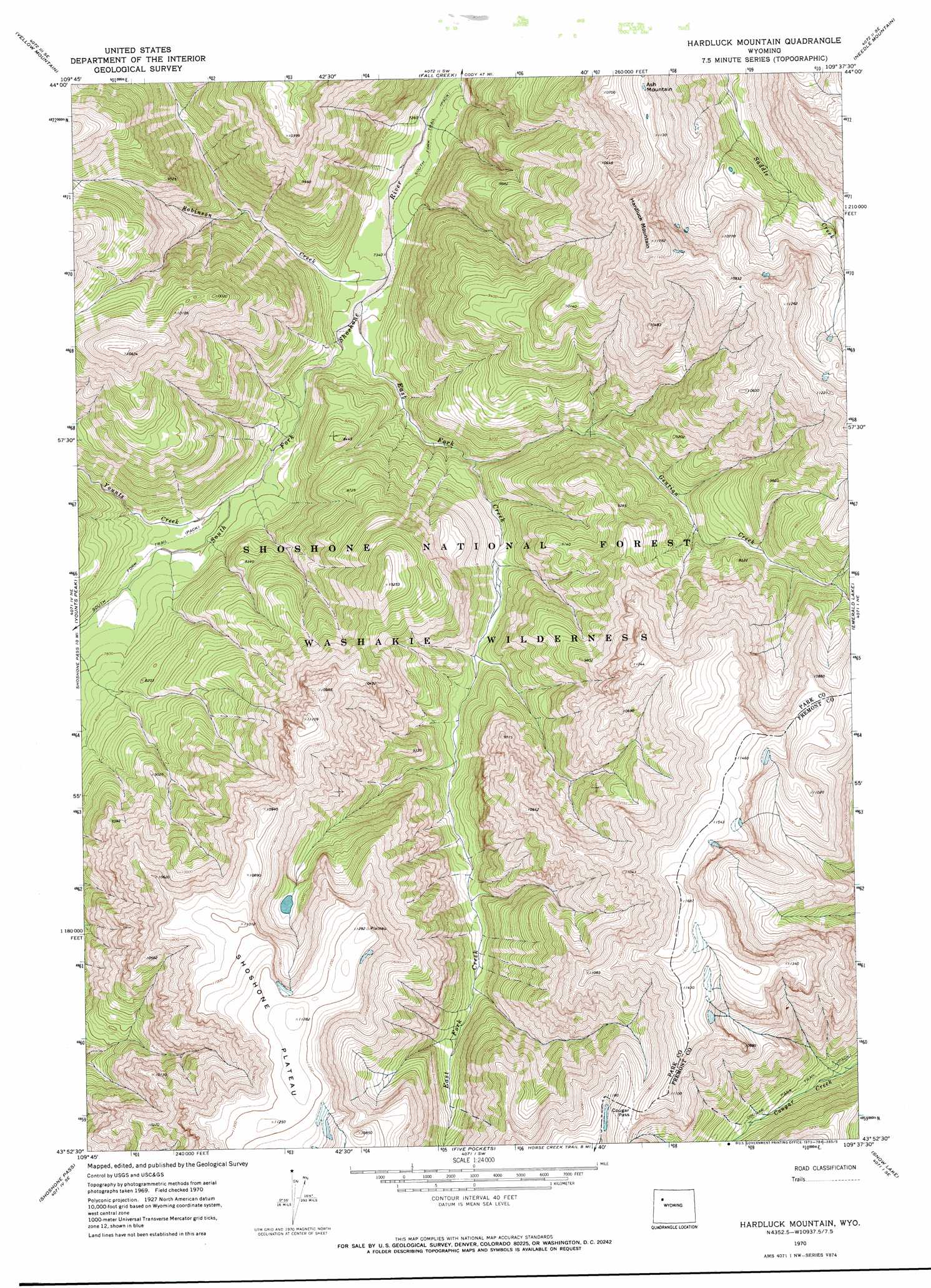
USGS Topo Quad 43109h6 - 1:24,000 scale
| Topo Map Name: | Hardluck Mountain |
| USGS Topo Quad ID: | 43109h6 |
| Print Size: | ca. 21 1/4" wide x 27" high |
| Southeast Coordinates: | 43.875° N latitude / 109.625° W longitude |
| Map Center Coordinates: | 43.9375° N latitude / 109.6875° W longitude |
| U.S. State: | WY |
| Filename: | o43109h6.jpg |
| Download Map JPG Image: | Hardluck Mountain topo map 1:24,000 scale |
| Map Type: | Topographic |
| Topo Series: | 7.5´ |
| Map Scale: | 1:24,000 |
| Source of Map Images: | United States Geological Survey (USGS) |
| Alternate Map Versions: |
Hardluck Mountain WY 1970, updated 1973 Download PDF Buy paper map Hardluck Mountain WY 1970, updated 1973 Download PDF Buy paper map Hardluck Mountain WY 1991, updated 1997 Download PDF Buy paper map Hardluck Mountain WY 2012 Download PDF Buy paper map Hardluck Mountain WY 2015 Download PDF Buy paper map |
| FStopo: | US Forest Service topo Hardluck Mountain is available: Download FStopo PDF Download FStopo TIF |
1:24,000 Topo Quads surrounding Hardluck Mountain
Open Creek |
Thorofare Buttes |
Clouds Home Peak |
Valley |
Aldrich Basin |
Thorofare Plateau |
Yellow Mountain |
Fall Creek |
Needle Mountain |
Irish Rock |
Ferry Lake |
Younts Peak |
Hardluck Mountain |
Emerald Lake |
Mount Burwell |
Dundee Meadows |
Shoshone Pass |
Five Pockets |
Snow Lake |
Wiggins Peak |
Kisinger Lakes |
Esmond Park |
Ramshorn Peak |
Indian Point |
Castle Rock |
> Back to 43109e1 at 1:100,000 scale
> Back to 43108a1 at 1:250,000 scale
> Back to U.S. Topo Maps home
Hardluck Mountain topo map: Gazetteer
Hardluck Mountain: Areas
Petrified Forest elevation 2944m 9658′Shoshone Plateau elevation 3443m 11295′
Hardluck Mountain: Gaps
Cougar Pass elevation 3281m 10764′Hardluck Mountain: Streams
East Fork Creek elevation 2248m 7375′Gentian Creek elevation 2338m 7670′
Robinson Creek elevation 2245m 7365′
Younts Creek elevation 2300m 7545′
Hardluck Mountain: Summits
Ash Mountain elevation 3395m 11138′Hardluck Mountain elevation 3579m 11742′
Hardluck Mountain: Trails
Cougar Pass Trail elevation 2847m 9340′South Fork Trail elevation 2230m 7316′
Hardluck Mountain digital topo map on disk
Buy this Hardluck Mountain topo map showing relief, roads, GPS coordinates and other geographical features, as a high-resolution digital map file on DVD: