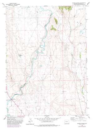
Warren Bridge Topo Map Wyoming
To zoom in, hover over the map of Warren Bridge
USGS Topo Quad 43110a1 - 1:24,000 scale
| Topo Map Name: | Warren Bridge |
| USGS Topo Quad ID: | 43110a1 |
| Print Size: | ca. 21 1/4" wide x 27" high |
| Southeast Coordinates: | 43° N latitude / 110° W longitude |
| Map Center Coordinates: | 43.0625° N latitude / 110.0625° W longitude |
| U.S. State: | WY |
| Filename: | o43110a1.jpg |
| Download Map JPG Image: | Warren Bridge topo map 1:24,000 scale |
| Map Type: | Topographic |
| Topo Series: | 7.5´ |
| Map Scale: | 1:24,000 |
| Source of Map Images: | United States Geological Survey (USGS) |
| Alternate Map Versions: |
Warren Bridge WY 1966, updated 1971 Download PDF Buy paper map Warren Bridge WY 1966, updated 1980 Download PDF Buy paper map Warren Bridge WY 1966, updated 1982 Download PDF Buy paper map Warren Bridge WY 2012 Download PDF Buy paper map Warren Bridge WY 2015 Download PDF Buy paper map |
1:24,000 Topo Quads surrounding Warren Bridge
> Back to 43110a1 at 1:100,000 scale
> Back to 43110a1 at 1:250,000 scale
> Back to U.S. Topo Maps home
Warren Bridge topo map: Gazetteer
Warren Bridge: Bridges
Warren Bridge elevation 2278m 7473′Warren Bridge: Canals
Bickel Ditch elevation 2282m 7486′Canyon Ditch elevation 2317m 7601′
Horsefly Ditch elevation 2278m 7473′
Pine Grove Ditch elevation 2331m 7647′
Warren Bridge: Gaps
The Narrows elevation 2289m 7509′Warren Bridge: Mines
Buds Pit Mine elevation 2305m 7562′Daylite Pit Mine elevation 2285m 7496′
Five Eighty-two Pit Number Two Mine elevation 2318m 7604′
Five Thirty-two Pit Number One Mine elevation 2297m 7536′
L L Pit Mine elevation 2322m 7618′
Marsh Creek Pit Mine elevation 2319m 7608′
Pocket Pit Mine elevation 2345m 7693′
Que Pit Mine elevation 2299m 7542′
Rexs Pit Mine elevation 2314m 7591′
Wardell Pit Mine elevation 2319m 7608′
Warren Bridge: Reservoirs
Franz Reservoir elevation 2342m 7683′Warren Bridge: Streams
Marsh Creek elevation 2300m 7545′Spring Creek elevation 2320m 7611′
Warren Bridge: Wells
Forty Rod Flat Well elevation 2327m 7634′Warren Bridge digital topo map on disk
Buy this Warren Bridge topo map showing relief, roads, GPS coordinates and other geographical features, as a high-resolution digital map file on DVD:


