Signal Hill Topo Map Wyoming
To zoom in, hover over the map of Signal Hill
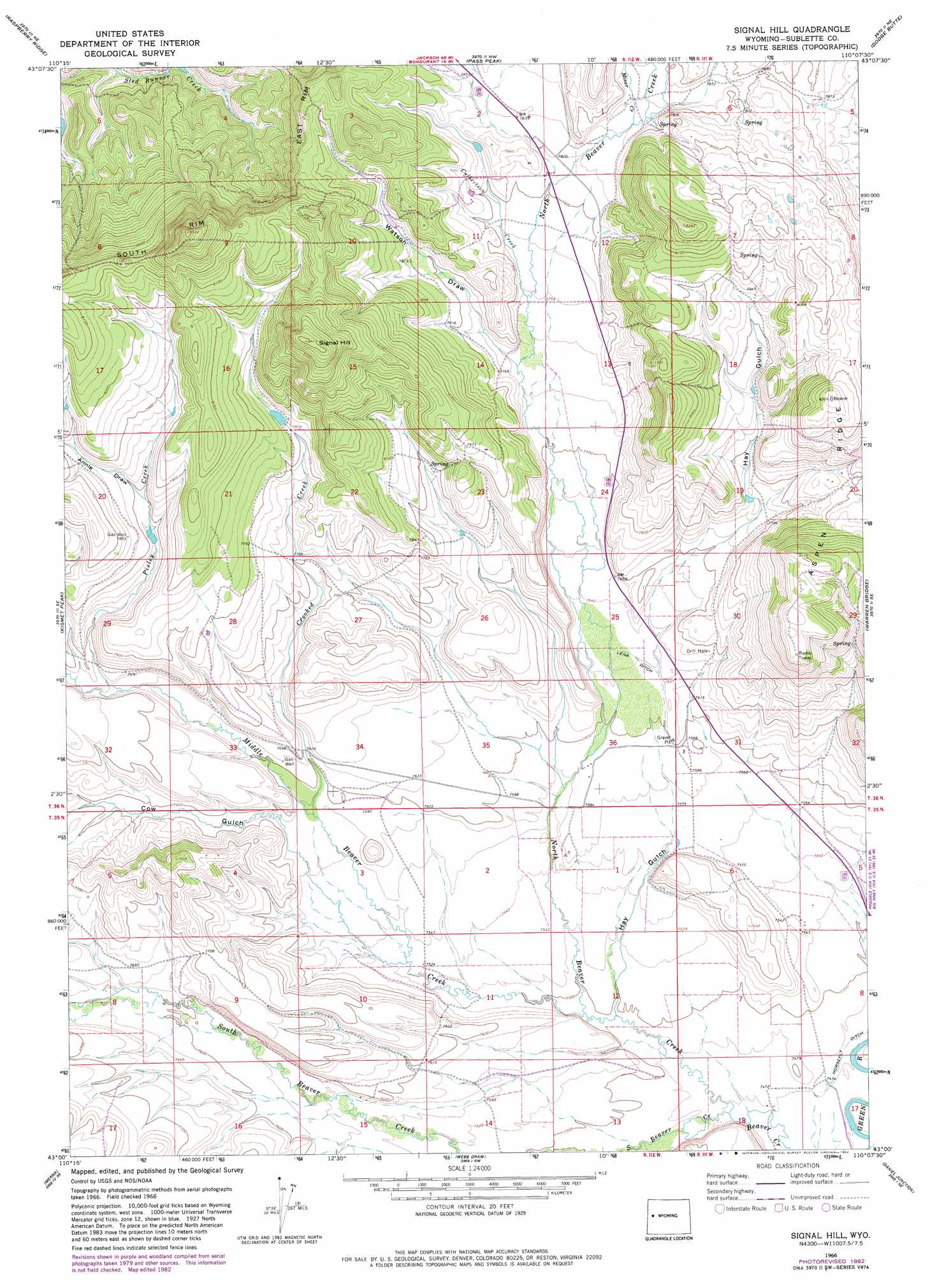
USGS Topo Quad 43110a2 - 1:24,000 scale
| Topo Map Name: | Signal Hill |
| USGS Topo Quad ID: | 43110a2 |
| Print Size: | ca. 21 1/4" wide x 27" high |
| Southeast Coordinates: | 43° N latitude / 110.125° W longitude |
| Map Center Coordinates: | 43.0625° N latitude / 110.1875° W longitude |
| U.S. State: | WY |
| Filename: | o43110a2.jpg |
| Download Map JPG Image: | Signal Hill topo map 1:24,000 scale |
| Map Type: | Topographic |
| Topo Series: | 7.5´ |
| Map Scale: | 1:24,000 |
| Source of Map Images: | United States Geological Survey (USGS) |
| Alternate Map Versions: |
Signal Hill WY 1966, updated 1971 Download PDF Buy paper map Signal Hill WY 1966, updated 1982 Download PDF Buy paper map Signal Hill WY 2012 Download PDF Buy paper map Signal Hill WY 2015 Download PDF Buy paper map |
| FStopo: | US Forest Service topo Signal Hill is available: Download FStopo PDF Download FStopo TIF |
1:24,000 Topo Quads surrounding Signal Hill
Granite Falls |
Doubletop Peak |
Tosi Peak |
Klondike Hill |
Big Sheep Mountain |
Bondurant |
Raspberry Ridge |
Pass Peak |
Dodge Butte |
Kendall Mountain |
Noble Basin |
Kismet Peak |
Signal Hill |
Warren Bridge |
New Fork Lakes |
Prospect Peak |
Merna Butte |
Webb Draw |
Daniel Junction |
Cora |
Maki Creek |
Halfway |
Onion Springs |
Daniel |
Mount Airy |
> Back to 43110a1 at 1:100,000 scale
> Back to 43110a1 at 1:250,000 scale
> Back to U.S. Topo Maps home
Signal Hill topo map: Gazetteer
Signal Hill: Canals
Lena Ditch elevation 2324m 7624′Signal Hill: Mines
Franz Pit Mine elevation 2395m 7857′Jakes Pit Mine elevation 2394m 7854′
Lot Two Pit Mine elevation 2383m 7818′
Quarter Corner Pit Mine elevation 2317m 7601′
Signal Hill: Ridges
Aspen Ridge elevation 2404m 7887′Signal Hill: Streams
Crooked Creek elevation 2310m 7578′Culbertson Creek elevation 2367m 7765′
Middle Beaver Creek elevation 2286m 7500′
Miner Creek elevation 2392m 7847′
North Beaver Creek elevation 2275m 7463′
Pixley Creek elevation 2333m 7654′
South Beaver Creek elevation 2275m 7463′
Signal Hill: Summits
Signal Hill elevation 2563m 8408′Signal Hill: Valleys
Annie Draw elevation 2380m 7808′Cow Gulch elevation 2311m 7582′
Hay Gulch elevation 2286m 7500′
Watson Draw elevation 2358m 7736′
Signal Hill digital topo map on disk
Buy this Signal Hill topo map showing relief, roads, GPS coordinates and other geographical features, as a high-resolution digital map file on DVD: