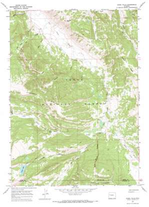
Ouzel Falls Topo Map Wyoming
To zoom in, hover over the map of Ouzel Falls
USGS Topo Quad 43110d2 - 1:24,000 scale
| Topo Map Name: | Ouzel Falls |
| USGS Topo Quad ID: | 43110d2 |
| Print Size: | ca. 21 1/4" wide x 27" high |
| Southeast Coordinates: | 43.375° N latitude / 110.125° W longitude |
| Map Center Coordinates: | 43.4375° N latitude / 110.1875° W longitude |
| U.S. State: | WY |
| Filename: | o43110d2.jpg |
| Download Map JPG Image: | Ouzel Falls topo map 1:24,000 scale |
| Map Type: | Topographic |
| Topo Series: | 7.5´ |
| Map Scale: | 1:24,000 |
| Source of Map Images: | United States Geological Survey (USGS) |
| Alternate Map Versions: |
Ouzel Falls WY 1967, updated 1971 Download PDF Buy paper map Ouzel Falls WY 1996, updated 1998 Download PDF Buy paper map Ouzel Falls WY 2012 Download PDF Buy paper map Ouzel Falls WY 2015 Download PDF Buy paper map |
| FStopo: | US Forest Service topo Ouzel Falls is available: Download FStopo PDF Download FStopo TIF |
1:24,000 Topo Quads surrounding Ouzel Falls
> Back to 43110a1 at 1:100,000 scale
> Back to 43110a1 at 1:250,000 scale
> Back to U.S. Topo Maps home
Ouzel Falls topo map: Gazetteer
Ouzel Falls: Falls
Ouzel Falls elevation 2578m 8458′Ouzel Falls: Lakes
Lunch Lake elevation 2803m 9196′Ouzel Falls: Ridges
Red Bluff Ridge elevation 2755m 9038′Sportsman Ridge elevation 3063m 10049′
Ouzel Falls: Streams
Big Cow Creek elevation 2291m 7516′Clear Creek elevation 2496m 8188′
Dry Fork Clear Creek elevation 2546m 8353′
Jones Creek elevation 2342m 7683′
Kinky Creek elevation 2495m 8185′
Lafferty Creek elevation 2322m 7618′
Little Cow Creek elevation 2301m 7549′
Lloyd Creek elevation 2310m 7578′
Mud Creek elevation 2326m 7631′
Trunk Creek elevation 2633m 8638′
Ouzel Falls: Summits
Sunday Peak elevation 2735m 8973′Ouzel Falls: Valleys
Little Grizzly Basin elevation 2622m 8602′Ouzel Falls digital topo map on disk
Buy this Ouzel Falls topo map showing relief, roads, GPS coordinates and other geographical features, as a high-resolution digital map file on DVD:


