Turquoise Lake Topo Map Wyoming
To zoom in, hover over the map of Turquoise Lake
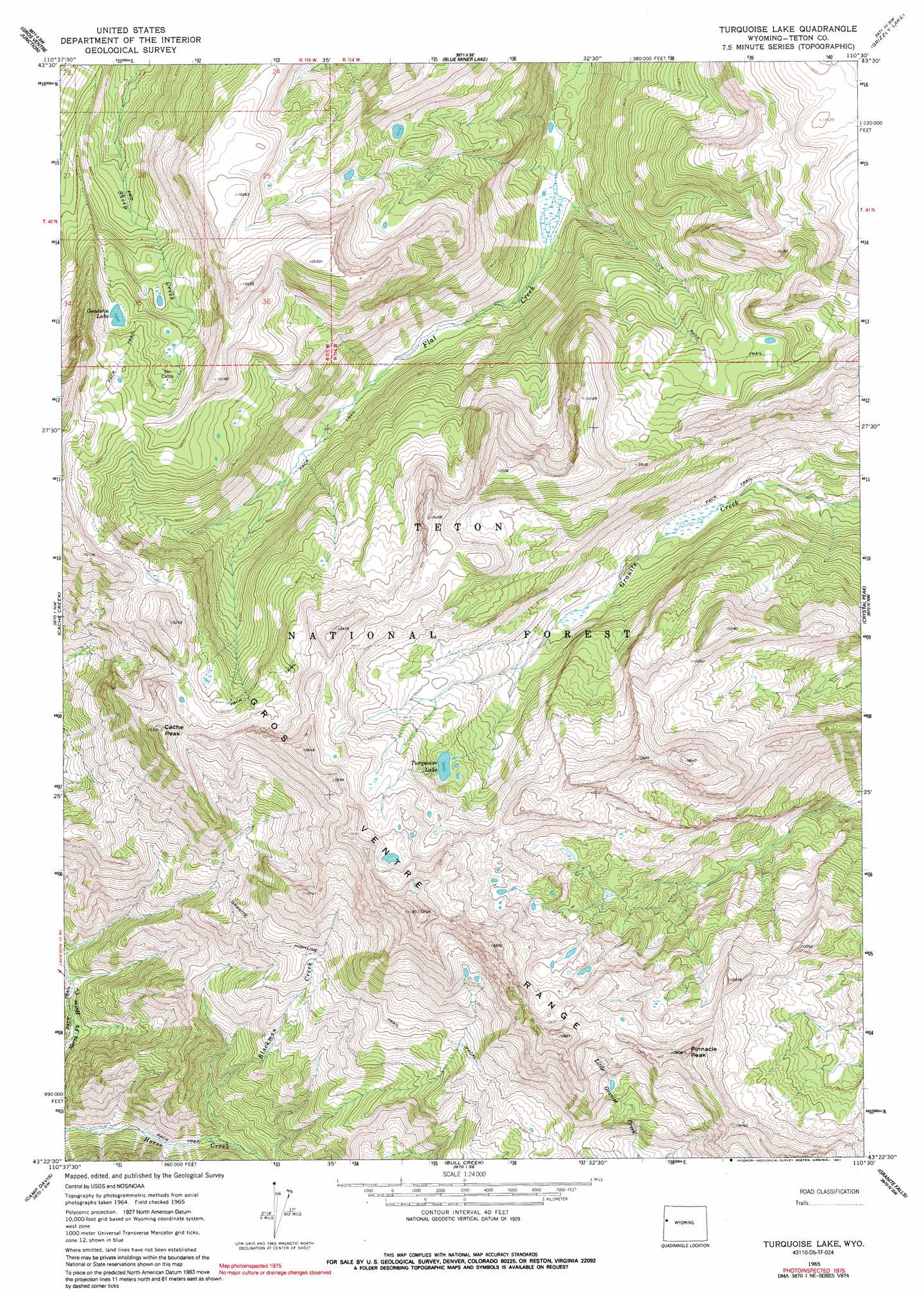
USGS Topo Quad 43110d5 - 1:24,000 scale
| Topo Map Name: | Turquoise Lake |
| USGS Topo Quad ID: | 43110d5 |
| Print Size: | ca. 21 1/4" wide x 27" high |
| Southeast Coordinates: | 43.375° N latitude / 110.5° W longitude |
| Map Center Coordinates: | 43.4375° N latitude / 110.5625° W longitude |
| U.S. State: | WY |
| Filename: | o43110d5.jpg |
| Download Map JPG Image: | Turquoise Lake topo map 1:24,000 scale |
| Map Type: | Topographic |
| Topo Series: | 7.5´ |
| Map Scale: | 1:24,000 |
| Source of Map Images: | United States Geological Survey (USGS) |
| Alternate Map Versions: |
Turquoise Lake WY 1965, updated 1968 Download PDF Buy paper map Turquoise Lake WY 1965, updated 1991 Download PDF Buy paper map Turquoise Lake WY 1996, updated 1998 Download PDF Buy paper map Turquoise Lake WY 1996, updated 1998 Download PDF Buy paper map Turquoise Lake WY 2012 Download PDF Buy paper map Turquoise Lake WY 2015 Download PDF Buy paper map |
| FStopo: | US Forest Service topo Turquoise Lake is available: Download FStopo PDF Download FStopo TIF |
1:24,000 Topo Quads surrounding Turquoise Lake
Grand Teton |
Moose |
Shadow Mountain |
Mount Leidy |
Green Mountain |
Teton Village |
Gros Ventre Junction |
Blue Miner Lake |
Grizzly Lake |
Upper Slide Lake |
Jackson |
Cache Creek |
Turquoise Lake |
Crystal Peak |
Darwin Peak |
Munger Mountain |
Camp Davis |
Bull Creek |
Granite Falls |
Doubletop Peak |
Pine Creek |
Bailey Lake |
Clause Peak |
Bondurant |
Raspberry Ridge |
> Back to 43110a1 at 1:100,000 scale
> Back to 43110a1 at 1:250,000 scale
> Back to U.S. Topo Maps home
Turquoise Lake topo map: Gazetteer
Turquoise Lake: Lakes
Goodwin Lake elevation 2897m 9504′Turquoise Lake elevation 2885m 9465′
Turquoise Lake: Streams
Blackman Creek elevation 2119m 6952′Turquoise Lake: Summits
Cache Peak elevation 3143m 10311′Pinnacle Peak elevation 3273m 10738′
Turquoise Lake: Trails
Granite Highline Trail elevation 2710m 8891′Turquoise Lake digital topo map on disk
Buy this Turquoise Lake topo map showing relief, roads, GPS coordinates and other geographical features, as a high-resolution digital map file on DVD: