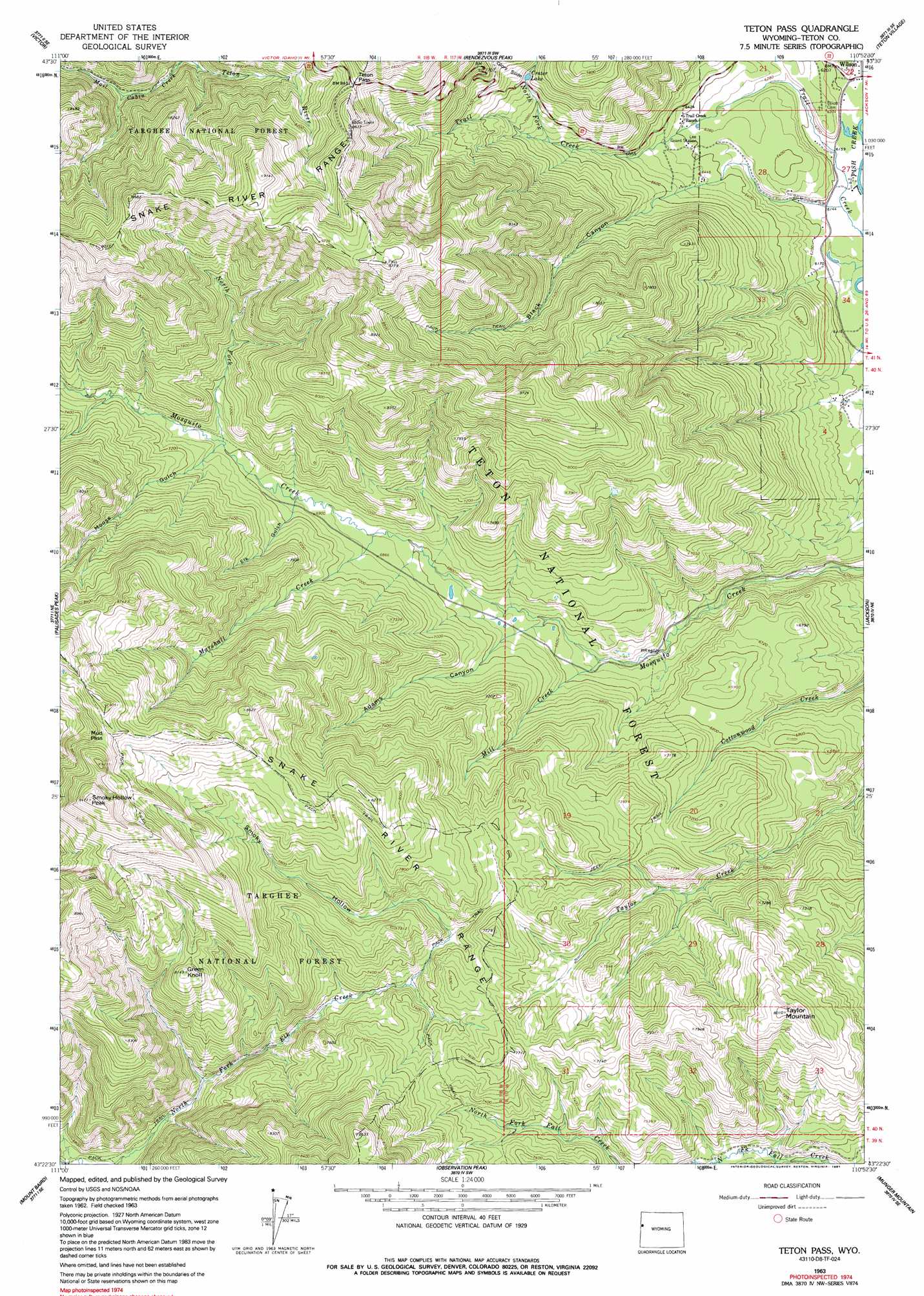
Teton Pass Topo Map Wyoming
To zoom in, hover over the map of Teton Pass
USGS Topo Quad 43110d8 - 1:24,000 scale
| Topo Map Name: | Teton Pass |
| USGS Topo Quad ID: | 43110d8 |
| Print Size: | ca. 21 1/4" wide x 27" high |
| Southeast Coordinates: | 43.375° N latitude / 110.875° W longitude |
| Map Center Coordinates: | 43.4375° N latitude / 110.9375° W longitude |
| U.S. State: | WY |
| Filename: | o43110d8.jpg |
| Download Map JPG Image: | Teton Pass topo map 1:24,000 scale |
| Map Type: | Topographic |
| Topo Series: | 7.5´ |
| Map Scale: | 1:24,000 |
| Source of Map Images: | United States Geological Survey (USGS) |
| Alternate Map Versions: |
Teton Pass WY 1963, updated 1966 Download PDF Buy paper map Teton Pass WY 1963, updated 1991 Download PDF Buy paper map Teton Pass WY 1963, updated 1991 Download PDF Buy paper map Teton Pass WY 1996, updated 1998 Download PDF Buy paper map Teton Pass WY 2012 Download PDF Buy paper map Teton Pass WY 2015 Download PDF Buy paper map |
| FStopo: | US Forest Service topo Teton Pass is available: Download FStopo PDF Download FStopo TIF |
1:24,000 Topo Quads surrounding Teton Pass
Bates |
Driggs |
Mount Bannon |
Grand Teton |
Moose |
Fourth Of July Peak |
Victor |
Rendezvous Peak |
Teton Village |
Gros Ventre Junction |
Thompson Peak |
Palisades Peak |
Teton Pass |
Jackson |
Cache Creek |
Palisades Dam |
Mount Baird |
Observation Peak |
Munger Mountain |
Camp Davis |
Poker Peak |
Alpine |
Ferry Peak |
Pine Creek |
Bailey Lake |
> Back to 43110a1 at 1:100,000 scale
> Back to 43110a1 at 1:250,000 scale
> Back to U.S. Topo Maps home
Teton Pass topo map: Gazetteer
Teton Pass: Gaps
Mud Pass elevation 2711m 8894′Teton Pass elevation 2571m 8435′
Teton Pass: Lakes
Crater Lake elevation 2179m 7148′Teton Pass: Mines
Wilson South Pit and Plant Mine elevation 1970m 6463′Teton Pass: Streams
Fish Creek elevation 1872m 6141′Marshall Creek elevation 2085m 6840′
Mill Creek elevation 1975m 6479′
North Fork Mosquito Creek elevation 2141m 7024′
North Fork Trail Creek elevation 2081m 6827′
Teton Pass: Summits
Green Knoll elevation 2484m 8149′Smoky Hollow Peak elevation 2883m 9458′
Taylor Mountain elevation 2445m 8021′
Teton Pass: Valleys
Black Canyon elevation 1871m 6138′Elk Gulch elevation 2111m 6925′
Glory Slide elevation 2185m 7168′
Moose Gulch elevation 2139m 7017′
Smoky Hollow elevation 2204m 7230′
Teton Pass digital topo map on disk
Buy this Teton Pass topo map showing relief, roads, GPS coordinates and other geographical features, as a high-resolution digital map file on DVD: