Blue Miner Lake Topo Map Wyoming
To zoom in, hover over the map of Blue Miner Lake
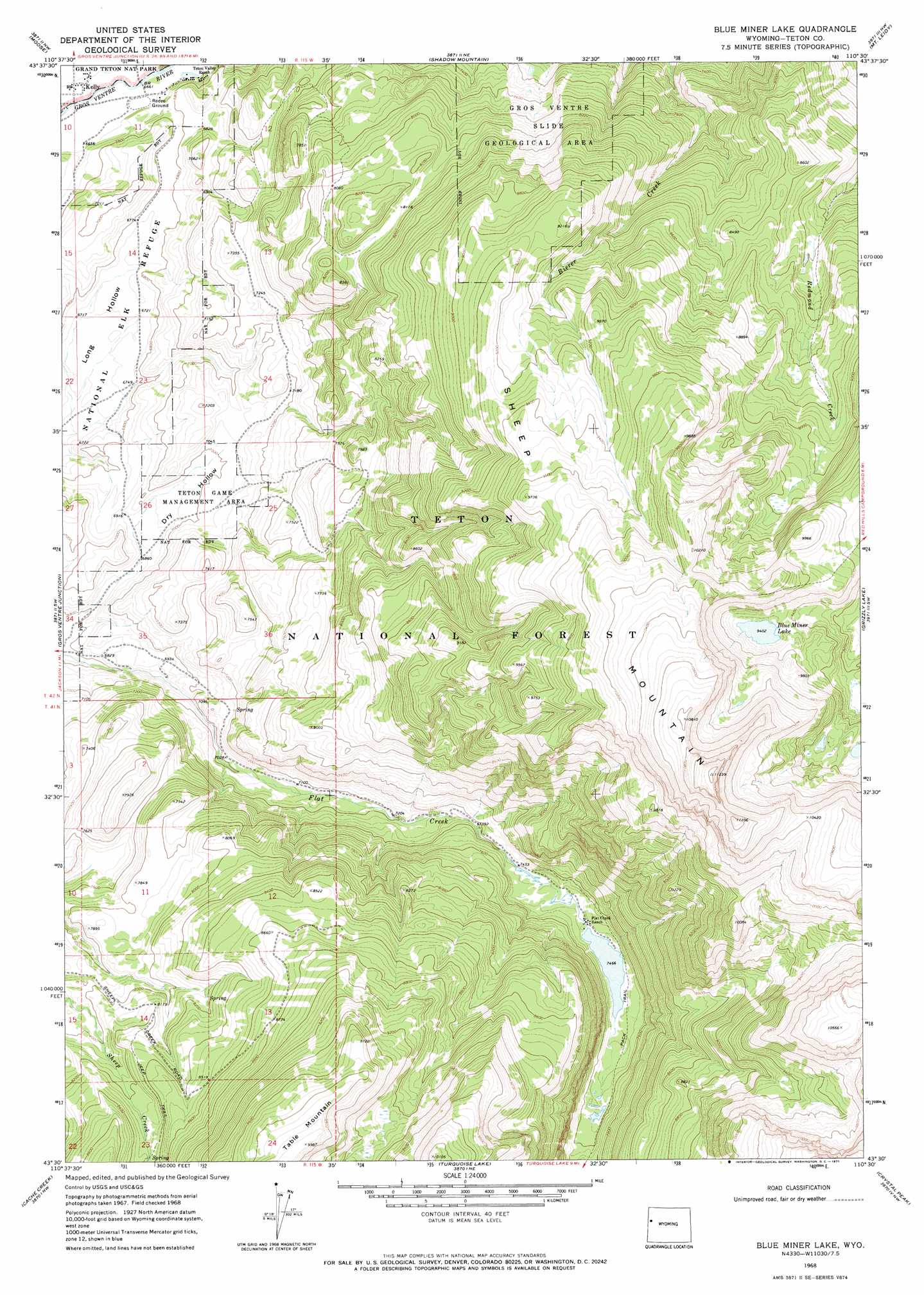
USGS Topo Quad 43110e5 - 1:24,000 scale
| Topo Map Name: | Blue Miner Lake |
| USGS Topo Quad ID: | 43110e5 |
| Print Size: | ca. 21 1/4" wide x 27" high |
| Southeast Coordinates: | 43.5° N latitude / 110.5° W longitude |
| Map Center Coordinates: | 43.5625° N latitude / 110.5625° W longitude |
| U.S. State: | WY |
| Filename: | o43110e5.jpg |
| Download Map JPG Image: | Blue Miner Lake topo map 1:24,000 scale |
| Map Type: | Topographic |
| Topo Series: | 7.5´ |
| Map Scale: | 1:24,000 |
| Source of Map Images: | United States Geological Survey (USGS) |
| Alternate Map Versions: |
Blue Miner Lake WY 1968, updated 1971 Download PDF Buy paper map Blue Miner Lake WY 1996, updated 1998 Download PDF Buy paper map Blue Miner Lake WY 2012 Download PDF Buy paper map Blue Miner Lake WY 2015 Download PDF Buy paper map |
| FStopo: | US Forest Service topo Blue Miner Lake is available: Download FStopo PDF Download FStopo TIF |
1:24,000 Topo Quads surrounding Blue Miner Lake
Mount Moran |
Jenny Lake |
Moran |
Davis Hill |
Rosies Ridge |
Grand Teton |
Moose |
Shadow Mountain |
Mount Leidy |
Green Mountain |
Teton Village |
Gros Ventre Junction |
Blue Miner Lake |
Grizzly Lake |
Upper Slide Lake |
Jackson |
Cache Creek |
Turquoise Lake |
Crystal Peak |
Darwin Peak |
Munger Mountain |
Camp Davis |
Bull Creek |
Granite Falls |
Doubletop Peak |
> Back to 43110e1 at 1:100,000 scale
> Back to 43110a1 at 1:250,000 scale
> Back to U.S. Topo Maps home
Blue Miner Lake topo map: Gazetteer
Blue Miner Lake: Areas
Gros Ventre Slide Geological Area elevation 2226m 7303′Blue Miner Lake: Lakes
Blue Miner Lake elevation 2867m 9406′Blue Miner Lake: Parks
Teton Game Management Area elevation 2137m 7011′Blue Miner Lake: Populated Places
Kelly elevation 2028m 6653′Blue Miner Lake: Summits
Sheep Mountain elevation 3418m 11213′Table Mountain elevation 3025m 9924′
Blue Miner Lake: Valleys
Dry Hollow elevation 2092m 6863′Blue Miner Lake digital topo map on disk
Buy this Blue Miner Lake topo map showing relief, roads, GPS coordinates and other geographical features, as a high-resolution digital map file on DVD: