Teton Village Topo Map Wyoming
To zoom in, hover over the map of Teton Village
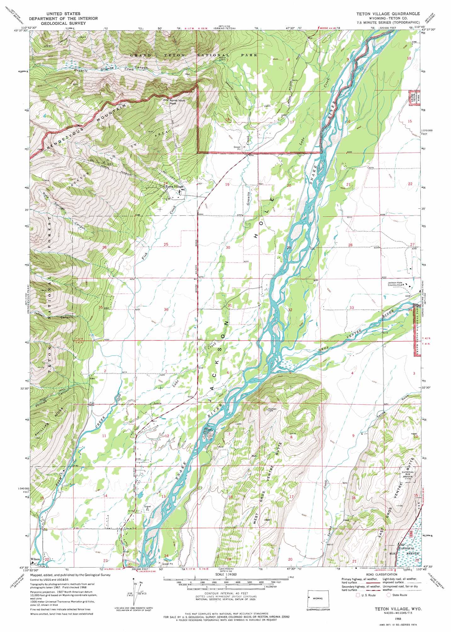
USGS Topo Quad 43110e7 - 1:24,000 scale
| Topo Map Name: | Teton Village |
| USGS Topo Quad ID: | 43110e7 |
| Print Size: | ca. 21 1/4" wide x 27" high |
| Southeast Coordinates: | 43.5° N latitude / 110.75° W longitude |
| Map Center Coordinates: | 43.5625° N latitude / 110.8125° W longitude |
| U.S. State: | WY |
| Filename: | o43110e7.jpg |
| Download Map JPG Image: | Teton Village topo map 1:24,000 scale |
| Map Type: | Topographic |
| Topo Series: | 7.5´ |
| Map Scale: | 1:24,000 |
| Source of Map Images: | United States Geological Survey (USGS) |
| Alternate Map Versions: |
Teton Village WY 1968, updated 1971 Download PDF Buy paper map Teton Village WY 1968, updated 1974 Download PDF Buy paper map Teton Village WY 1996, updated 1998 Download PDF Buy paper map Teton Village WY 1996, updated 1998 Download PDF Buy paper map Teton Village WY 2012 Download PDF Buy paper map Teton Village WY 2015 Download PDF Buy paper map |
| FStopo: | US Forest Service topo Teton Village is available: Download FStopo PDF Download FStopo TIF |
1:24,000 Topo Quads surrounding Teton Village
Clawson |
Granite Basin |
Mount Moran |
Jenny Lake |
Moran |
Driggs |
Mount Bannon |
Grand Teton |
Moose |
Shadow Mountain |
Victor |
Rendezvous Peak |
Teton Village |
Gros Ventre Junction |
Blue Miner Lake |
Palisades Peak |
Teton Pass |
Jackson |
Cache Creek |
Turquoise Lake |
Mount Baird |
Observation Peak |
Munger Mountain |
Camp Davis |
Bull Creek |
> Back to 43110e1 at 1:100,000 scale
> Back to 43110a1 at 1:250,000 scale
> Back to U.S. Topo Maps home
Teton Village topo map: Gazetteer
Teton Village: Areas
Jackson Hole Ski Area elevation 2461m 8074′Teton Village: Populated Places
Moose Wilson Road elevation 1888m 6194′Teton Village elevation 1929m 6328′
Teton Village: Streams
Granite Creek elevation 1915m 6282′Gros Ventre River elevation 1902m 6240′
Lake Creek elevation 1890m 6200′
Teton Village: Summits
Apres Vous Peak elevation 2561m 8402′West Gros Ventre Butte elevation 2099m 6886′
Teton Village: Trails
Granite Canyon Trail elevation 2145m 7037′Teton Village: Valleys
Granite Canyon elevation 2042m 6699′Jensen Canyon elevation 1912m 6272′
Phillips Canyon elevation 1946m 6384′
Rock Springs Canyon elevation 1915m 6282′
Spring Gulch elevation 1920m 6299′
Teton Village digital topo map on disk
Buy this Teton Village topo map showing relief, roads, GPS coordinates and other geographical features, as a high-resolution digital map file on DVD: