Green Mountain Topo Map Wyoming
To zoom in, hover over the map of Green Mountain
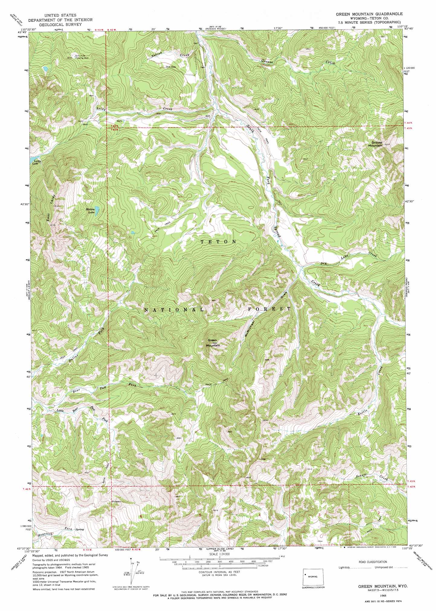
USGS Topo Quad 43110f3 - 1:24,000 scale
| Topo Map Name: | Green Mountain |
| USGS Topo Quad ID: | 43110f3 |
| Print Size: | ca. 21 1/4" wide x 27" high |
| Southeast Coordinates: | 43.625° N latitude / 110.25° W longitude |
| Map Center Coordinates: | 43.6875° N latitude / 110.3125° W longitude |
| U.S. State: | WY |
| Filename: | o43110f3.jpg |
| Download Map JPG Image: | Green Mountain topo map 1:24,000 scale |
| Map Type: | Topographic |
| Topo Series: | 7.5´ |
| Map Scale: | 1:24,000 |
| Source of Map Images: | United States Geological Survey (USGS) |
| Alternate Map Versions: |
Green Mountain WY 1965, updated 1968 Download PDF Buy paper map Green Mountain WY 1996, updated 1998 Download PDF Buy paper map Green Mountain WY 2012 Download PDF Buy paper map Green Mountain WY 2015 Download PDF Buy paper map |
| FStopo: | US Forest Service topo Green Mountain is available: Download FStopo PDF Download FStopo TIF |
1:24,000 Topo Quads surrounding Green Mountain
Two Ocean Lake |
Whetstone Mountain |
Hunter Mountain |
Joy Peak |
Crater Lake |
Moran |
Davis Hill |
Rosies Ridge |
Angle Mountain |
Togwotee Pass |
Shadow Mountain |
Mount Leidy |
Green Mountain |
Tripod Peak |
Lava Mountain |
Blue Miner Lake |
Grizzly Lake |
Upper Slide Lake |
Burnt Mountain |
Sheridan Pass |
Turquoise Lake |
Crystal Peak |
Darwin Peak |
Ouzel Falls |
Mosquito Lake |
> Back to 43110e1 at 1:100,000 scale
> Back to 43110a1 at 1:250,000 scale
> Back to U.S. Topo Maps home
Green Mountain topo map: Gazetteer
Green Mountain: Lakes
Hidden Lake elevation 2766m 9074′Leidy Lake elevation 2657m 8717′
Green Mountain: Streams
Dry Lake Creek elevation 2533m 8310′Grouse Creek elevation 2404m 7887′
Kettle Creek elevation 2581m 8467′
Leidy Creek elevation 2423m 7949′
Little Bear Paw Fork elevation 2310m 7578′
Nation Creek elevation 2403m 7883′
Green Mountain: Summits
East Leidy elevation 3090m 10137′Green Mountain elevation 2955m 9694′
Grouse Mountain elevation 3148m 10328′
Green Mountain: Valleys
McMichael Draw elevation 2530m 8300′Green Mountain digital topo map on disk
Buy this Green Mountain topo map showing relief, roads, GPS coordinates and other geographical features, as a high-resolution digital map file on DVD: