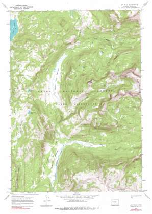
Joy Peak Topo Map Wyoming
To zoom in, hover over the map of Joy Peak
USGS Topo Quad 43110h2 - 1:24,000 scale
| Topo Map Name: | Joy Peak |
| USGS Topo Quad ID: | 43110h2 |
| Print Size: | ca. 21 1/4" wide x 27" high |
| Southeast Coordinates: | 43.875° N latitude / 110.125° W longitude |
| Map Center Coordinates: | 43.9375° N latitude / 110.1875° W longitude |
| U.S. State: | WY |
| Filename: | o43110h2.jpg |
| Download Map JPG Image: | Joy Peak topo map 1:24,000 scale |
| Map Type: | Topographic |
| Topo Series: | 7.5´ |
| Map Scale: | 1:24,000 |
| Source of Map Images: | United States Geological Survey (USGS) |
| Alternate Map Versions: |
Joy Peak WY 1965, updated 1972 Download PDF Buy paper map Joy Peak WY 1965, updated 1990 Download PDF Buy paper map Joy Peak WY 1996, updated 1998 Download PDF Buy paper map Joy Peak WY 2012 Download PDF Buy paper map Joy Peak WY 2015 Download PDF Buy paper map |
| FStopo: | US Forest Service topo Joy Peak is available: Download FStopo PDF Download FStopo TIF |
1:24,000 Topo Quads surrounding Joy Peak
> Back to 43110e1 at 1:100,000 scale
> Back to 43110a1 at 1:250,000 scale
> Back to U.S. Topo Maps home
Joy Peak topo map: Gazetteer
Joy Peak: Flats
North Fork Meadows elevation 2334m 7657′Soda Fork Meadows elevation 2249m 7378′
Joy Peak: Lakes
Clear Creek Lake elevation 2595m 8513′Divide Lake elevation 2632m 8635′
Enos Lake elevation 2383m 7818′
Joy Peak Lake elevation 2665m 8743′
Mud Lake elevation 2298m 7539′
Toppan Lake elevation 2534m 8313′
Joy Peak: Springs
North Buffalo Fork Springs elevation 2231m 7319′Soda Springs elevation 2256m 7401′
Joy Peak: Streams
Joy Creek elevation 2305m 7562′Soda Fork elevation 2228m 7309′
Joy Peak: Summits
Joy Peak elevation 3055m 10022′Joy Peak: Trails
Enos Lake Trail elevation 2392m 7847′North Buffalo Trail elevation 2381m 7811′
Joy Peak digital topo map on disk
Buy this Joy Peak topo map showing relief, roads, GPS coordinates and other geographical features, as a high-resolution digital map file on DVD:


